
 United Kingdom
 France
 Germany
 Netherlands
 Sweden
 USA
USA
 Italy
Italy
 Spain
Spain
More From Contributor


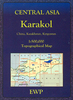


Karachi
Street plan of Karachi from the Pakistani national survey organization, showing names of principal streets within the city and numerous local neighbourhoods. The plan also indicates locations and names of main public buildings, institutions and various businesses/facilities such as markets/bazaars and shopping centres, post offices, schools, mosques, etc. Coverage extends well beyond the city centre: west to Paradise Point, north to the Hab Reservoir, and east to Dabeji. The plan has no index of streets or suburbs. Please note: the current edition available from the Pakistani Survey organization is based on the data obtained in the 1994-1995 survey. Deliveries from Pakistan are very irregular and we cannot guarantee a delivery date for any of their titles currently not in stock.
Product Description
Reviews/Comments
Add New
Intelligent Comparison
Archived Product
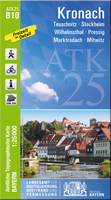
Kronach Stanfords
£11.50
Vouchers
No voucher codes found.
Do you know a voucher code for this product or supplier? Add it to Insights for others to use.
Do you know a voucher code for this product or supplier? Add it to Insights for others to use.
 Denmark