
 United Kingdom
 France
 Germany
 Netherlands
 Sweden
 USA
USA
 Italy
Italy
 Spain
Spain
More From Contributor


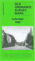
Ivybridge 1905
Ivybridge in 1905 in a fascinating series of reproductions of old Ordnance Survey plans in the Alan Godfrey Editions, ideal for anyone interested in the history of their neighbourhood or family. Selected towns in Great Britain and Ireland are covered by maps showing the extent of urban development in the last decades of the 19th and early 20th century.In this title: this detailed map covers most of the small town of Ivybridge, extending westward to Cadleigh House and northward to Henlake Down. Features include Fore Street area, town centre with individual buildings neatly shown, Highlands, St John's church, Union Corn Mills, Cattle Market, Stowford Paper Mills, GWR railway with station, Woodland, Langham Hill, Dinnaton. On the reverse is a 1906 directory of Ivybridge.About the
Alan Godfrey Editions of the 25
Alan Godfrey Editions of the 25
Product Description
Reviews/Comments
Add New
Intelligent Comparison
Archived Product
Ivybridge 1905 Stanfords
£3.50
Archived Product
Ferrybridge 1905 Stanfords
£2.95
Archived Product

Ferrybridge 1905 Stanfords
£3.50
Archived Product

Ironbridge 1901 Stanfords
£3.50
Archived Product

Uxbridge 1895 Stanfords
£3.50
Archived Product

Cambridge 1925 Stanfords
£3.50
Archived Product

Tonbridge 1895 Stanfords
£3.50
Archived Product
Banbridge 1903 Stanfords
£3.50
Vouchers
No voucher codes found.
Do you know a voucher code for this product or supplier? Add it to Insights for others to use.
Do you know a voucher code for this product or supplier? Add it to Insights for others to use.
 Denmark