
 United Kingdom
 France
 Germany
 Netherlands
 Sweden
 USA
USA
 Italy
Italy
 Spain
Spain
More From Contributor


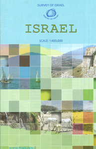
Israel
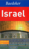
Indexed road map with street plans of Tel Aviv, Jerusalem and Haifa. In its effort to show the boundaries before various conflicts, the subsequent ceasefire lines and the present administrative arrangements, the map does not present the current situation as successfully and accurately as on other similar maps, with minor roads, particularly on the West Bank, sometimes difficult to read. All place names are given in Roman alphabet only. Geographical information includes nature reserves, oasis, hot springs and wells, dams, waterfalls and sand deserts. A series of symbols shows various religious buildings, ruins and archaeological sites, viewpoints, beaches and spas, campsites, caves, etc. Longitude and latitude lines are drawn at 30' intervals. Map legend includes English.
The index on the reverse includes names of towns and villages in the adjoining areas of the neighbouring countries. Clear, well presented street plans show Tel Aviv - Yafo, Jerusalem and Haifa.
The index on the reverse includes names of towns and villages in the adjoining areas of the neighbouring countries. Clear, well presented street plans show Tel Aviv - Yafo, Jerusalem and Haifa.
Product Description
Reviews/Comments
Add New
Intelligent Comparison
Archived Product

Israel Stanfords
£10.50
Archived Product
Israel Stanfords
£9.50
Archived Product
Israel Stanfords
£11.99
Archived Product
Israel Stanfords
£16.99
Archived Product
Israel Stanfords
£4.99
Archived Product

Israel Stanfords
£15.99
Vouchers
No voucher codes found.
Do you know a voucher code for this product or supplier? Add it to Insights for others to use.
Do you know a voucher code for this product or supplier? Add it to Insights for others to use.
 Denmark