More From Contributor
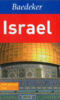
£6.95
Topographic coverage of mainland Spain at 1:50, 000 in the MTN50 (Mapa Topográfico Nacional) series from the Centro Nacional de Información Geografica, the country’s civilian survey organization. The maps have contours at 20m intervals, enhanced by relief shading, plus colouring and/or graphics to show different types of terrain, vegetation or land use. Boundaries of national parks & other protected areas are marked. In addition to all the usual information featured on topographic mapping at this scale, detailed presentation of the road & rail networks, rural tracks & paths, etc, the maps also show campsites & mountain refuges. On more recent editions some GRs, the official long-distance hiking routes, are also marked (although not as clearly as on hiking maps from other publishers). Each map covers 29.5x 18.5 km (with adjustments in the border or coastal areas). The maps have a 1-km UTM grid, plus margin ticks for latitude & longitude at 1` intervals. Map legend is in Spanish only.HOW TO CHOOSE THE RIGHT 50K MAP: all the titles in CNIG’s 200K Provincial Road Maps series at 1:200, 000 are overprinted with the grid for the 1:50, 000 maps & can be used to see the area covered by each 50K title. TO SEE THE LIST OF TITLES IN THIS SERIES PLEASE CLICK ON THE SERIES LINK.PLEASE NOTE
- MAP TITLES: the grids shown on our website serve both the civilian & the military 1:50, 000 topographic series. Although the areas covered by maps in both series are identical (apart from some border or coastal sheets), occasionally map titles differ – only one title is shown on the grid, usually the military one. In Galicia, the Basque country & in the Catalan speaking areas the tendency now is to use local place names rather than the often better known Castilian ones. Where possible, both versions are included in our titles. Map titles listed on our website are based on information received by us at the time of publication, but sometimes maps arrive showing a completely different title! As long as the map number is as ordered, the correct map has been supplied.
...
Archived Product
£10.50
Putumayo World Music presents Israel
- a collection highlighting a new generation of Israeli musicians who transcend the political
...
Archived Product
£9.50
Indexed, waterproof & tear-resistant road map of Israel with topographic & tourist information, published by Reise Know-How as part of their highly acclaimed World Mapping Project. The map is double-sided to provide the best balance between a good scale & a convenient size sheet Detailed road network & railways are shown on a clear base with subtle altitude colouring which shows the country ...
Archived Product
£8.50
Indexed road map with street plans of Tel Aviv, Jerusalem & Haifa. In its effort to show the boundaries before various conflicts, the subsequent ceasefire lines & the present administrative arrangements, the map does not present the current situation as successfully & accurately as on other similar maps, with minor roads, particularly on the West Bank, sometimes difficult to read. All place names are given in Roman alphabet only. Geographical information

Includes::
nature reserves, oasis, hot springs & wells, dams, waterfalls & sand deserts. A series of symbols shows various religious buildings, ruins & archaeological sites, viewpoints, beaches & spas, campsites, caves, etc. Longitude & latitude lines are drawn at 30' intervals. Map legend

Includes::
English. The index on the reverse

Includes::
names of towns & villages in the adjoining areas of the neighbouring countries. Clear, well presented street plans show Tel Aviv
- Yafo, Jerusalem & Haifa.


...
Archived Product
£11.99
Overview map of the country from the Israeli national survey organization, with the Sinai Peninsula shown as an inset. The map indicates zones of Palestinian or joint Israeli
- Palestinian authority, marks the course of the separation wall at the time of its publication in 2003, & shows various boundaries such as the cease-fire lines of 1967 & disengagement lines of 1974. Due to the scale of the map, the road network in the central part of the country is somewhat cluttered, but clearer on the Negev Desert & in the inset covering the Sinai Peninsula at 1:1, 600, 000. The map has a UTM grid, all place names are in Roman alphabet only & map legend is in English. Also included is a small political map of the whole of the Middle East.
...
Archived Product
£4.99
The highly successful Globetrotter Travel Series, which

Includes::
Travel Guides, Travel Maps, Road Atlases,

...
Archived Product
£15.99
This new third edition of Bradt`s Israel has been fully updated to reflect all the most recent changes &

Includes::


...
Archived Product
£12.79
Israel & the Palestinian Territories in the Countries & Regions series from Lonely Planet, market-leading comprehensive guides aimed at independent travellers & serving a large range of international destinations. Frank & informal in style, the guides explore an extensive range of sights, activities, accommodation, restaurants & nightlife & are designed for practical use while travelling on the road. Written & researched by a team of experts, each book is independent in its recommendations & suggestions, often offering individual takes on individual destinations. Widely recognised for their reliability, each Lonely Planet country & region guide has the same layout. Introductory sections profile the destination with individual chapters on particular highlights, getting started, (including when to go) itineraries, history, culture, arts, food & drink & the environment. Each guide is organised geographically by region, with individual sections detailing an extensive range of sights, places of interest, attractions, restaurants, nightlife, accommodation & any local activities. The guides have detailed explanations of historical context where relevant. There is also practical guidance on ...
Archived Product
£13.99
This full-colour guide to Jerusalem

Includes::
vibrant photos & helpful planning maps. Calls to prayer echo

...
Archived Product

Israel

Baedeker is proud to welcome this brand new title to the range. At the heart of this full-colour and visually inspiring guide is a wealth of well-researched, comprehensive information and detailed recommendations written by experts. From holy sites of three world religions, excavations of thousand-year-old sites and overwhelming scenery: Israel is packed full of attractions! You will find all the sights and top attractions explored in an easy-to-read A-Z format - it is ideal for independent travellers. Superb 3D laminated illustrations display the key sights which are brought to life at the turn of a page. The guide is accompanied by a large, fully indexed, pull-out map. All of this invaluable information is contained in a neatly packaged and handy plastic wallet that allows you to
keep the guide and map together whilst ensuring durability so both will survive in all weathers! Baedeker sets a new standard in 21st century, travel guide publishing.
RIP - This product is no longer available on our network. It was last seen on 25.09.2019

This page now acts as a permanent archive for this product. Add more information using the comments box below to ensure it can still be found by future generations.

Use our search facility to see if it is available from an alternative contributor.
  • External links may include paid for promotion
  • Availability: Out Of Stock
  • Supplier: Stanfords
  • SKU: 9783829768160
Availability: In Stock
£16.99

Product Description

Baedeker is proud to welcome this brand new title to the range. At the heart of this full-colour & visually inspiring guide is a wealth of well-researched, comprehensive information & detailed recommendations written by experts. From holy sites of three world religions, excavations of thous&-year-old sites & overwhelming scenery: Israel is packed full of attractions! You will find all the sights & top attractions explored in an easy-to-read A-Z format
- it is ideal for independent travellers. superb 3D laminated illustrations display the key sights which are brought to life at the turn of a page. The guide is accompanied by a large, fully indexed, pull-out map. All of this invaluable information is contained in a neatly packaged & handy plastic wallet that means that you can keep the guide & map together whilst ensuring durability so both will survive in all weathers! Baedeker sets a new standard in 21st century, travel guide publishing.

Reviews/Comments

Add New

Intelligent Comparison

Oooops!
We couldn't find anything!
Perhaps this product's unique.... Or perhaps we are still looking for comparisons!
Click to bump this page and we'll hurry up.

Price History

Vouchers

No voucher codes found.
Do you know a voucher code for this product or supplier? Add it to Insights for others to use.

Facebook

Jargon Buster

Plastic - A generic term for a synthetic product used in the manufacture of products
Key - A physical or virtual device or code used for opening something
World - A physical grouping, commonly used to describe earth and everything associated with ti
Colour - The categorised spectrum of light visable to humans
Year - The time it takes the planet earth to orbit the sun. This takes around 365.25 days.
Heart - An organ that pumps blood around the body. Usually related to love.
Large - something that takes up more space than normal.
illustrations - Pictures typically in books and newspapers.
Year - 365 days (366 days in a leap year), the time taken for planet earth to make one full revolution around the sun.
Invaluable - Something that cannot be replaces as it is indispensable.
Laminated - A thin layer of plastic that gives a coating and shine to a material.
Ideal - Something that satisfies a perfect criteria.

Supplier Information

Stanfords
Stanfords was established in 1853 and opened their iconic Covent Garden flagship store in 1901. They have become the top retailer of maps, travel books and accessories in the UK and arguably offer the largest selection of maps and travel books worldwide. Famous names such as Captain Robert Falcon Scott, Ranulph Fiennes and Michael Palin have purchased from Stanfords. They now have a shop in Bristol and both stores together with other venues operate a calendar of events including talks, book signings and exhibitions. As a specialist map retailer, the map selection is comprehensive and includes road maps, street maps and walking maps from worldwide destinations, as well as a selection of world atlases and wall maps. Books include travel guides and travel literature. Stanfords also stock globes, from miniatures made of blue marble to magnificent floor-standing globes. The website features a selection of interesting articles on travel topics.
Page Updated: 2023-11-12 20:15:36

Community Generated Product Tags

Oh No! The productWIKI community hasn't generated any tags for this product yet!
Menu