
 United Kingdom
 France
 Germany
 Netherlands
 Sweden
 USA
USA
 Italy
Italy
 Spain
Spain
More From Contributor


Israel Road Atlas
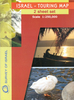
Road Atlas from Israel at 1:160, 000 from the Jerusalem-based Carta with street plans of Tel Aviv and Jerusalem and pages annotated with radio reception information. Road network includes local roads, shows junction names and gives driving distances on main routes. The maps also have 1km margin ticks for calculating distances. Railway lines are shown with stations and local airfields and landing strips are marked. The atlas also shows the course of the
Product Description
Reviews/Comments
Add New
Vouchers
No voucher codes found.
Do you know a voucher code for this product or supplier? Add it to Insights for others to use.
Do you know a voucher code for this product or supplier? Add it to Insights for others to use.
 Denmark