
 United Kingdom
 France
 Germany
 Netherlands
 Sweden
 USA
USA
 Italy
Italy
 Spain
Spain
More From Contributor


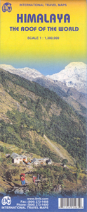
Himalaya
The Himalayas at 1:1, 500, 000 from Nelles Verlag, with the smaller size, double-sided map offering a convenient format for use when travelling. Vivid relief shading with plenty of names of various mountain chains and peaks, plus additional spot heights shows the topography.The map divides the region north-west/south-east, covering on one side the area from Kabul to Mount Kailash and the Nepali border, and on the reverse the whole of Nepal, the southern part of Tibet, Bhutan and part of the north-eastern states of India including Sikkim.Road network distinguishes highways in good or poor condition and partly surfaced secondary roads, and shows distances on main routes. Railway lines and local airports are included and the map also shows internal administrative boundaries with names
of the provinces/states and borders of the disputed regions.Various places of interest, from temples and hill stations to national parks and reserves are prominently marked. Latitude and longitude margin ticks are at 2
of the provinces/states and borders of the disputed regions.Various places of interest, from temples and hill stations to national parks and reserves are prominently marked. Latitude and longitude margin ticks are at 2
Product Description
Reviews/Comments
Add New
Intelligent Comparison
Archived Product

Himalaya Stanfords
£8.99
Archived Product
Himalaya ITMB Stanfords
£9.99
Archived Product
Nepal Himalaya Stanfords
£14.99
Vouchers
No voucher codes found.
Do you know a voucher code for this product or supplier? Add it to Insights for others to use.
Do you know a voucher code for this product or supplier? Add it to Insights for others to use.
 Denmark