
 United Kingdom
 France
 Germany
 Netherlands
 Sweden
 USA
USA
 Italy
Italy
 Spain
Spain
More From Contributor


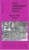


Hayes South 1935
Hayes South in 1935 in a fascinating series of reproductions of old Ordnance Survey plans in the Alan Godfrey Editions, ideal for anyone interested in the history of their neighbourhood or family. The map covers what until the end of the 18th century this was a completely rural area, but the development of brickmaking and then the arrival of the railway stimulated growth. But the real turning point came in 1899 when the Hayes Development Co acquired land near the railway and laid out roads for industry. This title shows the result, with numerous factories close to Hayes & Harlington station and the Grand Junction Canal. These include the Hayes Cocoa Co, taken over by Nestle in 1929, and the Gramophone Co (soon part of EMI). Factories are also shown for potato crisps, postage stamps,
chairs and cheese. Elsewhere on the map development continues to the south, the start of the Paddington Branch canal is shown, and there are still some orchards or market gardens. The population of Hayes UD rose from 2, 594 in 1901 to about 31, 000 by 1935 and this busy map, with its comprehensive introduction by John Griffiths, helps show why.About the Alan Godfrey Editions of the 25” OS Series:Selected towns in Great Britain and Ireland are covered by maps showing the extent of urban development in the last decades of the 19th and early 20th century. The plans have been taken from the Ordnance Survey mapping and reprinted at about 15 inches to one mile (1:4, 340). On the reverse most maps have historical notes and many also include extracts from contemporary directories. Most maps
cover about one mile (1.6kms) north/south, one and a half miles (2.4kms) across; adjoining sheets can be combined to provide wider coverage.FOR MORE INFORMATION AND A COMPLETE LIST OF ALL AVAILABLE TITLES PLEASE CLICK ON THE SERIES LINK.

Product Description
Reviews/Comments
Add New
Intelligent Comparison
Archived Product

Halifax South 1905 Stanfords
£3.50
Archived Product

Horsham South 1938 Stanfords
£3.50
Vouchers
No voucher codes found.
Do you know a voucher code for this product or supplier? Add it to Insights for others to use.
Do you know a voucher code for this product or supplier? Add it to Insights for others to use.
 Denmark