More From Contributor
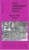
£8.99
” Penguin Decades” bring you the novels that helped shape modern Britain. When they were published, some were bestsellers, some were considered scandalous, & others were simply misunderstood. All represent their time & helped define their generation, while today each is considered a landmark work of storytelling. Peter Ackroyd`s ” Hawksmoor” was first published in 1985. Alternating between the eighteenth century, when Nicholas Dyer, assistant to Christopher Wren, builds seven London churches that house a terrible secret, & the 1980s, when London detective Nicholas Hawksmoor is investigating a series of gruesome murders on the sight of certain old churches, ” Hawksmoor” is a brilliant tale of darkness & shadow. ...
Archived Product
£6.95
Nicholas Hawksmoor was the architect of some of London`s most prominent landmarks
- St Mary Woolnoth in the City; St George`s,
...
Archived Product
£3.50
Haworth & Lees cum Cross Roads in 1906 in a fascinating series of reproductions of old Ordnance Survey plans in the Alan Godfrey Editions, ideal for anyone interested in the history of their neighbourhood or family. The map is double-sided. The main map covers the lower end of the village, including the railway & station, Old Hall, Ivy Bank Mills, Bridgehouse Lane, Haworth Brow, Mill Hill, Bridgehouse Mills, Ebor Mill & Lees Mill. Coverage extends eastward along Lees Lane to the small communities of Lees, Cross Roads & Barcroft, & across Brow Moor to Flappit Spring. On the reverse is a section of the adjacent sheet 200.10 showing upper Haworth, including the church, the rectory (the home of the Brontës), Spring Head Mills, West Lane, Haworth Cemetery, Main Street, & extending westward to Sladen Bridge, Stanbury Cemetery & Lumbfoot Mill. About the Alan Godfrey Editions of the 25” OS Series: Selected towns in Great Britain & Ireland are covered by maps showing the extent of urban development in the last decades of the 19th & early 20th century. The plans have been taken from the Ordnance Survey mapping & reprinted at about 15 inches to one mile (1:4, 340). On the reverse most maps have historical notes & many also include extracts from contemporary directories. Most maps cover about one mile (1.6kms) north/south, one & a half miles (2.4kms) across; adjoining sheets can be combined to provide wider coverage.FOR MORE INFORMATION & A COMPLETE LIST OF ALL AVAILABLE TITLES PLEASE CLICK ON THE SERIES LINK. ...
Archived Product
£11.50
Topographic survey of France at 1:25, 000 in IGN`s excellent TOP25 / Série Bleue series. All the maps are GPS compatible, with a 1km UTM grid plus latitude & longitude lines at 5’ intervals. Contours are at 5m intervals except for mountainous areas where the maps have contours at 10m intervals, vividly enhanced by hill shading & graphics for rocky terrain. Colouring with graphics indicates different types of vegetation or land use (deciduous or coniferous forests, moors, orchards, vineyards, etc). PLEASE NOTE: coverage of France at this scale is currently being revised – the format & the presentation of each title are indicated by the letters at the end of its Sheet Reference number (e.g. 0416ET, 3531ETR, 1923SB, etc.)MAPS WITH FULL TOURIST OVERPRINT & AN ENGLISH MAP LEGEND: all TOP25 maps & the SB editions of Série Bleue have an overprint highlighting waymarked walking trails including long-distance GR routes &, where appropriate, ski routes. Symbols indicate campsites, gîtes d’etape, refuges, equestrian centres & other recreational facilities or sites, tourist information centres, cultural heritage, etc. Towns & locations of particular interest are highlighted.- ET or OT = single-sided TOP25 map covering approx. 29x 21 km / 18x 13 miles.- ETR or OTR = waterproof & tear resistant TOP25 map covering the same area as the corresponding ET or OT number, but double-sided, printed on a smaller size sheet with a good overlap between the sides.- SB = Série Bleue map with full tourist overprint; these maps, first introduced in summer 2014, each cover approx. 29x 24km / 18x 15 miles.SÉRIE BLEUE maps with numbers ending in E (Est) or O (Ouest): most editions now indicate the GR routes, but do not show any other tourist information. Map legend is in French only. Each map covers approx. 14x 20km / 9x 12 miles. ...
Archived Product
£3.50
Haydock North in 1906 in a fascinating series of reproductions of old Ordnance Survey plans in the Alan Godfrey Editions, ideal for anyone interested in the history of their neighbourhood or family. The map covers the northern part of Haydock, stretching from St James church northward to Garswood House, & from North Florida eastward to Lodge Lane. Features include New Boston area, Old Boston area, tramway, New Boston Pits, part of Haydock Colliery, Old Boston Pits, Haydock Colliery Railway, GCR St Helens Branch with Ashton in Makerfield station, New Hall Wood, Kenyon`s Lane area, site of Haydock Hall, site of Piele Hall, Wicken Hedge, etc. On the reverse is a directory of Haydock in 1918. About the Alan Godfrey Editions of the 25” OS Series: Selected towns in Great Britain & Ireland are covered by maps showing the extent of urban development in the last decades of the 19th & early 20th century. The plans have been taken from the Ordnance Survey mapping & reprinted at about 15 inches to one mile (1:4, 340). On the reverse most maps have historical notes & many also include extracts from contemporary directories. Most maps cover about one mile (1.6kms) north/south, one & a half miles (2.4kms) across; adjoining sheets can be combined to provide wider coverage.FOR MORE INFORMATION & A COMPLETE LIST OF ALL AVAILABLE TITLES PLEASE CLICK ON THE SERIES LINK. ...
Archived Product
£3.50
Hayes in 1907 in a fascinating series of reproductions of old Ordnance Survey plans in the Alan Godfrey Editions, ideal for anyone interested in the history of their neighbourhood or family. The map covers Hayes village, with extending westward to Pickhurst Green & part of West Wickham. Features include St Mary`s church, rectory, Hayes Place, Hayes Street Farm, Pickhurst Manor, Pickhurst Mead, Pickhurst Farm, railway with Hayes station, Hawes Farm, eastern edge of West Wickham station, The Green, part of Langley Park, etc. On the reverse is a 1905 directory of Hayes. About the Alan Godfrey Editions of the 25” OS Series: Selected towns in Great Britain & Ireland are covered by maps showing the extent of urban development in the last decades of the 19th & early 20th century. The plans have been taken from the Ordnance Survey mapping & reprinted at about 15 inches to one mile (1:4, 340). On the reverse most maps have historical notes & many also include extracts from contemporary directories. Most maps cover about one mile (1.6kms) north/south, one & a half miles (2.4kms) across; adjoining sheets can be combined to provide wider coverage.FOR MORE INFORMATION & A COMPLETE LIST OF ALL AVAILABLE TITLES PLEASE CLICK ON THE SERIES LINK. ...
Archived Product
£3.50
Hayes End in 1894 in a fascinating series of reproductions of old Ordnance Survey plans in the Alan Godfrey Editions, ideal for anyone interested in the history of their neighbourhood or family. The map covers the hamlet of Hayesend (or Hayes End), extending southward to Woodend Green. A largely rural map, features include Hayesend Farm, Hayes Park (a private lunatic asylum), Westcombe Lodge etc. An 1890 directory of Hayes is on the reverse. About the Alan Godfrey Editions of the 25” OS Series: Selected towns in Great Britain & Ireland are covered by maps showing the extent of urban development in the last decades of the 19th & early 20th century. The plans have been taken from the Ordnance Survey mapping & reprinted at about 15 inches to one mile (1:4, 340). On the reverse most maps have historical notes & many also include extracts from contemporary directories. Most maps cover about one mile (1.6kms) north/south, one & a half miles (2.4kms) across; adjoining sheets can be combined to provide wider coverage.FOR MORE INFORMATION & A COMPLETE LIST OF ALL AVAILABLE TITLES PLEASE CLICK ON THE SERIES LINK. ...
Archived Product
£15.95
The quiet farming community of Hayes was precipitated into the industrial age by the construction of the Grand Union Canal, the importance of the Great West Road & the vast extension of Heathrow. Companies such as EMI & Fairey Aviation settled here & for many years, the working population overwhelmed the facilities of the little village. ...
Archived Product
£3.50
Hayes South in 1935 in a fascinating series of reproductions of old Ordnance Survey plans in the Alan Godfrey Editions, ideal for anyone interested in the history of their neighbourhood or family. The map covers what until the end of the 18th century this was a completely rural area, but the development of brickmaking & then the arrival of the railway stimulated growth. But the real turning point came in 1899 when the Hayes Development Co acquired land near the railway & laid out roads for industry. This title shows the result, with numerous factories close to Hayes & Harlington station & the Grand Junction Canal. These include the Hayes Cocoa Co, taken over by Nestle in 1929, & the Gramophone Co (soon part of EMI). Factories are also shown for potato crisps, postage stamps, chairs & cheese. Elsewhere on the map development continues to the south, the start of the Paddington Branch canal is shown, & there are still some orchards or market gardens. The population of Hayes UD rose from 2, 594 in 1901 to about 31, 000 by 1935 & this busy map, with its comprehensive introduction by John Griffiths, helps show why. About the Alan Godfrey Editions of the 25” OS Series: Selected towns in Great Britain & Ireland are covered by maps showing the extent of urban development in the last decades of the 19th & early 20th century. The plans have been taken from the Ordnance Survey mapping & reprinted at about 15 inches to one mile (1:4, 340). On the reverse most maps have historical notes & many also include extracts from contemporary directories. Most maps cover about one mile (1.6kms) north/south, one & a half miles (2.4kms) across; adjoining sheets can be combined to provide wider coverage.FOR MORE INFORMATION & A COMPLETE LIST OF ALL AVAILABLE TITLES PLEASE CLICK ON THE SERIES LINK. ...
Archived Product
£3.50
Hayfield in 1919 in a fascinating series of reproductions of old Ordnance Survey plans in the Alan Godfrey Editions, ideal for anyone interested in the history of their neighbourhood or family. The map covers the north Derbyshire village of Hayfield, with some rural coverage southward to Ollersett. Features include railway with station, Hayfield village, Print Works, Birch Quarry, Swallowhouse Mills, St Matthew`s church, Jumble, Rockhall, Kinder Row, Bowden Bridge, etc. On the reverse are directories for Hayfield in 1904 & 1916, together with a timetable for the Hayfield branch in 1922 About the Alan Godfrey Editions of the 25” OS Series: Selected towns in Great Britain & Ireland are covered by maps showing the extent of urban development in the last decades of the 19th & early 20th century. The plans have been taken from the Ordnance Survey mapping & reprinted at about 15 inches to one mile (1:4, 340). On the reverse most maps have historical notes & many also include extracts from contemporary directories. Most maps cover about one mile (1.6kms) north/south, one & a half miles (2.4kms) across; adjoining sheets can be combined to provide wider coverage.FOR MORE INFORMATION & A COMPLETE LIST OF ALL AVAILABLE TITLES PLEASE CLICK ON THE SERIES LINK. ...
Archived Product

Haydock Park 1906

Haydock Park in 1906 in a fascinating series of reproductions of old Ordnance Survey plans in the Alan Godfrey Editions, ideal for anyone interested in the history of their neighbourhood or family. The map covers the eastern part of Haydock and western part of Golborne. Coverage runs from Haydock Lodge eastward to Bank Heath, and from Haydock Park station southward to Dean Dam Farm. The principal feature is Haydock Park Race Course, including grandstand, paddock etc. Other features include Haydock Lodge lunatic asylum, Haydock Park Farm, small stretch of railway with Haydock Park station, Bank Heath area of Golborne, Brookside Mills, Upper Mills, Chocolate Factory, Golborne Iron Works, Harvey Lane Bridge, etc. On the reverse is a 1918 directory of Golborne. About the Alan
Godfrey Editions of the 25” OS Series:Selected towns in Great Britain and Ireland are covered by maps showing the extent of urban development in the last decades of the 19th and early 20th century. The plans have been taken from the Ordnance Survey mapping and reprinted at about 15 inches to one mile (1:4, 340). On the reverse most maps have historical notes and many also include extracts from contemporary directories. Most maps cover about one mile (1.6kms) north/south, one and a half miles (2.4kms) across; adjoining sheets can be combined to provide wider coverage.FOR MORE INFORMATION AND A COMPLETE LIST OF ALL AVAILABLE TITLES PLEASE CLICK ON THE SERIES LINK.
RIP - This product is no longer available on our network. It was last seen on 25.09.2019

This page now acts as a permanent archive for this product. Add more information using the comments box below to ensure it can still be found by future generations.

Use our search facility to see if it is available from an alternative contributor.
  • External links may include paid for promotion
  • Availability: Out Of Stock
  • Supplier: Stanfords
  • SKU: 9781847844231
Availability: In Stock
£3.50

Product Description

Haydock Park in 1906 in a fascinating series of reproductions of old Ordnance Survey plans in the Alan Godfrey Editions, ideal for anyone interested in the history of their neighbourhood or family. The map covers the eastern part of Haydock & western part of Golborne. Coverage runs from Haydock Lodge eastward to Bank Heath, & from Haydock Park station southward to Dean Dam Farm. The principal feature is Haydock Park Race Course, including grandst&, paddock etc. Other features include Haydock Lodge lunatic asylum, Haydock Park Farm, small stretch of railway with Haydock Park station, Bank Heath area of Golborne, Brookside Mills, Upper Mills, Chocolate Factory, Golborne Iron Works, Harvey Lane Bridge, etc. On the reverse is a 1918 directory of Golborne. About the Alan Godfrey Editions of the 25” OS Series: Selected towns in Great Britain & Ireland are covered by maps showing the extent of urban development in the last decades of the 19th & early 20th century. The plans have been taken from the Ordnance Survey mapping & reprinted at about 15 inches to one mile (1:4, 340). On the reverse most maps have historical notes & many also include extracts from contemporary directories. Most maps cover about one mile (1.6kms) north/south, one & a half miles (2.4kms) across; adjoining sheets can be combined to provide wider coverage.FOR MORE INFORMATION & A COMPLETE LIST OF ALL AVAILABLE TITLES PLEASE CLICK ON THE SERIES LINK.

Reviews/Comments

Add New

Price History

Vouchers

No voucher codes found.
Do you know a voucher code for this product or supplier? Add it to Insights for others to use.

Facebook

Jargon Buster

Contemporary - Modern era design
Contemporary - A design reference to indicate post war modern design
Chocolate - A confectionary food made from the cacao bean
Chocolate - A brown colour
iron - An electrical deviced used for removing creases from fabrics
iron - A chemical element (FE). The most common element on earth
History - Anything that happens in the past. An acedemic subject.
Small - something that takes up less space than normal.
Contemporary - An object that is living in the same time.
Feature - An attribute that makes something stand out.
Ideal - Something that satisfies a perfect criteria.
Family - A group of people that live together made up from parents and children.

Supplier Information

Stanfords
Stanfords was established in 1853 and opened their iconic Covent Garden flagship store in 1901. They have become the top retailer of maps, travel books and accessories in the UK and arguably offer the largest selection of maps and travel books worldwide. Famous names such as Captain Robert Falcon Scott, Ranulph Fiennes and Michael Palin have purchased from Stanfords. They now have a shop in Bristol and both stores together with other venues operate a calendar of events including talks, book signings and exhibitions. As a specialist map retailer, the map selection is comprehensive and includes road maps, street maps and walking maps from worldwide destinations, as well as a selection of world atlases and wall maps. Books include travel guides and travel literature. Stanfords also stock globes, from miniatures made of blue marble to magnificent floor-standing globes. The website features a selection of interesting articles on travel topics.
Page Updated: 2023-11-12 20:15:36

Community Generated Product Tags

Oh No! The productWIKI community hasn't generated any tags for this product yet!
Menu