
 United Kingdom
 France
 Germany
 Netherlands
 Sweden
 USA
USA
 Italy
Italy
 Spain
Spain
More From Contributor


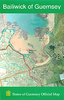

Guernsey Flexi Map
Guernsey with Alderney and Sark on a laminated, tear-resistant Insight Flexi Map, with a road map of the islands at 1:35, 000 and a street plan of St. Peter Port, all indexed and highlighting various sights, plus extensive tourist information.The main map covers Guernsey and Herm at 1:35, 000, with Alderney and Sark included on insets. The islands
Product Description
Reviews/Comments
Add New
Intelligent Comparison
Archived Product
Jersey Flexi Map Stanfords
£4.99
Archived Product
Germany Flexi Map Stanfords
£6.99
Archived Product
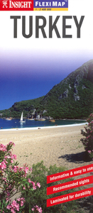
Turkey Flexi Map Stanfords
£4.99
Archived Product
Sydney Flexi Map Stanfords
£4.99
Archived Product
Venice Flexi Map Stanfords
£4.99
Archived Product
Bruges Flexi Map Stanfords
£4.99
Archived Product
Melbourne Flexi Map Stanfords
£4.99
Archived Product
Paris Flexi Map Stanfords
£4.99
Vouchers
No voucher codes found.
Do you know a voucher code for this product or supplier? Add it to Insights for others to use.
Do you know a voucher code for this product or supplier? Add it to Insights for others to use.
 Denmark