
 United Kingdom
 France
 Germany
 Netherlands
 Sweden
 USA
USA
 Italy
Italy
 Spain
Spain
More From Contributor


Germany North
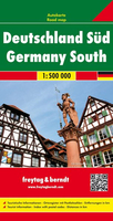
Motorways are clearly depicted on this map, but the other main roads are not differentiated much from each other, and town names and road numbers jostle together, making the map rather cluttered. International borders are also difficult to pick out. However national parks are shown, as are railways, places of interest and campsites. Includes index.
Product Description
Reviews/Comments
Add New
Intelligent Comparison
Archived Product
Germany North F&B Stanfords
£10.99
Archived Product
Germany South Stanfords
£12.50
Archived Product
Germany Borch Stanfords
£9.99
Archived Product
Germany North ITMB Stanfords
£9.99
Archived Product
Graz North Stanfords
£8.95
Archived Product
Germany South F&B Stanfords
£10.99
Archived Product
Berlin North Stanfords
£9.99
Archived Product
Germany South 1864 Stanfords
£120.00
Vouchers
No voucher codes found.
Do you know a voucher code for this product or supplier? Add it to Insights for others to use.
Do you know a voucher code for this product or supplier? Add it to Insights for others to use.
 Denmark