
 United Kingdom
 France
 Germany
 Netherlands
 Sweden
 USA
USA
 Italy
Italy
 Spain
Spain
More From Contributor


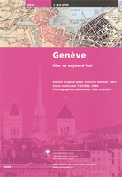
Geneva Once And Today Swisstopo Map No. 303
Geneva Once and Today map from Swisstopo, Switzerland’s national survey organization, with an excellent combination of two detailed topographic maps and two aerial photos, comparing presentation of the city at different stages in its development. One side shows the city and its environs on two topographic maps at 1:25, 000: a beautiful colour reproduction of Swiss Survey’s famous “Dufourkarte” series drawn in 1837/1838, contrasting it with a map of the same area from 2004/2005.On the reverse there are two aerial images at 1:12, 500: a black and white photo from 1932 with the same area photographed in colour in 2004. The accompanying text about the two topographic series and the two aerial imagery series is in French and German only.For the list of other titles in this series
please click on the series link.
please click on the series link.

Product Description
Reviews/Comments
Add New
Intelligent Comparison
Archived Product
Berne Once And Today Swisstopo Map No. 301 Stanfords
£12.99
Archived Product
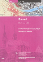
Basel Once And Today Swisstopo Map No. 302 Stanfords
£12.99
Archived Product
Zurich Once And Today Swisstopo Map No. 304 Stanfords
£12.99
Archived Product
Sasso San Gottardo Once And Today Swisstopo Map No. 305 Stanfords
£12.99
Archived Product
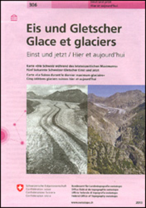
Switzerland: Ice & Glaciers Once And Today Swisstopo Map No. 306 Stanfords
£12.99
Archived Product
Gotthard Railway Axis Once & Today Swisstopo Map No. 307 Stanfords
£12.99
Vouchers
No voucher codes found.
Do you know a voucher code for this product or supplier? Add it to Insights for others to use.
Do you know a voucher code for this product or supplier? Add it to Insights for others to use.
 Denmark