More From Contributor

£12.99
Geneva Once & Today map from Swisstopo, Switzerland’s national survey organization, with an excellent combination of two detailed topographic maps & two aerial photos, comparing presentation of the city at different stages in its development. One side shows the city & its environs on two topographic maps at 1:25, 000: a beautiful colour reproduction of Swiss Survey’s famous “ Dufourkarte” series drawn in 1837/1838, contrasting it with a map of the same area from 2004/2005. On the reverse there are two aerial images at 1:12, 500: a black & white photo from 1932 with the same area photographed in colour in 2004. The accompanying text about the two topographic series & the two aerial imagery series is in French & German only. For the list of other titles in this series please click on the series link. ...
Archived Product
£3.99
The ultimate pocket map of Geneva! Explore Geneva with ease with the help of this genuinely pocket-sized, pop-up map. Small in size yet big on detail, this compact, dependable, city map will ensure you don't miss a thing.

Includes::
2 Pop Out maps
- a detailed street map of central Geneva & a street map of the greater city area Additional maps of the area surrounding Lake Geneva & the United Nations complex are also included Handy, self-folding, tourist map is small enough to fit in your pocket yet offers extensive coverage of the city in an easy-to-use format Thorough street index is also featured & cross-referenced to the map so you can easily find your destination Hotels, restaurants, stores & attractions are all included on the maps


...
Archived Product
£3.99
Discover the lakeside beauty of Geneva with ease with the help of this genuinely pocket-sized, pop-up map. Small in size yet big on detail, this compact, dependable, Geneva city map will ensure you don`t miss a thing. *

Includes::
2 Pop Out maps
- a detailed street map of central Geneva & a street map of the greater city area * Additional maps of the area surrounding Lake Geneva & the United Nations complex are also included * Handy, self-folding, tourist map is small enough to fit in your pocket yet offers extensive coverage of the city in an easy-to-use format * Thorough street index is also featured & cross-referenced to the map so you can easily find your destination * Hotels, restaurants, stores & attractions are all included on the maps Ideal to pop in a pocket or bag for quick reference while exploring the city. Fold

Size:
95mm x 130mm (3.75” x 5.25”) Sheet

Size:
215mm x 225mm (8.5” x 9.75”) (per sheet; 2 sheets) Approx scale: Central Geneva 1:7000 Greater Geneva 1:34000 (Scale to be used as a guideline only)


...
Archived Product
£19.99
Geneva Region at 1:60, 000 in Kümmerly + Frey’s hiking series of Switzerl&, with most titles now printed on light, waterproof & tear-resistant plastic paper. The series offers a popular alternative to Swiss survey maps & cartography which many walkers find easier to follow. Coverage of the whole country is designed so that each title presents a popular hiking area. The maps have contours at 50 or 25-metre intervals according to the terrain, enhanced by graphic relief & shading. An overprint distinguishes between sign-posted hiking paths, mountain path where proper walking shoes are necessary, & alpine paths requiring special equipment. Most titles now also indicate national & regional long-distance hiking routes, each annotated with its official number. Mountain huts are marked, plus various types of accommodation: campsites, youth hostels, “ Friends of Nature” houses, & secluded hotels & restaurants. Road network indicates local bus routes with stops. Railways, narrow gauge mountain railways, cable car lines, & chair lifts are shown, with various symbols highlighting places of interest, viewpoints, picnic sites, swimming pools, etc. Each title covers an area of Approx. 60 x 42 km (37 x 26 miles). The maps have a 1km Swiss national grid, plus latitude & longitude margin ticks at 5’ intervals. * Map legend

Includes::
English.* On the reverse, an index of towns & villages

Includes::
names of geographical features such as mountains, alpine passes, glaciers, lakes, rivers, as well as places of interest. Also provided is an overview road map of surrounding region.


...
Archived Product
£12.99
Map No. 1301, Geneva, in the topographic survey of Switzerland at 1:25, 000 from Bundesamt für Landestopographie (swisstopo), covering the whole country on 247 small format sheets, with special larger maps published for popular regions including some titles now available in hiking versions. Highly regarded for their superb use of graphic relief & hill shading, the maps give an almost 3-D picture of Switzerland`s mountainous terrain. Contours are at 10 m intervals, with 20m intervals in the mountainous areas. All the maps have a 1-km grid for Swiss national coordinates (datum CH 1903). * Small format sheets (Nos. 1011
- 1374)* Map legend in the language of the area covered by the map. Additional margin ticks show latitude & longitude in steps of 2`. The area covered by each map is 17 x 12 km (11 x 7 miles approx). * Special larger sheets (Nos. from 2501 onwards) – STANDARD editions:* No map legend is included but a separate leaflet can be provided instead. The area covered by each map is 25 x 17 km (15 x 11 miles approx).* Special larger sheets (Nos. from 2501 onwards) – HIKING editions:* An overprint highlights hiking, mountain & alpine paths, including regional & national long-distance trails. The maps also show bus routes with bus stops, plus inns in remote locations. The area covered by each map is 25 x 17 km (15 x 11 miles approx).
...
Archived Product
£18.99
Geneva area, map No. 270T, at 1:50, 000 in a special hiking edition of the country’s topographic survey, published by Swisstopo in cooperation with the Swiss Hiking Federation. The map covers the south-western tip of Lake Geneva &

Includes::
the French territory with Gex & Crête de la Neige, the highest peak in the Jura mountains. Cartography, identical to the standard version of the survey, is highly regarded for its superb use of graphic relief & hill shading to provide an almost 3-D picture of Switzerland`s mountainous terrain. Contours are at 20m intervals. An overprint highlights routes maintained by the SHF, distinguishing between hiking routes, mountain routes requiring proper footwear, & alpine routes where equipment is needed. Paths which are part of the national or regional network of long-distance hiking routes are specially marked & in the more recent editions are annotated with their official numbers. The maps show mountain huts, refuges & in remote areas also inns, plus roads with bus service & the positions of bus stops. All the maps have a 1-km grid of the Swiss national coordinates. For a list of all the titles in this series, please click on the series link.

...
Archived Product
£5.95
Geneva in the Wallpaper City Guide series, published by Phaidon & encompassing a collection of pocket-size guides dedicated to the best design elements in major cities. Compiled by experts at the Wallpaper magazine, the guides are widely recognized for appealing to design-conscious travellers & are aimed at those interested in art, design & architecture. Each guide identifies the best bars, restaurants, hotels, places to shop, leisure activities & excursions with a unique emphasis on the finest examples of unusual architecture & design. Each Wallpaper City Guide has the same layout, with separate tabs allowing readers & travellers to access individual sections easily. The tabs consist of Landmarks, Hotels, 24 Hours, Urban Life, Architour, Shopping, Sports & Escapes. High quality colour photographs appear alongside brief descriptions of each hotel, bar or attraction, highlighting distinctive & unusual styles of architecture & design. Extra pages are provided at the back of each guide, allowing readers to record their own notes & sketches. ...
Archived Product
£19.99
Geneva with the adjoining communes on a street plan at 1:20, 000 from Editions MPA with cartography from the Swiss publishers Orell Füsli, showing bus & tram routes with stops & line numbers. An enlargement shows the city’s central districts in greater detail. Streets are annotated with selected house numbers for easier identification of addresses. The map covers the city with its outer suburbs & adjoining communes, including the French side of the border (so covering the whole of the CERN site). Tram & bus routes are shown with stops & line numbers; the plan also shows ferry terminals & connections across Lake Geneva, taxi ranks & car parks. Locations of over 200 hotels in the whole area covered by the map are highlighted & cross-referenced to a list of their names. Symbols indicate various places of interest & facilities including museums, supermarkets, etc. The index is in a separate booklet attached to the map cover. Map legend

Includes::
English.

...
Archived Product
£10.99
John Man’s study of Genghis Khan is a thoroughly captivating account of the man himself, his historical impact, & his cultural impact today. Nowadays, Genghis is by turns scourge, hero & demi-god. To Muslims, Russians & Europeans, he is a mass-murderer. Yet in his homel&, Mongols revere him as the nation’s father; Chinese honour him as dynastic founder; & in both countries, worshippers seek his blessing. This book is more than just a gripping account of Genghis’ rise & conquests; John Man uses first-hand experiences to reveal Khan’s enduring influence
- he is the first writer to explore the hidden valley where Genghis may have died, & one of the few westerners to climb the sacred mountain where Khan was probably buried.
...
Archived Product
£24.95
This is a heavily illustrated, beautifully produced & accessible scholarly treatment of Mongol history for the wider public, offering a comprehensive view from pre-historic times to the modern age. The book is a concise, rich text, with contributions from archaeology to biological anthropology. Presented in five parts
- Before Genghis, lands & peoples of Mongolia; Genghis Times; Mongolian Western Empire; Kublai Khan & Yuan China; concluding with Genghis` Legacy, the decline of the Yuan dynasty to the present day. Findings from excavations & extensive evidence of handicraft production & metalwork illustrate the book. The clear prose, beautiful design, & wide-ranging illustrations will fascinate general readers as well as scholars. The book has contributions from forty leading scholars & is published in collaboration with The Smithsonian Institution & the Mongolian Preservation Foundation.
...
Archived Product

Geneva Swisstopo 270

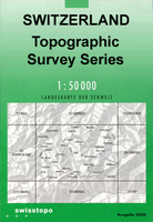
Geneva, map No. 270, in the standard topographic survey of Switzerland at 1:50, 000 from Swisstopo, i.e. without the special overprint highlighting walking trails, local bus stops, etc, presented in Swisstopo’s hiking editions of the 50K survey. The map covers the south-western tip of Lake Geneva and includes the French territory with Gex and Crête de la Neige, the highest peak in the Jura mountains.Highly regarded for their superb use of graphic relief and hill shading, the maps give an almost 3-D picture of Switzerland`s mountainous terrain. Contours are at 20m intervals. All the maps have a 1-km grid with the Swiss national coordinates. This standard version of the 50K survey covers the whole country on 78 small format sheets, with special larger format maps published for
several popular tourist destinations. Small format sheets cover an area of 35 x 24 km (21 x 15 miles approx) and have map legend in the language of the area covered by the map. The special larger sheets cover 50 x 35 km (31 x 22 miles approx) and have no map legend, but a separate leaflet can be provided instead.PLEASE NOTE: the hiking editions of the 1:50, 000 Swisstopo survey are listed on our website in a separate series.
RIP - This product is no longer available on our network. It was last seen on 25.09.2019

This page now acts as a permanent archive for this product. Add more information using the comments box below to ensure it can still be found by future generations.

Use our search facility to see if it is available from an alternative contributor.
  • Availability: Out Of Stock
  • Supplier: Stanfords
  • SKU: 9783302002705
Availability: In Stock
£12.99

Product Description

Geneva, map No. 270, in the standard topographic survey of Switzerland at 1:50, 000 from Swisstopo, i.e. without the special overprint highlighting walking trails, local bus stops, etc, presented in Swisstopo’s hiking editions of the 50K survey. The map covers the south-western tip of Lake Geneva &

Includes::
the French territory with Gex & Crête de la Neige, the highest peak in the Jura mountains. Highly regarded for their superb use of graphic relief & hill shading, the maps give an almost 3-D picture of Switzerland`s mountainous terrain. Contours are at 20m intervals. All the maps have a 1-km grid with the Swiss national coordinates. This standard version of the 50K survey covers the whole country on 78 small format sheets, with special larger format maps published for several popular tourist destinations. Small format sheets cover an area of 35 x 24 km (21 x 15 miles approx) & have map legend in the language of the area covered by the map. The special larger sheets cover 50 x 35 km (31 x 22 miles approx) & have no map legend, but a separate leaflet can be provided instead.PLEASE NOTE: the hiking editions of the 1:50, 000 Swisstopo survey are listed on our website in a separate series.

Reviews/Comments

Add New

Price History

Vouchers

No voucher codes found.
Do you know a voucher code for this product or supplier? Add it to Insights for others to use.

Facebook

Jargon Buster

Hiking - An outdoor activity envolving walking in nature
swiss - Short for Switzerland, one of the richest countries in the world
switzerland - A landlocked country in western Europe. One of the richest countries in the world
Language - the method of communication used in different areas. Humans and computers have many different languages.
Km - Kilometre. A unit of measurement equal to 1000 metres.
Small - something that takes up less space than normal.
Popular - Something that is admired and liked by many people.
Language - The way humans communicate either written and spoken.

Supplier Information

Stanfords
Stanfords was established in 1853 and opened their iconic Covent Garden flagship store in 1901. They have become the top retailer of maps, travel books and accessories in the UK and arguably offer the largest selection of maps and travel books worldwide. Famous names such as Captain Robert Falcon Scott, Ranulph Fiennes and Michael Palin have purchased from Stanfords. They now have a shop in Bristol and both stores together with other venues operate a calendar of events including talks, book signings and exhibitions. As a specialist map retailer, the map selection is comprehensive and includes road maps, street maps and walking maps from worldwide destinations, as well as a selection of world atlases and wall maps. Books include travel guides and travel literature. Stanfords also stock globes, from miniatures made of blue marble to magnificent floor-standing globes. The website features a selection of interesting articles on travel topics.
Page Updated: 2023-11-12 20:15:36

Community Generated Product Tags

Oh No! The productWIKI community hasn't generated any tags for this product yet!
Menu