More From Contributor

£9.95
Appennino Riminese at 1:50, 000 in a series of contoured, GPS compatible maps at 1:50, 000 published by Selca together with the Emilia-Romagna branch of the Club Alpino Italiano (CAI). Each map has a list of local waymarked routes. Cartographic style of maps in this series differs according to the publication date, but all the maps are contoured (interval is either 25m or 40m), with additional relief shading on most sheets & plenty of spot heights. The overprint highlights waymarked hiking trails, showing their route numbers & indicating difficult passages. The overprint also shows which paths form part of the GEA ...
Archived Product
£10.99
Appennino Tosco Romagnolo map at 1:50, 000 from Kompass, printed on durable, waterproof & tear-resistant synthetic paper. Coverage

Includes::
the Mugello hills & Alpe di San Benedetto. Contours are at 40m intervals, with a 2-km UTM grid. Extensive overprint

Includes::
GEA
- Grande Escursione Appenninica, Sentiero Italia, Trekking Lunigiana, etc, plus cycling & selected mountain bike routes. KOMPASS HIKING MAPS OF ITALY – TO SEE THE OTHER TITLES IN THIS SERIES PLEASE CLICK ON THE SERIES LINK. The series covers the northern part of the Italian Alps, the lake region of Lombardy, the Dolomites, selected parts of Tuscany & Umbria, the Sorrento Peninsula, central Sardinia & the islands of the Tyrrhenian Sea. Coverage of the Dolomites by Kompass at more detailed scales (mainly 1:25, 000) is listed on our website in a separate series (please search for SI00000405). Kompass are Europe’s largest publishers of walking maps, with extensive coverage of hiking areas in other countries, all listed on our website.CARTOGRAPHY: Contour interval varies according to the terrain, 40m in most titles. Colouring and/or graphics show different types of the terrain, including woodlands, vineyards, heath, exposed rock, etc. All the maps highlight local hiking paths indicating, where appropriate, long-distance routes or via ferrata trails. Symbols show various types of accommodation such as selected inns & hotels, campsites, mountain huts & refuges, etc. Most titles also include cycle or mountain bike trails and/or ski routes. GPS COMPATIBILITY & MAP LEGEND: All the titles are GPS compatible with a UTM grid, unless indicated to the contrary in the individual description. Map legend

Includes::
English.DURABILITY: Many new editions are now published on sturdy, waterproof & tear-resistant synthetic paper, as indicated in the individual description.BOOKLETS: PLEASE NOTE BEFORE ORDERING!
- Many titles come with a booklet describing the area and/or various hiking routes. Unless indicated in the individual description that the booklet

Includes::
English, these booklets are in Italian & German only. The booklets are not necessary to use the maps since, as stated above, full English language map legend is provided.


...
Archived Product
£21.50
Appennino Tosco-Emiliano National Park at 1:25, 000 in a set of two double-sided, contoured & GPS compatible maps published by Selca together with the park authorities, highlighting hiking routes waymarked either by the Club Alpino Italiano or other local organizations. The maps have contours at 25m intervals, enhanced by relief shading. An overprint highlights waymarked hiking trails, indicating difficult or via ferrata sections & showing, where appropriate, the CAI route numbers. Symbols indicate refuges, hotels, campsites, horse riding facilities, locations with bus service, etc. The maps have a 1-km UTM grid. Map legend

Includes::
English. Each map also

Includes::
a list of waymarked trails indicating their length, the degree of difficulty, change in elevation & approximate timing.


...
Archived Product
£10.99
Map No. 135, Appennino Tosco-Romagnolo East, in a series of GPS compatible hiking maps at 1:50, 000 from the Istituto Geografico Adriatico, covering parts of central Italy: eastern Tuscany, with northern Umbria & the Marches, plus the south-eastern of part of Emilia-Romagna. The maps have contours at 50m intervals with additional shading & numerous spot heights. Colouring indicates different types of land use, including woodlands, olive groves, vineyards & orchards. National park & protected areas are marked. An overprint highlights local waymarked hiking routes, indicating their official number or name, including many long-distance routes such GEA (Grande Escursione Appeninica) & the course of the E1 cross-European footpath. Most titles also show cycle routes and/or mountain bike trails. A range of symbols indicate various facilities such as campsites, mountain refuges & other rural accommodation, bars & restaurants, sport & recreational places, historical & cultural monuments, etc. Road network is graded according to width,

Includes::
country tracks, & shows sections closed to motorised traffic plus locations of petrol stations. The maps have a 5km UTM, plus latitude & longitude lines at intervals of 5’. Map legend

Includes::
English. * * Please note: titles shown on the accompanying grid in broken lines are not yet published.*


...
Archived Product
£19.99
Appenzell
- Rheintal area at 1:50, 000 in a series of waterproof & tear-resistant, contoured mountain biking maps from Hallwag,
...
Archived Product
£18.99
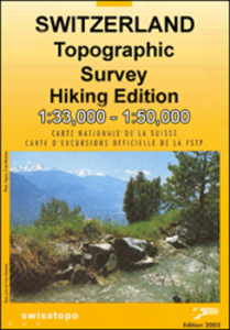
Appenzell area, map No. 227T, at 1:50, 000 in a special hiking edition of the country’s topographic survey, published by Swisstopo in cooperation with the Swiss Hiking Federation. Coverage

Includes::
the peak of Säntis & the north-western corner of Liechtenstein. Cartography, identical to the standard version of the survey, is highly regarded for its superb use of graphic relief & hill shading to provide an almost 3-D picture of Switzerland`s mountainous terrain. Contours are at 20m intervals. An overprint highlights routes maintained by the SHF, distinguishing between hiking routes, mountain routes requiring proper footwear, & alpine routes where equipment is needed. Paths which are part of the national or regional network of long-distance hiking routes are specially marked & in the more recent editions are annotated with their official numbers. The maps show mountain huts, refuges & in remote areas also inns, plus roads with bus service & the positions of bus stops. All the maps have a 1-km grid of the Swiss national coordinates. For a list of all the titles in this series, please click on the series link.

...
Archived Product
£18.99
33 specially selected hiking trails in the Appenzellerland
- Säntis region of Switzerland presented at 1:50, 000 on a waterproof
...
Archived Product
£19.99
An Appetite for Puglia belongs to the innovative new series An Appetite For… which aims to help the reader get to know & appreciate a region through its food & the people who produce it. Offering a fresh approach to the enjoyment of a place, it combines interviews & profiles with beautiful, mouthwatering photography. This book is a homage to those Pugliesi who refuse to turn their backs on their culinary traditions in the face of modern convenience food, & author Christine Smallwood has produced a book dedicated to the art of producing delicious food with good, fresh produce. A series of portraits of the most interesting characters behind some of the best restaurants in Puglia, this guide-cum-cookbook explores not only their cooking but also their stories & views, which are thought-provoking, entertaining & inspiring. Lavishly illustrated throughout, compelling inside stories on the people behind the food accompany original recipes from the chefs themselves – many never before published – so that this beautiful new series offers a real insight into some of the best & most fascinating eating & drinking establishments in a region. They range from the stylish & sophisticated to the fun & frivolous, but they all have one thing in common: a genuine appetite for the best that the region can offer. Discover Puglia through tantalizing recipes such as Minestra of Swiss Chard, Mussels, Cherry Tomatoes & Fish Eggs with Toasted Altamura bread, or indulgent desserts such as Bocconotto (sweet pastry filled with cream & bitter cherries). You just hope that the portions will turn out to be as generous as the photographs in this book! ...
Archived Product
£20.00
Newly reissued, the classic ` Appetite` frees foodies from the tyranny of the cook book, as the brilliant Nigel Slater gives voice to his guiding philosophy: `recipes don`t rule`. Inspiring, irresistible, ` Appetite` takes 100 classic dishes & then throws caution to the wind. With its unpretentious & simple food ideas, such as a cheap spaghetti supper or a spicy curry to make you sweat, it is the anti-recipe book. Offering suggestions & tips, it encourages readers to use their own judgement, giving you the confidence to experiment in the kitchen. Deliciously colourful & witty ` Appetite` puts the fun back into food & gets cooks thinking more instinctively, taking jaded food lovers back to the fundamental question: what do you want to eat today? ...
Archived Product
£26.00
Brash, wild, original & badass. This is Anthony Bourdain`s interpretation of a normal cookbook. As a restaurant professional, Bourdain spent his life on the fringes of normality
- he worked while normal people played, & played while normal people slept. Since then he has settled (kind of) into family life & is cooking for the people he loves rather than people who pay. These are the recipes he turns to when called in for pancake service at sleepover parties or when preparing a violence-free family dinner. Each & every word is informed by his years in the industry & a life dedicated to food. This is a man who has declared the club sandwich as America`s Enemy & wants you to understand the principles of Bad Sandwich Theory. He has distilled his views on dessert to this: it should always be Stilton. Illustrated with photography that somehow manages to be both strangely beautiful & utterly grotesque, this cookbook
- Bourdain`s first in ten years
- is a home-cooking, home-entertaining cookbook like no other.


...
Archived Product

Appenzell Swisstopo 227

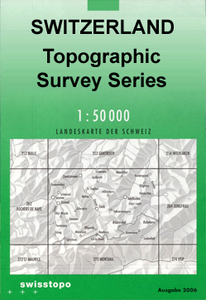
Appenzell, map No. 227, in the standard topographic survey of Switzerland at 1:50, 000 from Swisstopo, i.e. without the special overprint highlighting walking trails, local bus stops, etc, presented in Swisstopo’s hiking editions of the 50K survey. Coverage includes the peak of Säntis and the north-western corner of Liechtenstein. Highly regarded for their superb use of graphic relief and hill shading, the maps give an almost 3-D picture of Switzerland`s mountainous terrain. Contours are at 20m intervals. All the maps have a 1-km grid with the Swiss national coordinates. This standard version of the 50K survey covers the whole country on 78 small format sheets, with special larger format maps published for several popular tourist destinations. Small format sheets cover an area
of 35 x 24 km (21 x 15 miles approx) and have map legend in the language of the area covered by the map. The special larger sheets cover 50 x 35 km (31 x 22 miles approx) and have no map legend, but a separate leaflet can be provided instead.PLEASE NOTE: the hiking editions of the 1:50, 000 Swisstopo survey are listed on our website in a separate series.
RIP - This product is no longer available on our network. It was last seen on 25.09.2019

This page now acts as a permanent archive for this product. Add more information using the comments box below to ensure it can still be found by future generations.

Use our search facility to see if it is available from an alternative contributor.
  • Availability: Out Of Stock
  • Supplier: Stanfords
  • SKU: 9783302002279
Availability: In Stock
£12.99

Product Description

Appenzell, map No. 227, in the standard topographic survey of Switzerland at 1:50, 000 from Swisstopo, i.e. without the special overprint highlighting walking trails, local bus stops, etc, presented in Swisstopo’s hiking editions of the 50K survey. Coverage

Includes::
the peak of Säntis & the north-western corner of Liechtenstein. Highly regarded for their superb use of graphic relief & hill shading, the maps give an almost 3-D picture of Switzerland`s mountainous terrain. Contours are at 20m intervals. All the maps have a 1-km grid with the Swiss national coordinates. This standard version of the 50K survey covers the whole country on 78 small format sheets, with special larger format maps published for several popular tourist destinations. Small format sheets cover an area of 35 x 24 km (21 x 15 miles approx) & have map legend in the language of the area covered by the map. The special larger sheets cover 50 x 35 km (31 x 22 miles approx) & have no map legend, but a separate leaflet can be provided instead.PLEASE NOTE: the hiking editions of the 1:50, 000 Swisstopo survey are listed on our website in a separate series.

Reviews/Comments

Add New

Price History

Vouchers

No voucher codes found.
Do you know a voucher code for this product or supplier? Add it to Insights for others to use.

Facebook

Jargon Buster

Hiking - An outdoor activity envolving walking in nature
swiss - Short for Switzerland, one of the richest countries in the world
switzerland - A landlocked country in western Europe. One of the richest countries in the world
Language - the method of communication used in different areas. Humans and computers have many different languages.
Km - Kilometre. A unit of measurement equal to 1000 metres.
Small - something that takes up less space than normal.
Popular - Something that is admired and liked by many people.
Language - The way humans communicate either written and spoken.

Supplier Information

Stanfords
Stanfords was established in 1853 and opened their iconic Covent Garden flagship store in 1901. They have become the top retailer of maps, travel books and accessories in the UK and arguably offer the largest selection of maps and travel books worldwide. Famous names such as Captain Robert Falcon Scott, Ranulph Fiennes and Michael Palin have purchased from Stanfords. They now have a shop in Bristol and both stores together with other venues operate a calendar of events including talks, book signings and exhibitions. As a specialist map retailer, the map selection is comprehensive and includes road maps, street maps and walking maps from worldwide destinations, as well as a selection of world atlases and wall maps. Books include travel guides and travel literature. Stanfords also stock globes, from miniatures made of blue marble to magnificent floor-standing globes. The website features a selection of interesting articles on travel topics.
Page Updated: 2023-11-12 20:15:36

Community Generated Product Tags

Oh No! The productWIKI community hasn't generated any tags for this product yet!
Menu