More From Contributor

£10.99
The southern part of Romania’s Black Sea coast & the Bulgarian coast on a double-sided map at 1:150, 000 from Freytag & Berndt prominently highlighting the region’s 20 most interesting locations, with their descriptions provided in the accompanying booklet. Coverage extends from well north of Constanta to the Turkish border &

Includes::
Varna, Burgas & other popular holiday destinations. Road network is clearly presented on a background with hill shading to show the topography. Names of main towns are in large size print to help navigating in unfamiliar area; within Bulgaria all place names are given in both Latin & Cyrillic alphabets. The map indicates various places of interest & facilities, including campsites, beaches, picturesque towns & villages, etc. 20 of the region’s best sights are prominently highlighted & cross-referenced to their descriptions in a separate booklet attached to the map cover. Latitude & longitude lines are drawn at 10’ intervals. The index is in the booklet & lists locations with their postcodes. Also provided are street plans of Constanta, Varna & Burgas, plus a more general overview road map of Bulgaria with southern Romania. Map legend & the text in the booklet include English.

...
Archived Product
£7.50
Romanian & Bulgarian coast of the Black Sea on a detailed, double-sided road map from Cartographia at 1:200, 000, with street plans of towns & main holiday resorts overprinted with names of numerous hotels & other tourist information. In Bulgaria names of towns & villages are shown in both Latin & Cyrillic alphabet, geographical information & places of interest, etc. are in Latin alphabet only. The map shows the region’s road network & highlights various places of interest, including protected areas, campsites, beaches, diving sites, etc. Latitude & longitude lines are at intervals of 10’. The index lists Bulgarian locations in both scripts. Map legend

Includes::
English. The map also provides are street plan of central Varna & Nesebar, highlighting various places of interest, plus plans of holiday resorts with names of hotels: Slancev Brjag, Zlati Pjasaci in Bulgaria, plus the Olimp
- Neptun
- Jupiter
- Cap Aurora
- Venus
- Saturn area, Eforie North & South & the Mamaia strip in Romania.


...
Archived Product
£3.99
The Lonely Planet Bulgarian Phrasebook is not only an extensive list of useful phrases, but also an ideal tool to start getting to grips with a language & beginning two-way communication. Containing excellent sections on language basics such as numbers, question phrases, dates, phrase construction, grammar & pronunciation, as well as containing concise but well-rounded two-way dictionaries, Lonely Planet phrasebooks enable you to quickly & confidently construct your own phrases in addition to those given. The given phrases cover all the essential travel & tourism categories such as transport, communications, business meetings & accommodation, as well as in-depth categories such as health, food & social interaction. The phrasebooks are designed to enable more than just simple question-answer communication, allowing the start of two-way conversations ...
Archived Product
£3.99
The Bulgarian Phrase Guide is designed to help travellers get the most out of their trip. Presented in a user-friendly style, the guide focuses on the most popular & commonly used phrases & words. In-depth sections on shopping, eating & drinking are supplemented by essential phrases to put the language into context, helping you to say the right thing at the right time. ...
Archived Product
£185.00
This fully updated second edition is aimed at enhancing the safety & efficiency of bulk carriers & their crews. Robert Lorenz-Meyer, President & Chairman BIMCO, said in the Foreword: “ Anyone in the bulk carrier industry will benefit fromreading Bulk Carrier Practice. It deserves to be on the bookshelf on the bridge of all bulk carriers, & in the offices of all bulk carrier operators.” The CD contains details of a serving modern bulk carrier ...
Archived Product
£18.99
Bulle area, map No. 252T, at 1:50, 000 in a special hiking edition of the country’s topographic survey, published by Swisstopo in cooperation with the Swiss Hiking Federation. Cartography, identical to the standard version of the survey, is highly regarded for its superb use of graphic relief & hill shading to provide an almost 3-D picture of Switzerland`s mountainous terrain. Contours are at 20m intervals. An overprint highlights routes maintained by the SHF, distinguishing between hiking routes, mountain routes requiring proper footwear, & alpine routes where equipment is needed. Paths which are part of the national or regional network of long-distance hiking routes are specially marked & in the more recent editions are annotated with their official numbers. The maps show mountain huts, refuges & in remote areas also inns, plus roads with bus service & the positions of bus stops. All the maps have a 1-km grid of the Swiss national coordinates. For a list of all the titles in this series, please click on the series link. ...
Archived Product
£7.99
A coming-of-age tale reimagined as a searing Western epic. In the small town of S&, populated by gunslingers & surrounded by endless desert, Imma washes dishes & grieves for a life she never had. She & her brother, Nikko, dreamed of escaping to become bullet catchers, a legendary band of outlaws who can deflect bullets with their hands. But they were wiped out years ago, Nikko with them. & leaving is impossible when walking into the desert means certain death. When she sees a stranger catch a man`s bullet & turn it back on him, Imma knows it can only mean one thing: the bullet catchers live on, & this is her way out. Determined to follow him, Imma starts a journey that will take her to her physical extremes & force her to question just what family means & who she really is: bullet catcher or gunslinger; hero or monster. ...
Archived Product
£9.99
Bulqiza Prefecture at 1:100, 000 in a series of handy size, waterproof & tear-resistant, contoured & GPS compatible road maps from the Tirana-based publishers Vektor. Landscape is presented by altitude colouring & contours lines at 100m intervals, with spot heights & a few more names of topographic features than found on Vektor’s 200K road maps of the country. National parks & nature reserves are prominently highlighted. The prefecture maps appear to show the same small local dirt roads as in the 200K series, but given the increase in scale do so with greater clarity & also provide more detailed GPS coordinates (latitude & longitude lines are drawn at 5’ intervals), useful when travelling across the more remote parts of the country. Railway lines are included & local airports are marked. Symbols highlight campsites, beaches, archaeological & historical sites, caves, etc. The maps also show subdivisions of prefectures & names of the communes, & indicate administrative status of towns. Map legend

Includes::
English. Please note: border crossings are prominently marked but beyond topographic colouring no road or other information is provided outside the country’s borders.

...
Archived Product
£3.00
Bulwell in 1913 in a fascinating series of reproductions of old Ordnance Survey plans in the Alan Godfrey Editions, ideal for anyone interested in the history of their neighbourhood or family. The map covers the centre & eastern side of Bulwell. Features include Main Street area, Market Place, St Mary`s church, Midland Railway with Bulwell station, Forest Side area, Forest Works, Highbury Vale area, Great Central Railway with Bulwell Common station, Bulwell North & South junctions, GNR railway with Bulwell Forest station & wagon works, etc. Street directory extracts are on the reverse. About the Alan Godfrey Editions of the 25” OS Series Selected towns in Great Britain & Ireland are covered by maps showing the extent of urban development in the last decades of the 19th & early 20th century. The plans have been taken from the Ordnance Survey mapping & reprinted at about 15 inches to one mile (1:4, 340). On the reverse most maps have historical notes & many also include extracts from contemporary directories. Most maps cover about one mile (1.6kms) north/south, one & a half miles (2.4kms) across; adjoining sheets can be combined to provide wider coverage.FOR MORE INFORMATION & A COMPLETE LIST OF ALL AVAILABLE TITLES PLEASE CLICK ON THE SERIES LINK. ...
Archived Product
£12.99
A br&-new picture book from the creator of WHERE THE WILD THINGS ARE! BUMBLE-ARDY is a glorious picture book about a mischievous pig who has reached the age of nine without ever having had a birthday party. But all that changes when Bumble throws a party for himself & invites all his friends, leading to a wild masquerade that quickly gets out of h&. In this highly anticipated book, Maurice Sendak once again explores the exuberance of young children & the unshakeable love between parent (in this case, an aunt) & child. BUMBLE-ARDY is the first book illustrated & written by Sendak since Outside Over There in 1981. ...
Archived Product

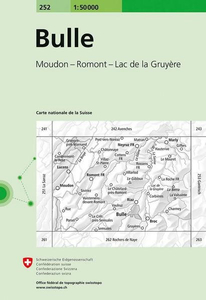
Bulle Swisstopo 252

Bulle, map No. 252, in the standard topographic survey of Switzerland at 1:50, 000 from Swisstopo, i.e. without the special overprint highlighting walking trails, local bus stops, etc, presented in Swisstopo’s hiking editions of the 50K survey. Highly regarded for their superb use of graphic relief and hill shading, the maps give an almost 3-D picture of Switzerland`s mountainous terrain. Contours are at 20m intervals. All the maps have a 1-km grid with the Swiss national coordinates. This standard version of the 50K survey covers the whole country on 78 small format sheets, with special larger format maps published for several popular tourist destinations. Small format sheets cover an area of 35 x 24 km (21 x 15 miles approx) and have map legend in the language of the area
covered by the map. The special larger sheets cover 50 x 35 km (31 x 22 miles approx) and have no map legend, but a separate leaflet can be provided instead.PLEASE NOTE: the hiking editions of the 1:50, 000 Swisstopo survey are listed on our website in a separate series.
RIP - This product is no longer available on our network. It was last seen on 25.09.2019

This page now acts as a permanent archive for this product. Add more information using the comments box below to ensure it can still be found by future generations.

Use our search facility to see if it is available from an alternative contributor.
  • External links may include paid for promotion
  • Availability: Out Of Stock
  • Supplier: Stanfords
  • SKU: 9783302002521
Availability: In Stock
£12.99

Product Description

Bulle, map No. 252, in the standard topographic survey of Switzerland at 1:50, 000 from Swisstopo, i.e. without the special overprint highlighting walking trails, local bus stops, etc, presented in Swisstopo’s hiking editions of the 50K survey. Highly regarded for their superb use of graphic relief & hill shading, the maps give an almost 3-D picture of Switzerland`s mountainous terrain. Contours are at 20m intervals. All the maps have a 1-km grid with the Swiss national coordinates. This standard version of the 50K survey covers the whole country on 78 small format sheets, with special larger format maps published for several popular tourist destinations. Small format sheets cover an area of 35 x 24 km (21 x 15 miles approx) & have map legend in the language of the area covered by the map. The special larger sheets cover 50 x 35 km (31 x 22 miles approx) & have no map legend, but a separate leaflet can be provided instead.PLEASE NOTE: the hiking editions of the 1:50, 000 Swisstopo survey are listed on our website in a separate series.

Reviews/Comments

Add New

Price History

Vouchers

No voucher codes found.
Do you know a voucher code for this product or supplier? Add it to Insights for others to use.

Facebook

Jargon Buster

Hiking - An outdoor activity envolving walking in nature
swiss - Short for Switzerland, one of the richest countries in the world
switzerland - A landlocked country in western Europe. One of the richest countries in the world
Language - the method of communication used in different areas. Humans and computers have many different languages.
Km - Kilometre. A unit of measurement equal to 1000 metres.
Small - something that takes up less space than normal.
Popular - Something that is admired and liked by many people.
Language - The way humans communicate either written and spoken.

Supplier Information

Stanfords
Stanfords was established in 1853 and opened their iconic Covent Garden flagship store in 1901. They have become the top retailer of maps, travel books and accessories in the UK and arguably offer the largest selection of maps and travel books worldwide. Famous names such as Captain Robert Falcon Scott, Ranulph Fiennes and Michael Palin have purchased from Stanfords. They now have a shop in Bristol and both stores together with other venues operate a calendar of events including talks, book signings and exhibitions. As a specialist map retailer, the map selection is comprehensive and includes road maps, street maps and walking maps from worldwide destinations, as well as a selection of world atlases and wall maps. Books include travel guides and travel literature. Stanfords also stock globes, from miniatures made of blue marble to magnificent floor-standing globes. The website features a selection of interesting articles on travel topics.
Page Updated: 2023-11-12 20:15:36

Community Generated Product Tags

Oh No! The productWIKI community hasn't generated any tags for this product yet!
Menu