
 United Kingdom
 France
 Germany
 Netherlands
 Sweden
 USA
USA
 Italy
Italy
 Spain
Spain
More From Contributor


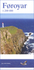
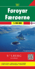
Faroe Islands
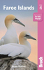
During his first trip to Iceland in 1991, the Swiss Photographer Marco Paoluzzo stayed on the Faroe Isles for two days. He was immediately mesmerised by the solitary group of islands in the North Atlantic. More birds and sheep than people live on the isles that can be found over 1300 kilometres off the Danish coast. It rains over 300 days a year there yet the climate by no means affects the magic of the sinister and mysterious scenery. Each time the photographer visited the isles, he came closer to their essence and unspoiled wild beauty. He discovered a place beyond time, a refuge where you can dream and enjoy life, a spot that offers peace and a space that seems to stretch forever.
Product Description
Reviews/Comments
Add New
Vouchers
No voucher codes found.
Do you know a voucher code for this product or supplier? Add it to Insights for others to use.
Do you know a voucher code for this product or supplier? Add it to Insights for others to use.
 Denmark