
 United Kingdom
 France
 Germany
 Netherlands
 Sweden
 USA
USA
 Italy
Italy
 Spain
Spain
More From Contributor


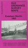


Evesham And Bengeworth 1903
Evesham and Bengeworth in 1903 in a fascinating series of reproductions of old Ordnance Survey plans in the Alan Godfrey Editions, ideal for anyone interested in the history of their neighbourhood or family. The map is double-sided, covering the central and southern part of Evesham and extending across the River Avon to include Great Hampton and Little Hampton. The main map covers the centre of the town from Central Market and Swan Lane southward. Features include All Saints church, St Lawrence`s church, Avondale Mills, Bengeworth Bridge, Merstow Green, Town Hall, Vine Street, Abbey Gardens, The Workman Gardens, Owlett`s End, Little Hampton, Great Hampton, Evesham Workhouse, Hampton Manor, Eastwick, Fairfield, Midland Railway with Bengeworth station, No Gains Farm, St
Andrew`s church, etc. On the reverse is part of the adjacent map 49.04 extending coverage eastward to include more of Bengeworth with St Peter`s church, old church site, brick works, cemetery, etc. A list of private residents from an 1896 directory is also provided. About the Alan Godfrey Editions of the 25” OS Series:Selected towns in Great Britain and Ireland are covered by maps showing the extent of urban development in the last decades of the 19th and early 20th century. The plans have been taken from the Ordnance Survey mapping and reprinted at about 15 inches to one mile (1:4, 340). On the reverse most maps have historical notes and many also include extracts from contemporary directories. Most maps cover about one mile (1.6kms) north/south, one and a half miles (2.4kms)
across; adjoining sheets can be combined to provide wider coverage.FOR MORE INFORMATION AND A COMPLETE LIST OF ALL AVAILABLE TITLES PLEASE CLICK ON THE SERIES LINK.
Product Description
Reviews/Comments
Add New
Intelligent Comparison
Archived Product

Evesham North 1903 Stanfords
£3.50
Vouchers
No voucher codes found.
Do you know a voucher code for this product or supplier? Add it to Insights for others to use.
Do you know a voucher code for this product or supplier? Add it to Insights for others to use.
 Denmark