
 United Kingdom
 France
 Germany
 Netherlands
 Sweden
 USA
USA
 Italy
Italy
 Spain
Spain
More From Contributor


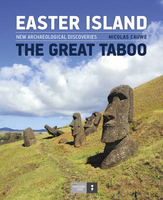
Easter Island
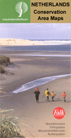
Topographic road map with relief showed by 20m contours, elevation tinting and spot heights for selected peaks. Main roads, secondary roads, tracks & airports are shown. Symbols denote statues, topknots, craters and other landmarks & points of interest, also accommodation, post offices & hosptals.Latitude and longitude margin ticks at 5' intervals.Annotated with geographical and historical information.
Product Description
Reviews/Comments
Add New
Intelligent Comparison
Archived Product
Easter Island Stanfords
£13.95
Archived Product
Easter Island Stanfords
£19.95
Archived Product
Fraser Island Stanfords
£8.95
Archived Product
Fraser Island Stanfords
£8.99
Archived Product
Chile & Easter Island Stanfords
£15.99
Archived Product
Chile & Easter Island Stanfords
£15.99
Archived Product
Gaasterland Stanfords
£8.99
Archived Product
Chile And Easter Island Stanfords
£12.79
Vouchers
No voucher codes found.
Do you know a voucher code for this product or supplier? Add it to Insights for others to use.
Do you know a voucher code for this product or supplier? Add it to Insights for others to use.
 Denmark