
 United Kingdom
 France
 Germany
 Netherlands
 Sweden
 USA
USA
 Italy
Italy
 Spain
Spain
More From Contributor
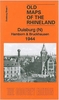
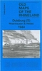


Dukinfield South 1896
Dukinfield South in 1896 in a fascinating series of reproductions of old Ordnance Survey plans in the Alan Godfrey Editions, ideal for anyone interested in the history of their neighbourhood or family. Selected towns in Great Britain and Ireland are covered by maps showing the extent of urban development in the last decades of the 19th and early 20th century.In this title: this detailed map covers the southern part of Dukinfield, and northern fringe of Hyde. Coverage stretches from Pickford Lane southward to Bennett Street, and from Cheetham Hill Road westward to the River Tame. Please note that the small area of Lancashire west of the Tame is left blank. Features include Newton Wood area, Peak Forest Canal, Dukinfield Hall, Great Central Railway, Hyde Junction station,
Bradleyhurst Farm, Barnmeadow Dyewood Mills, Dukinfield Collieries, Dewsnap Pit, Astley Deep Pit, Hyde Junction Iron Works, Johnsonbrook Mill, Victoria Colliery, St Luke's church, St Matthew's Mission Church, Plain Pit, Albert Mill etc. On the reverse is a list of private residents from an 1896 directory. About the Alan Godfrey Editions of the 25
Bradleyhurst Farm, Barnmeadow Dyewood Mills, Dukinfield Collieries, Dewsnap Pit, Astley Deep Pit, Hyde Junction Iron Works, Johnsonbrook Mill, Victoria Colliery, St Luke's church, St Matthew's Mission Church, Plain Pit, Albert Mill etc. On the reverse is a list of private residents from an 1896 directory. About the Alan Godfrey Editions of the 25
Product Description
Reviews/Comments
Add New
Intelligent Comparison
Archived Product

Dukinfield South 1896 Stanfords
£3.50
Archived Product
Dukinfield North 1896 Stanfords
£2.95
Archived Product

Dukinfield North 1896 Stanfords
£3.50
Archived Product

Enfield South 1895 Stanfords
£3.50
Archived Product

Wakefield South 1890 Stanfords
£3.50
Archived Product

Dumfries South 1899 Stanfords
£3.50
Archived Product

Enfield North 1895 Stanfords
£3.50
Archived Product

Sunderland South 1895 Stanfords
£3.50
Vouchers
No voucher codes found.
Do you know a voucher code for this product or supplier? Add it to Insights for others to use.
Do you know a voucher code for this product or supplier? Add it to Insights for others to use.
 Denmark