
 United Kingdom
 France
 Germany
 Netherlands
 Sweden
 USA
USA
 Italy
Italy
 Spain
Spain
More From Contributor


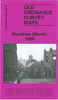


Dumfries South 1899
Dumfries South in 1899 in a fascinating series of reproductions of old Ordnance Survey plans in the Alan Godfrey Editions, ideal for anyone interested in the history of their neighbourhood or family. The map covers the southern part of Dumfries, stretching from Queensberry Square southward to Castledykes and the Comyn`s Castle site, and from the New Bridge eastward to Noblehill. Features include stretch of GSWR railway with Goods Station, Mount St Michael RC College, Dumfries & Galloway Infirmary, Castledykes, Westfield area, Nithsdale Mills, River Nith, High Street and town centre, St Michael`s church, St Andrew`s RC Pro Cathedral, Cattle Market, Old Bridge. A small section of Maxwelltown in Kirkcudbrightshire is shown on the west bank of the Nith, including Troqueer Mills,
Troqueer Holm, West Park and Corbelly Hill Nursery. On the reverse is a selection of street directory entries, including Bank Street, Broom`s Road, English Street, Friars Vennel, Nithbank and Shakespeare Street. About the Alan Godfrey Editions of the 25” OS Series:Selected towns in Great Britain and Ireland are covered by maps showing the extent of urban development in the last decades of the 19th and early 20th century. The plans have been taken from the Ordnance Survey mapping and reprinted at about 15 inches to one mile (1:4, 340). On the reverse most maps have historical notes and many also include extracts from contemporary directories. Most maps cover about one mile (1.6kms) north/south, one and a half miles (2.4kms) across; adjoining sheets can be combined to provide wider
coverage.FOR MORE INFORMATION AND A COMPLETE LIST OF ALL AVAILABLE TITLES PLEASE CLICK ON THE SERIES LINK.

Product Description
Reviews/Comments
Add New
Intelligent Comparison
Archived Product

Dumfries North 1899 Stanfords
£3.50
Archived Product
Dukinfield South 1896 Stanfords
£2.95
Archived Product

Dukinfield South 1896 Stanfords
£3.50
Archived Product

Derby South 1899 Stanfords
£3.50
Archived Product

Enfield South 1895 Stanfords
£3.50
Vouchers
No voucher codes found.
Do you know a voucher code for this product or supplier? Add it to Insights for others to use.
Do you know a voucher code for this product or supplier? Add it to Insights for others to use.
 Denmark