
 United Kingdom
 France
 Germany
 Netherlands
 Sweden
 USA
USA
 Italy
Italy
 Spain
Spain
More From Contributor


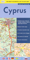
Cyprus
Cyprus on an indexed, waterproof and tear-resistant road map with topographic and tourist information, published by Reise Know-How as part of their highly acclaimed World Mapping Project. The map clearly shows the demarcation line and the UN buffer zone and indicates crossing points between the two parts of the island.On the Greek side names of towns and villages are given in both alphabets, with geographical names and places of interest shown in the Latin alphabet only, and boundaries of administrative provinces are marked. North of the demarcation line many towns and villages show both their current and the old Greek names.Topography is indicated by altitude colouring with spot heights and mountain passes, plus names of mountain ranges and peaks. Road information includes dirt roads
and tracks. National parks or protected areas and picturesque towns or villages are highlighted and symbols mark campsites and numerous places of interest: forts and religious buildings, archaeological sites, beaches, surfing and fishing locations, riding stables, viewpoints, etc. Restricted entry areas, including the Akrotiri Base, are clearly mraked. The map has a UTM grid for GPS users, plus a latitude/longitude grid at intervals of 10
and tracks. National parks or protected areas and picturesque towns or villages are highlighted and symbols mark campsites and numerous places of interest: forts and religious buildings, archaeological sites, beaches, surfing and fishing locations, riding stables, viewpoints, etc. Restricted entry areas, including the Akrotiri Base, are clearly mraked. The map has a UTM grid for GPS users, plus a latitude/longitude grid at intervals of 10
Product Description
Reviews/Comments
Add New
Intelligent Comparison
Archived Product
Cyprus Stanfords
£4.99
Archived Product
Cyprus Stanfords
£8.95
Archived Product
Cyprus Stanfords
£8.99
Archived Product
Cyprus Stanfords
£16.95
Archived Product
Cyprus Stanfords
£11.19
Archived Product
Cyprus Stanfords
£12.99
Archived Product
Cyprus Stanfords
£11.19
Archived Product

Crush Stanfords
£7.99
Vouchers
No voucher codes found.
Do you know a voucher code for this product or supplier? Add it to Insights for others to use.
Do you know a voucher code for this product or supplier? Add it to Insights for others to use.
 Denmark