More From Contributor
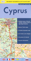
£8.99
Cyclogeography is an essay about the bicycle in the cultural imagination & a portrait of London seen from the saddle. Informed by his years spent as a bicycle courier, Jon Day reflects on the way bicycles connect people with places. Parasitic on the city, couriers have an intimate knowledge of London, & for those who survive the grinding toughness of the job the bicycle can become the only thing holding them together. ...
Archived Product
£16.99
The world of cycling is a veritable treasure trove ready to be plundered & in ” Cyclopedia, ” renowned two-wheeled aficionado, William Fotheringham, delves deep to unearth some 24-carat bike booty. This essential book is a miscellany of facts, figures, interesting snippets & quirky characters from the world of cycling. It tells you everything you could ever want to know about the bicycle from the history of the Tour de France to Chris Hoy`s dominance of the Beijing Velodrome via the origins of the ubiquitous quick release system & the diet that powered Graeme Obree to the world hour record
- marmalade & cornflakes. ” Cyclopedia” has all the gear, the equipment, the races, the chases, the faces, the places, the drugs, the sex & the scandals to convert any amateur cyclist into a fully-fledged BMX bandit.
...
Archived Product
£12.99
This unusual book is a celebration of our most wonderful invention, a machine which, like no other, magnifies the power of our bodies & carries us, in all senses, to places new. This is a book of big ideas & fascinating information. It is also a guide to the latest creative design & technology from around the world. Cycling brings different pleasures to different people. Whatever your cycling interests -- commuting, touring, racing, family outings, carrying loads, having fun, or just heading off onto the open road -- you will discover a world of pedal-powered wonders in Cyclorama. ...
Archived Product
£19.99
Cyclosportives, or long-distance cycle rides, are growing in popularity all over the world. From the Etape du Tour
- where cyclists
...
Archived Product
£8.99
Kamin Mohammadi was nine years old when her family fled Iran during the 1979 Revolution. Bewildered by the seismic changes in her homel&, she turned her back on the past & spent her teenage years trying to fit in with British attitudes to family, food & freedom. She was twenty-seven before she returned to Iran, drawn inexorably back by memories of her grandmother`s house in Abadan, with its traditional inner courtyard, its noisy gatherings & its very walls steeped in history. The Cypress Tree is Kamin`s account of her journey home, to rediscover her Iranian self & to discover for the first time the story of her family: a sprawling clan that sprang from humble roots to bloom during the affluent, Biba-clad 1960s, only to be shaken by the horrors of the Iran-Iraq War & the heartbreak of exile, & toughened by the struggle for democracy that continues today. This moving & passionate memoir is a love letter both to Kamin`s extraordinary family & to Iran itself, an ancient country which has survived so much modern tumult but where joy & resilience will always triumph over despair. ...
Archived Product
£9.50
Cyprus on an indexed, waterproof & tear-resistant road map with topographic & tourist information, published by Reise Know-How as part of their highly acclaimed World Mapping Project. The map clearly shows the demarcation line & the UN buffer zone & indicates crossing points between the two parts of the isl&. On the Greek side names of towns & villages are given in both alphabets, with geographical names & places of interest shown in the Latin alphabet only, & boundaries of administrative provinces are marked. North of the demarcation line many towns & villages show both their current & the old Greek names. Topography is indicated by altitude colouring with spot heights & mountain passes, plus names of mountain ranges & peaks. Road information

Includes::
dirt roads & tracks. National parks or protected areas & picturesque towns or villages are highlighted & symbols mark campsites & numerous places of interest: forts & religious buildings, archaeological sites, beaches, surfing & fishing locations, riding stables, viewpoints, etc. Restricted entry areas, including the Akrotiri Base, are clearly mraked. The map has a UTM grid for GPS users, plus a latitude/longitude grid at intervals of 10

...
Archived Product
£8.95
Cyprus on a light, waterproof & tear-resistant map from Berndtson, highlighting the islands 15 top sites, plus an enlargement of the Troodos Mountains, street plans of main cities & detailed maps showing access to the holiday resorts. On one side is a map at 1:275, 000 showing the island ...
Archived Product
£8.99
Indexed road map of Cyprus from the Nicosia based cartographic publishers Selas, with street plans of main cities & resorts indexed for main places of interest, an enlargement for the Troodos Mountains, maps of various nature trails, etc. The main map at 1:250, 000 has altitude colouring to give a general impression of the island’s topography. Road network

Includes::
unpaved roads & indicates locations of petrol stations. A wide range of symbols highlights various facilities, including accommodation & numerous restaurants, beaches, sport & recreational facilities, archaeological sites & other places of interest, etc. The overprint is limited to the Greek park of the isl&. Place names are shown in Latin alphabet only, with old Greek names used in Northern Cyprus. The map has an index with a separate list of places of interest. Margin ticks give latitude & longitude at 30’ intervals. Enlargements at scales around 1:50, 000/75, 000 show waymarked nature trails in the central part of the Troodos mountains, Stavros mountains, plus on Akamas & Gkreko peninsulas. These maps are not contoured but have altitude colouring & show local landmarks. On the reverse, an enlargement at 1:100, 000 shows in greater detail the road network & various facilities in the whole of the Troodos mountains. Large street plans cover the central areas of Nicosia, Larnaka, Limassol & Pafos, indicating one way streets, petrol stations & banks, as well as accommodation, places of interest & various facilities all indexed. Similarly annotated & indexed insets cover Agia Napa, Eastern Larnaka Beach & Protoras. Also included is a distance table. Main map legend is multilingual, including English; all indexes are in English only.

...
Archived Product
£16.95
The SELAS Cyprus illustrated guide book, researched & produced locally, is primarily aimed at those taking a touring holiday on the island; including in-depth descriptions of towns & villages, historical, geographical & economic information, as well as a selection of regional road maps, town plans & overview maps to excursion/archaeological sites. The guide is divided into broad chapters dealing with districts: Pafos, Limassol, Nicosia, Larnaka, Famagusta, with subsections focussing on local area exploration & regional introductory information on the principal towns, sites, monuments, museums, churches & other places of interest. Specific excursion information is included for visitor sites, nature trails, camping sites & especial beaches.A general background to the country is given, with a brief historical survey of Cyprus provided, ancient/current names married, & political problems discussed. Additional useful information concludes the guide, covering topics such as logistically & socially orientating yourself, health & safety, food, drink & shopping, as well as some introductory vocabulary. ...
Archived Product
£11.19
Cyprus in the Countries & Regions series from Lonely Planet, market-leading comprehensive guides aimed at independent travellers & serving a large range of international destinations. Frank & informal in style, the guides explore an extensive range of sights, activities, accommodation, restaurants & nightlife & are designed for practical use while travelling on the road. Written & researched by a team of experts, each book is independent in its recommendations & suggestions, often offering individual takes on individual destinations. Widely recognised for their reliability, each Lonely Planet country & region guide has the same layout. Introductory sections profile the destination with individual chapters on particular highlights, getting started, (including when to go) itineraries, history, culture, arts, food & drink & the environment. Each guide is organised geographically by region, with individual sections detailing an extensive range of sights, places of interest, attractions, restaurants, nightlife, accommodation & any local activities. The guides have detailed explanations of historical context where relevant. There is also practical guidance on ...
Archived Product

Cyprus

Cyprus at 1:250, 000 is an indexed map with additional street plans and enlargements of popular regions on the reverse. The publisher has chosen to concentrate on creating a map which will primarily be of use for a tourist navigating between main points of interest as opposed to stressing more detailed cartography.Motorways, national, main, minor roads and tracks are clearly marked with special attention given to indicating scenic routes and a separate map shows recommended circular tours on the island. In keeping with the publisher
RIP - This product is no longer available on our network. It was last seen on 25.09.2019

This page now acts as a permanent archive for this product. Add more information using the comments box below to ensure it can still be found by future generations.

Use our search facility to see if it is available from an alternative contributor.
  • Availability: Out Of Stock
  • Supplier: Stanfords
  • SKU: 9781847735362
Availability: In Stock
£4.99

Product Description

Cyprus at 1:250, 000 is an indexed map with additional street plans & enlargements of popular regions on the reverse. The publisher has chosen to concentrate on creating a map which will primarily be of use for a tourist navigating between main points of interest as opposed to stressing more detailed cartography. Motorways, national, main, minor roads & tracks are clearly marked with special attention given to indicating scenic routes & a separate map shows recommended circular tours on the isl&. In keeping with the publisher

Reviews/Comments

Add New

Price History

Vouchers

No voucher codes found.
Do you know a voucher code for this product or supplier? Add it to Insights for others to use.

Facebook

Jargon Buster

Popular - Something that is admired and liked by many people.

Supplier Information

Stanfords
Stanfords was established in 1853 and opened their iconic Covent Garden flagship store in 1901. They have become the top retailer of maps, travel books and accessories in the UK and arguably offer the largest selection of maps and travel books worldwide. Famous names such as Captain Robert Falcon Scott, Ranulph Fiennes and Michael Palin have purchased from Stanfords. They now have a shop in Bristol and both stores together with other venues operate a calendar of events including talks, book signings and exhibitions. As a specialist map retailer, the map selection is comprehensive and includes road maps, street maps and walking maps from worldwide destinations, as well as a selection of world atlases and wall maps. Books include travel guides and travel literature. Stanfords also stock globes, from miniatures made of blue marble to magnificent floor-standing globes. The website features a selection of interesting articles on travel topics.
Page Updated: 2023-11-12 20:15:36

Community Generated Product Tags

Oh No! The productWIKI community hasn't generated any tags for this product yet!
Menu