
 United Kingdom
 France
 Germany
 Netherlands
 Sweden
 USA
USA
 Italy
Italy
 Spain
Spain
More From Contributor


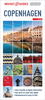

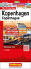
Copenhagen Flexi Map
Copenhagen on a laminated, tear-resistant Insight Flexi Map with an indexed street plan of the city, maps of the Copenhagen area and of north-eastern Zealand, a diagram of the metro lines, plus extensive tourist information.The street plan extends west to include the Frederiksberg Park and Castle. Metro stations, one way streets and car parks are clearly marked. Main public buildings, places of interest and selected hotels are prominently highlighted and named. The plan is indexed for streets, districts, parks, hotels, points of interest and public buildings. Also included is a diagram of the metro lines.Copenhagen area is covered at 1:115, 000, showing road access to the centre from the surrounding motorways and the international airport, including the exit onto the bridge to
Malm
Malm
Product Description
Reviews/Comments
Add New
Intelligent Comparison
Archived Product
Copenhagen Flexi Map Stanfords
£4.99
Archived Product
Charleston Flexi Map Stanfords
£5.99
Archived Product
Crete Flexi Map Stanfords
£4.99
Archived Product
Copenhagen PopOut Map Stanfords
£3.99
Archived Product
Vienna Flexi Map Stanfords
£4.99
Archived Product
Venice Flexi Map Stanfords
£4.99
Archived Product
Prague Flexi Map Stanfords
£4.99
Archived Product
Vienna Flexi Map Stanfords
£3.74
Vouchers
No voucher codes found.
Do you know a voucher code for this product or supplier? Add it to Insights for others to use.
Do you know a voucher code for this product or supplier? Add it to Insights for others to use.
 Denmark