
 United Kingdom
 France
 Germany
 Netherlands
 Sweden
 USA
USA
 Italy
Italy
 Spain
Spain
More From Contributor


Copenhagen F&B
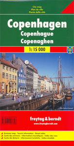
Indexed street plan of central Copenhagen and the adjoining districts. Coverage extends from the airport on Amager in the south-east to Kongens Lyngby in the north and Roedovre in the west. Detail includes pedestrian zones, metro and S-Tog lines & stations, public buildings, industrial areas, theatres, museums, parks, emergency services, campsites, marinas, monuments, places of worship, tourist information offices, car parks, post offices. An inset shows a small road map of north-eastern Zealand. Map legend includes English. Index on reverse.

Product Description
Reviews/Comments
Add New
Intelligent Comparison
Archived Product
Copenhagen Stanfords
£8.95
Archived Product
Copenhagen Stanfords
£10.39
Archived Product
Copenhagen Stanfords
£29.99
Archived Product
Copenhagen Borch Stanfords
£8.99
Archived Product

Copenhagen Noir Stanfords
£9.99
Archived Product
Copenhagen 1844 Stanfords
£180.00
Archived Product

Copenhagen Tales Stanfords
£10.99
Archived Product
Copenhagen PopOut Stanfords
£4.99
Vouchers
No voucher codes found.
Do you know a voucher code for this product or supplier? Add it to Insights for others to use.
Do you know a voucher code for this product or supplier? Add it to Insights for others to use.
 Denmark