
 United Kingdom
 France
 Germany
 Netherlands
 Sweden
 USA
USA
 Italy
Italy
 Spain
Spain
More From Contributor


Congo Journey
Congo Journey combines the acute observation of a nineteenth-century missionary, and the wit of a Monty Python player, Redmond O'Hanlon is famous for his adventurous travel. In Congo Journey his challenge is the Congo, the most dangerous and inhospitable jungle in the world.
Product Description
Reviews/Comments
Add New
Intelligent Comparison
Archived Product
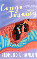
Congo Journey Stanfords
£18.99
Archived Product

A Journey Stanfords
£9.99
Vouchers
No voucher codes found.
Do you know a voucher code for this product or supplier? Add it to Insights for others to use.
Do you know a voucher code for this product or supplier? Add it to Insights for others to use.
 Denmark