
 United Kingdom
 France
 Germany
 Netherlands
 Sweden
 USA
USA
 Italy
Italy
 Spain
Spain
More From Contributor


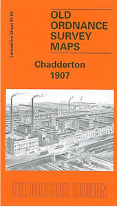
Chadderton 1907
Chadderton in 1907 in a fascinating series of reproductions of old Ordnance Survey plans in the Alan Godfrey Editions, ideal for anyone interested in the history of their neighbourhood or family. The map covers much of Chadderton and the western fringe of Oldham. Coverage stretches from Chadderton Park and Ferney Field eastward to Featherstall Road, and from Burnley Lane southward to Cow Hill. Features include Hartford Iron Works, Werneth station, Stockfield Colliery, Alder Root, Westwood, Busk, tramways, Britannia Mills, Werneth Goods station, Anchor Mill, Gresham Mill, Olive Mill, Ashley Mill, Springfield Mill, Glenby Mill, Hartford Forge, Sun Mill, Palm Mill, Wren Mill, Melbourne Mills, other mills, the steep Middleton Jct & Oldham branch, Chadderton Cemetery,
Springbrook Works, Ferney Field colliery (disused), Falcon Mill, Manor Mill, Westhulme Fever Hospital, etc. On the reverse are street directory entries for Featherstall Road and Middleton Road, plus a Chadderton directory entry.About the Alan Godfrey Editions of the 25” OS Series:Selected towns in Great Britain and Ireland are covered by maps showing the extent of urban development in the last decades of the 19th and early 20th century. The plans have been taken from the Ordnance Survey mapping and reprinted at about 15 inches to one mile (1:4, 340). On the reverse most maps have historical notes and many also include extracts from contemporary directories. Most maps cover about one mile (1.6kms) north/south, one and a half miles (2.4kms) across; adjoining sheets can be combined
to provide wider coverage.FOR MORE INFORMATION AND A COMPLETE LIST OF ALL AVAILABLE TITLES PLEASE CLICK ON THE SERIES LINK.

Product Description
Reviews/Comments
Add New
Intelligent Comparison
Archived Product

Chadderton North 1932 Stanfords
£3.50
Archived Product

Charlton 1867 Stanfords
£3.50
Archived Product
Charlton 1914 Stanfords
£3.50
Archived Product

Charlton 1894 Stanfords
£3.50
Vouchers
No voucher codes found.
Do you know a voucher code for this product or supplier? Add it to Insights for others to use.
Do you know a voucher code for this product or supplier? Add it to Insights for others to use.
 Denmark