
 United Kingdom
 France
 Germany
 Netherlands
 Sweden
 USA
USA
 Italy
Italy
 Spain
Spain
More From Contributor


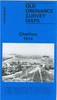


Charlton 1867
Charlton in 1867 in a fascinating series of reproductions of old Ordnance Survey plans in the Alan Godfrey Editions, ideal for anyone interested in the history of their neighbourhood or family. Three versions have been published for this area, stretching from Beaconsfield Rd and Westcombe Park station eastward to Mount Street and Maryon Park, and from New Charlton and Anchor Hope Lane southward to Charlton House. Features include Charlton House, Westcombe Park and Charlton stations, Woolwich Road with its tramways, the Angerstein Wharf railway branch, numerous old sand pits, Charlton Village, and much of the Westcombe Park estate including Mycenae Road and Woodlands. A small portion of Woolwich around Sand St is also covered. Churches include St Luke`s Charlton, St Paul`s
Fairfield Road, St George`s Glenluce Road, Holy Trinity Woolwich Road, St Thomas Woodland Terrace. Roads on the 1867 map include Greenwich and Woolwich Lower Road, Lansdowne Road, Church Lane, Charlton Road, Combe Farm Lane, Victoria Road. The 1867 map also includes a tramway into the sandpits (near what is now Charlton FC) and has an extract of the map southward to Shooters Hill Rd. Each version has extracts from early directories.About the Alan Godfrey Editions of the 25” OS Series:Selected towns in Great Britain and Ireland are covered by maps showing the extent of urban development in the last decades of the 19th and early 20th century. The plans have been taken from the Ordnance Survey mapping and reprinted at about 15 inches to one mile (1:4, 340). On the reverse most maps
have historical notes and many also include extracts from contemporary directories. Most maps cover about one mile (1.6kms) north/south, one and a half miles (2.4kms) across; adjoining sheets can be combined to provide wider coverage.FOR MORE INFORMATION AND A COMPLETE LIST OF ALL AVAILABLE TITLES PLEASE CLICK ON THE SERIES LINK.

Product Description
Reviews/Comments
Add New
Intelligent Comparison
Archived Product

Charlton 1894 Stanfords
£3.50
Archived Product

Charlton 1914 Stanfords
£3.50
Archived Product
Dalston 1870 Stanfords
£3.50
Archived Product
Chadderton 1907 Stanfords
£3.50
Vouchers
No voucher codes found.
Do you know a voucher code for this product or supplier? Add it to Insights for others to use.
Do you know a voucher code for this product or supplier? Add it to Insights for others to use.
 Denmark