
 United Kingdom
 France
 Germany
 Netherlands
 Sweden
 USA
USA
 Italy
Italy
 Spain
Spain
More From Contributor


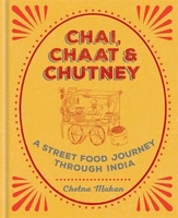
Chai, Chaat & Chutney
Shortlisted for a 2018 Edward Stanford Travel Writing Award.Chetna Makan has travelled to the four corners of India - Mumbai, Kolkata, Delhi and Chennai - sampling the extreme varieties of street food on offer. Each area has subtle differences in ingredients and techniques, making the cuisine completely unique and full of character.In Chai, Chaat & Chutney, Chetna has taken inspiration from the street and created delicious recipes that are simple to cook at home. The result is a completely fresh take on Indian cuisine - try Tamarind Stuffed Chillis, Chana Dal Vada with Coconut Chutney and Sticky Bombay Chicken from the South or let your senses venture to the North for Chole, one of the ultimate curries, sweet Carrot Halwa, Pani Puri and Cardamom & Pistachio Kulfi.

Product Description
Reviews/Comments
Add New
Vouchers
No voucher codes found.
Do you know a voucher code for this product or supplier? Add it to Insights for others to use.
Do you know a voucher code for this product or supplier? Add it to Insights for others to use.
 Denmark