
 United Kingdom
 France
 Germany
 Netherlands
 Sweden
 USA
USA
 Italy
Italy
 Spain
Spain
More From Contributor


Central Tien Shan
Detailed trekking map of the eastern corner of Kyrgyzstan on the border with Kazakhstan and China. The map shows mountain ridges with numerous spot heights and passes and indicates various types of terrain, glaciers, crevasses, moraine, rocky deposits, as well and springs and rivers. Roads, tracks, settlements and shephards
Product Description
Reviews/Comments
Add New
Intelligent Comparison
Archived Product
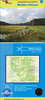
Central Highlands Stanfords
£17.95
Archived Product
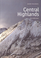
Central Highlands Stanfords
£5.99
Vouchers
No voucher codes found.
Do you know a voucher code for this product or supplier? Add it to Insights for others to use.
Do you know a voucher code for this product or supplier? Add it to Insights for others to use.
 Denmark