More From Contributor
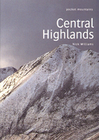
£7.95
Central Franconia
- Tauber Valley area in a series of cycling maps of Germany from ADFC, the Allgemeiner Deutscher Fahrrad-Club,
...
Archived Product
£10.99
Central Franconia
- Tauber Valley: Würzburg
- Nuremburg
- Rothenburg o.d. Tauber area of northern Bavaria in a series of


...
Archived Product
£16.99
Sverigeserien is an outdoor map series consisting of 116 sheets with coverage of southern & central Sweden & the northern coastline. The map is suitable for outdoor activities such as hiking, excursions, trail running, hunting, fishing, riding, cycling, mountain biking, paddling, skating & much more. Every sheet covers an area of 45x 68km. These topographical maps in scale 1:50 000 contain all the information needed for outdoor activities: Terrain information, hiking trails, illuminated tracks, camping, shelters, golf courses, leisure baths, historical remains, roads in different categories, railway lines & much more. Easy to read topography with contour lines, vertical interval 5 m. Sverigeserien is a high-quality map series & is durable for frequent use! Updated content with map data from Lantmäteriet (National Land Survey of Sweden) & printed on Polyart which is water & tear resistant. This means that the map can be folded repeatedly without breaking & can withstand the challenging weather in Sweden during both winter & summer. Legend is in Swedish, English & German. ...
Archived Product
£8.99
Central Greece at 1:250, 000 on a light, waterproof & tear resistant indexed road map from Anavasi, highlighting ten areas of particular natural beauty. Coverage

Includes::
the most popular hiking regions of the Pindos Mountains, Mount Olympus & Mount Parnassos, extending from Thebes (Thiva) in the south to Kozani & Katerini. Place names are in both Greek & Latin alphabet. Altitude colouring with relief shading & plenty if names of mountain ranges & peaks provides an excellent presentation of the region’s mountainous topography. The map indicates minor unsurfaced roads & dirt tracks in poor condition, & shows locations of petrol stations. Driving distances are marked in main routes. The map also

Includes::
railway lines & administrative boundaries & highlights the course of the Greek & European long-distance hiking trails. Symbols indicate various places of interest including archaeological remains, historical sites, beaches, etc. The map has a 5-km UTM grid plus latitude & longitude crosshairs. The index, in both alphabets, in is a removable protective cover. Map legend

Includes::
English.A special feature of this title are descriptions of 10 areas specially selected for their natural beauty. The map is part of Anavasi’s coverage of the Peloponnese & mainland Greece at 1:200, 000/1:250, 000.


...
Archived Product
£17.95
The Scottish Mountaineering Club District Guide to the Central Highlands is a comprehensive guide to hill-walking & climbing in the region. Each chapter begins by providing information on available maps, principle hill & mountain groups with elevation details, access, transport, accommodation & a general description of the isl&. Following this, detailed descriptions are given for the areas hills & mountains, walking on the isl&, as well as rock climbing opportunities. Each chapter is accompanied by hand drawn maps & is illustrated throughout with photographs. An introductory section provides general information on the region as a whole, including access, transport, accommodation, weather, mountain rescue, geology, natural history & social history. About this series These sturdy hardbacked volumes could be said to be the definitive guides to the mountaineering districts of Scotl&. An enormous amount of detail is included in these titles. Each chapter covers a specific area, with a detailed diagrammatic map & a separate description for each of the principle hills, including ascent & descent instructions. Extensive additional information is included for walkers, cavers, geologists & climbers. There is also advice on public transport & accommodation. ...
Archived Product
£9.99
A guide to the classic backpacking routes of Scotland's Central Highlands. If you are looking to escape the more populous walking areas of the Highlands this is the book for you. The author takes us away from the ?honey-pots' with six superb long-distance backpacking routes, three to eight days' in length, almost all on rights of way. This is Wild Scotland
- a working landscape of deer forest, grouse moor, hill sheep farms, beef & dairy farms & commercial forest, where a sense of peace & isolation is guaranteed & accommodation is largely confined to the odd B+B, youth hostel, bothy or tent. Each route has opportunities to explore adjacent glens & peaks, with variations & alternatives to the set walks. Route starts & finishes are well supplied by bus & rail services, & the numerous sketch maps for each walk provide additional information to the OS maps. All the routes have been surveyed & graded by the author, Peter Koch-Osborne, whose affection for the ?wild places' is manifest.
...
Archived Product
£5.99
Central Hymettos in a series of waterproof & tear-resistant hiking maps at scales varying from 1:50, 000 to 1:10, 000, with a UTM grid for GPS users. Contour interval varies depending on the scale, on most maps it is 20m. Relief shading, spot heights, springs, seasonal streams &, in most titles, landscape/l&-use variations, e.g. forests, orchards, or vineyards provide additional information on the terrain. Place names are given in both Greek & Latin script. Local footpaths, hostels & mountain huts are clearly marked. For road users intermediate driving distances & petrol stations are shown. Symbols highlight places of interest, including archaeological sites, churches & monasteries, etc. The maps have a UTM grid & margin ticks for latitude & longitude. Map legend

Includes::
English.* In this title:* the central Hymettos range just east of Athens. More detailed scale was used to show clearly the dense network of footpaths across the area of 6km x 6km. Street names are shown in built-up areas. Coverage extends from the fringe of the Athenian suburb Ilioupoli eastwards to the peak Kastro, northwards to the Kareas monastery & southwards as far as the summit of Stroma. On the reverse is a simplified version of the same map highlighting roads & hiking routes. Some of the accompanying notes have English translation.

...
Archived Product
£7.95
Central Italy at 1:400, 000 from the Touring Club Italiano, printed on light, waterproof & tear-resistant plastic paper; one of the titles in a series of three touring maps conveniently grouping together several popular holiday areas. The maps very effectively present the country ...
Archived Product
£9.50
Central Italy at 1:400, 000 from the Touring Club Italiano, printed on light, waterproof & tear-resistant plastic paper; one of the titles in a series of three touring maps conveniently grouping together several popular holiday areas. The maps very effectively present the country’s topography with attractive altitude colouring, supplemented by names of numerous hill & mountain ranges, valleys, etc, plus spot heights for selected peaks. National parks & scenic routes are highlighted. National parks & scenic routes are highlighted. Grading according to the degree of importance & interest is given not only to towns, villages & historical or architectural sites, but also to holiday resorts & natural curiosities. Symbols highlight churches, monasteries, castles, palaces, ruins & archaeological sites, caves & waterfalls, etc. The maps also provide some information on accommodation, indicating selected isolated hotels, refuges, tourist villages & campsites, Road network stands out clearly against the background information. Railways, ferry routes & the country’s regional & provincial boundaries are also marked. The maps have no geographical coordinates or an index. Map legend

Includes::
English.

...
Archived Product
£13.95
One of the regional road maps derived from data provided by the Danish national survey organization, Kort og- Matrikelstyrelsen. Communications network

Includes::
secondary roads, motorway filling stations & services, scenic routes, etc., as well as railways & vehicle & passenger ferries. Symbols show various facilities & places of interest, including campsites, tourist offices, various landmarks, antiquities, amusement parks, zoos, viewpoints, etc. County boundaries are marked & forests, nature reserves, heaths, marshes, etc. are distinguished, although there is no relief detail. Latitude & longitude lines are drawn at 10' & 20' intervals respectively. Map legend in English, Danish & German. The maps have no index.

...
Archived Product

Central Highlands

This guide features 40 circular routes in the inspiring mountain heartland of the Central Highlands. With the brooding mountains of Glencoe, the long ridges over Glen Nevis and the rolling plateau of the Monadh Liath, this popular region has something for everyone. The routes in this volume take in all of the Munros and many other fine hills. Each walk section contains a detailed route description and information on walk distance, walk time, ascent, walk start/finish points and available maps for the route. Each walk description is also accompanied by a full-colour route maps and photographs.
RIP - This product is no longer available on our network. It was last seen on 25.09.2019

This page now acts as a permanent archive for this product. Add more information using the comments box below to ensure it can still be found by future generations.

Use our search facility to see if it is available from an alternative contributor.
  • External links may include paid for promotion
  • Availability: Out Of Stock
  • Supplier: Stanfords
  • SKU: 9780954421731
Availability: In Stock
£5.99

Product Description

This guide features 40 circular routes in the inspiring mountain heartland of the Central Highlands. With the brooding mountains of Glencoe, the long ridges over Glen Nevis & the rolling plateau of the Monadh Liath, this popular region has something for everyone. The routes in this volume take in all of the Munros & many other fine hills. Each walk section contains a detailed route description & information on walk distance, walk time, ascent, walk start/finish points & available maps for the route. Each walk description is also accompanied by a full-colour route maps & photographs.

Reviews/Comments

Add New

Price History

Vouchers

No voucher codes found.
Do you know a voucher code for this product or supplier? Add it to Insights for others to use.

Facebook

Jargon Buster

Colour - The categorised spectrum of light visable to humans
Popular - Something that is admired and liked by many people.

Supplier Information

Stanfords
Stanfords was established in 1853 and opened their iconic Covent Garden flagship store in 1901. They have become the top retailer of maps, travel books and accessories in the UK and arguably offer the largest selection of maps and travel books worldwide. Famous names such as Captain Robert Falcon Scott, Ranulph Fiennes and Michael Palin have purchased from Stanfords. They now have a shop in Bristol and both stores together with other venues operate a calendar of events including talks, book signings and exhibitions. As a specialist map retailer, the map selection is comprehensive and includes road maps, street maps and walking maps from worldwide destinations, as well as a selection of world atlases and wall maps. Books include travel guides and travel literature. Stanfords also stock globes, from miniatures made of blue marble to magnificent floor-standing globes. The website features a selection of interesting articles on travel topics.
Page Updated: 2023-11-12 20:15:36

Community Generated Product Tags

Oh No! The productWIKI community hasn't generated any tags for this product yet!
Menu