More From Contributor

£9.99
Adventure Maps provide global travellers with the perfect combination of detail & perspective. Iceland`s western half is shown on the front side of the map including the cities of Reykjavik, Kpavogur, Mossfellsbaer, & Siglufj”rdur. The reverse side covers the eastern portion of the country showing the cities of Akureyri, Egilsstadir, Eskifj”rdur, Neskaupstadur, Hsavik, & H”fn. Popular locations to ski, golf, camp, fish, & swim are marked, as are World Heritage sites, museums, churches, & other points of interest. Scale: 1:465, 000 Flat Size: 965 x 660 mm. ...
Archived Product
£15.99
Birdwatchers’ Map of Iceland from Mál og menning with 78 species of Iceland’s breeding birds, all with beautiful drawings of the bird itself & of its egg. Each species is presented with a map showing its distribution in summer, winter or all year round, plus a graph indicating months when it can be seen. Icons indicate its habitat & whether migrant or resident, & information is also provided on the average size & weight of each bird & its egg. The map also

Includes::
drawings of 27 migrant species. All the birds are shown with their English, German & Latin names & all other text

Includes::
English. Also included is a simple map of Iceland showing best birdwatching in the country.


...
Archived Product
£15.99
78 of Island’s flowering plants, all beautifully illustrated & each presented with a map showing its distribution plus information on the type of habitat, size & flowering time. 32 more drawings show ferns, grasses, algae, lichens & fungi. All plants are shown with their English, German & Latin names & all other text

Includes::
English. The map provides clear & accessible information on Iceland’s main flora.

...
Archived Product
£15.99
A new, thoroughly updated edition of Bradt`s Icel&, recipient of the Lowell Thomas Award (the highest travel writing award available in the United States) providing more context for individual places than any other guidebook, plus honest, investigative hotel & restaurant reviews that hide nothing. Based on 20 years of personal & business travel, exploration & adventure all around the country, Bradt`s Iceland is in-depth, well-researched & comprehensive, featuring a year-round approach to travelling in Iceland in line with the development of the local tourist industry to offer attractions beyond the normal summer season. This latest edition covers the growing tourist infrastructure: the new, fully-paved road system, better routes through the interior, a wave of new hotels & resorts, more tour companies with more tour options, new adventure activities, plus day tours from port city destinations & tips for those travellers arriving by cruise ship. Natural history & wildlife experiences are featured prominently along with a focus on the outdoors & help in accessing even the most difficult corners of Icel&. Also featured is the most in-depth political & economic analysis offered by any guidebook since the turmoil of 2008. &, even though Iceland is notoriously expensive, there are now a lot more options for travellers, including more hostels, campsites, & budget airlines. This new edition also

Includes::
a foreword by the newly elected President of Icel&, Gudni Th. Johannesson. Containing information on remote offshore islands, the uninhabited interior & Reykjavik`s bustling music & art scene, this remains the definitive guide. Replete with lava flows, colossal glaciers & thundering waterfalls, Iceland is one of Europe`s most unusual destinations. Pure, wild, & still in the midst of its own creation, it stands apart from the rest of Europe. With its moody volcanoes & massive ice caps, Iceland has caught the world`s curiosity like never before. Iceland offers visitors a chance to get close & personal with its immense nature & vivid wildlife, to experience the live volcanoes & ancient glaciers, & gape at roaring waterfalls & the drifts of obsidian sand in the country`s bleak desert interior. Andrew Evans has been travelling in Iceland for over 20 years. As a contributor to National Geographic, & a frequent host for tours to Icel&, he explores some of the remotest corners of the country regularly. He has studied the Icelandic language, history, & biology & continues to lecture about the country to high-end tour groups, as well as the National Geographic Society & Smithsonian Institution. His guide is exhaustive, allowing travellers to make informed decisions, to go anywhere & explore anything.

...
Archived Product
£15.99
Central Iceland at 1:200, 000 on a detailed map from Mál og Menning with exceptionally vivid presentation of the country’s topography & landscape, hard surface or gravel roads & numerous country tracks, superb drawings of local birds & flowers, etc. Coverage extends from Havmmstangi in the north-western corner of the map to the Grímsvötn part of the Vatnajökull Glacier in the south-east. Maps in this series, first published in summer 2013, are based on the publishers’ topographic mapping of Iceland at 1:100, 000 & provides an outstanding presentation of Iceland’s unique topography & landscape. Contours at 100m intervals are supplemented by very vivid relief shading & altitude colouring, with many more names of topographic features than on the publishers’ 1:300, 000 series. The maps also have additional colouring and/or graphics to indicate different types of land cover. Road network is also finely presented, divided into main & secondary roads with hard or gravel surface. Significantly more cross-country tracks are marked than on other road maps. Symbols indicate location of fords, emergency shelters, campsites, tourist huts or shelters, swimming pools & golf courses, thermal & hydro-electric power stations, local airfields, etc. The maps have a grid with latitude & longitude at 4’ & 10` intervals respectively. On the reverse the maps have photographs of main natural sights in the region with multilingual descriptions which include English. Each map also has lovely drawings of local birds & flowers (names include English & Latin). ...
Archived Product
£7.50
Pictorial map of Iceland for children, covered with illustrations showing natural features, notable landmarks & historical sites. Sixty of these are numbered on the map & listed with brief descriptions. On the reverse, eight selected locations are described in more detailed. All the text is in English & Icelandic. ...
Archived Product
£15.99
Eastern Iceland at 1:200, 000 on a detailed map from Mál og Menning with exceptionally vivid presentation of the country’s topography & landscape, hard surface or gravel roads & numerous country tracks, superb drawings of local birds & flowers, etc. Coverage extends from the central part of the Vatnajökull Glacier with Grimsfjall in the south-west to well beyond Egilsstaðir in the north-eastern part of the map. Maps in this series, first published in summer 2013, are based on the publishers’ topographic mapping of Iceland at 1:100, 000 & provides an outstanding presentation of Iceland’s unique topography & landscape. Contours at 100m intervals are supplemented by very vivid relief shading & altitude colouring, with many more names of topographic features than on the publishers’ 1:300, 000 series. The maps also have additional colouring and/or graphics to indicate different types of land cover. Road network is also finely presented, divided into main & secondary roads with hard or gravel surface. Significantly more cross-country tracks are marked than on other road maps. Symbols indicate location of fords, emergency shelters, campsites, tourist huts or shelters, swimming pools & golf courses, thermal & hydro-electric power stations, local airfields, etc. The maps have a grid with latitude & longitude at 4’ & 10` intervals respectively. On the reverse the maps have photographs of main natural sights in the region with multilingual descriptions which include English. Each map also has lovely drawings of local birds & flowers (names include English & Latin). ...
Archived Product
£5.99
Iceland in the Essential Guide Series from the AA exploring the best places to see & things to do in a range of popular destinations. Each illustrated, pocket-sized guide is divided into five sections
- the essence of the area, planning your trip, the best places to see, best things to do & an exploration of notable highlights, organised by area. An introductory chapter profiles each destination &

Includes::
notes on local cuisine & recommendations for short breaks. A planning section advises on pre-trip preparations & getting there & around as well as outlining useful language tips & what


...
Archived Product
£7.99
Iceland in the Eyewitness Top 10 series from Dorling Kindersley is a condensed format guide book featuring dozens of illustrated, top ten lists for the traveller regardless of their disposable budget. To save you time & money a Top 10 Things to Avoid is also included. Top 10 lists are given for things to see & do both in & around town, as well as the top ten features of particular locations or events. Practicalities are not forgotten as Top 10s are also provided for topics such as planning your trip, getting around town & shopping. Accommodation lists provide the ten most recommended places to stay for a range of budgets, whilst restaurant top tens feature as the guide works its way through the location in question. Simple, small street plans illustrate the location of the top ten recommends within their neighbourhoods & basic, fold out maps form the inside covers. An additional pull out feature of the guide suggests ideas on how to spend your day & a phrase section is included which will help the traveller to acclimatise. ...
Archived Product
£5.99
Iceland in the Eyewitness Top 10 series from Dorling Kindersley is a condensed format guide book featuring dozens of illustrated, top ten lists for the traveller regardless of their disposable budget. To save you time & money a Top 10 Things to Avoid is also included. Top 10 lists are given for things to see & do both in & around town, as well as the top ten features of particular locations or events. Practicalities are not forgotten as Top 10s are also provided for topics such as planning your trip, getting around town & shopping. Accommodation lists provide the ten most recommended places to stay for a range of budgets, whilst restaurant top tens feature as the guide works its way through the location in question. Simple, small street plans illustrate the location of the top ten recommends within their neighbourhoods & basic, fold out maps form the inside covers. An additional pull out feature of the guide suggests ideas on how to spend your day & a phrase section is included which will help the traveller to acclimatise. ...
Archived Product

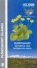
Iceland Central Highlands

Central Iceland at 1:300, 000 in a series from Mál og menning covering the country on five road maps with fine presentation of the topography, road network indicating gravel roads, GPS waypoints for important road and track junctions, plus on the reverse photos and descriptions of main sights and an extensive list of the waypoints.Maps in Mál og menning ‘s 300K series have contours at 100m intervals, enhanced by very effective relief shading and altitude colouring, plus plenty of spot heights and names of mountain ranges, peaks, glaciers, etc. Road information distinguishes between hard surface and gravel roads, includes local tracks and indicates river fords. Symbols show locations of campsites, swimming pools, thermal and hydro-electric power stations, local airfields,
etc. The maps have a grid with latitude and longitude at 15` and 30` intervals respectively; the map covering the Central Highlands also has GPS waypoints for important road junctions and other sites. Map legend includes English. On the reverse of the maps there are photographs of main natural sights in the region with multilingual descriptions which include English; maps 1 to 4 also have a comprehensive distance table for the whole country; map no. 5 has instead a list of the local GPS waypoints.
RIP - This product is no longer available on our network. It was last seen on 25.09.2019

This page now acts as a permanent archive for this product. Add more information using the comments box below to ensure it can still be found by future generations.

Use our search facility to see if it is available from an alternative contributor.
  • External links may include paid for promotion
  • Availability: Out Of Stock
  • Supplier: Stanfords
  • SKU: 9789979323983
Availability: In Stock
£15.99

Product Description

Central Iceland at 1:300, 000 in a series from Mál og menning covering the country on five road maps with fine presentation of the topography, road network indicating gravel roads, GPS waypoints for important road & track junctions, plus on the reverse photos & descriptions of main sights & an extensive list of the waypoints. Maps in Mál og menning ‘s 300K series have contours at 100m intervals, enhanced by very effective relief shading & altitude colouring, plus plenty of spot heights & names of mountain ranges, peaks, glaciers, etc. Road information distinguishes between hard surface & gravel roads,

Includes::
local tracks & indicates river fords. Symbols show locations of campsites, swimming pools, thermal & hydro-electric power stations, local airfields, etc. The maps have a grid with latitude & longitude at 15` & 30` intervals respectively; the map covering the Central Highlands also has GPS waypoints for important road junctions & other sites. Map legend

Includes::
English. On the reverse of the maps there are photographs of main natural sights in the region with multilingual descriptions which include English; maps 1 to 4 also have a comprehensive distance table for the whole country; map no. 5 has instead a list of the local GPS waypoints.

Reviews/Comments

Add New

Intelligent Comparison

Oooops!
We couldn't find anything!
Perhaps this product's unique.... Or perhaps we are still looking for comparisons!
Click to bump this page and we'll hurry up.

Price History

Vouchers

No voucher codes found.
Do you know a voucher code for this product or supplier? Add it to Insights for others to use.

Facebook

Jargon Buster

GPS - Global Positioning System - Global position using satellites
Electric - A general term for the flow of electric charge
Gravel - A size of rock between 2mm and 64mm
Natural - not manmade
Network - A link and communication between things. Often computers or people.
Road - a manmade lane or a path that is used to speed up travel.
Altitude - Something that can be quite high in relation to sea or ground level.

Supplier Information

Stanfords
Stanfords was established in 1853 and opened their iconic Covent Garden flagship store in 1901. They have become the top retailer of maps, travel books and accessories in the UK and arguably offer the largest selection of maps and travel books worldwide. Famous names such as Captain Robert Falcon Scott, Ranulph Fiennes and Michael Palin have purchased from Stanfords. They now have a shop in Bristol and both stores together with other venues operate a calendar of events including talks, book signings and exhibitions. As a specialist map retailer, the map selection is comprehensive and includes road maps, street maps and walking maps from worldwide destinations, as well as a selection of world atlases and wall maps. Books include travel guides and travel literature. Stanfords also stock globes, from miniatures made of blue marble to magnificent floor-standing globes. The website features a selection of interesting articles on travel topics.
Page Updated: 2023-11-12 20:15:36

Community Generated Product Tags

Oh No! The productWIKI community hasn't generated any tags for this product yet!
Menu