More From Contributor

£14.99
These are stylish guides to island getaways, thematically rather than geographically organized. The chapters are thematic essays with helpful hints & information on making the most of your island experience. Each chapter will feature a map tailored to its theme. Chapter 1 will feature the physical isl&, its location, climate, geology & geography. Chapter 2 covers the island's culture, including its people, religions, festivals, music, dance, arts & crafts, architecture, history, population, official languages, currency, etc. Chapter 3 deals with accommodation, giving a range of the best hotels & resorts & supplying information on facilities & services. Chapter 4 gives advice on where, when & how to shop, & a profile of the best buys, with features on indigenous arts & crafts. Chapter 5 covers the island's cuisine & top restaurants, & also offers advice on where to shop for food. Chapter 6 features sports & other activities available on the isl&, including offshore activities such as diving & sailing. At the end of the book, there will be a Travel Tips section covering practical matters such as transport, useful information, contact details, language information, & a calendar of holidays & festivals. ...
Archived Product
£12.99
Illustrated with Sabine Baring-Gould`s own drawings, Iceland: Its Scenes & Sagas, is an entertaining & eccentric insight into a world of myth & legend as well as a classic of natural & human observation. This is Sabine Baring-Gould`s account of his journey on horseback around Iceland in 1862; aged twenty-eight, the young writer & teacher was fascinated by the tradition of the Icelandic sagas, & this was the catalyst for his adventure & the book that emerged from it. His voyage took him from the then tiny settlement of Reykjavik through remote & hostile terrain, passing through the empty expanse of Iceland`s countryside. He observed mountains & glaciers, volcanoes & geysers, wondering at the wild beauty of the landscape. He also recorded the rich flora & fauna that he saw-&, to his chagrin, that his companions shot. But Baring-Gould`s account is more than a travelogue. Throughout he recreates & interprets Icelandic sagas, bringing to life the extraordinary characters & events of these age-old stories. Evoking a world of trolls, witches & magic, he explores the mythology & language of Icelandic lore. He also turns a critical eye on his fellow travellers & the Icelanders he meets, passing judgment on food such as stuffed puffin, pungent fish & ptarmigan. By turns amusing & acerbic, Baring-Gould provides a colourful account of an Icelandic society that has long since disappeared. ...
Archived Product
£269.95
Iceland at 1:100, 000 in a Complete Set of 31 topographic survey maps published by Mál og menning, with excellent, vivid presentation of the terrain, footpaths & bridleways, campsites, etc. The maps have contours at 20m intervals, enhanced by bold relief shading plus colouring and/or graphics to show glaciers, lava fields, sands & mudflats, as well as to distinguish land with vegetation cover from the more sparsely covered terrain. The series provides a splendid presentation of the country’s topography, with large amount of detail & over 43, 000 place names. Road network indicates gravel roads &

Includes::
country tracks. Also marked are local footpaths, clear to see with their distinctive colouring, & bridleways. Symbols shows campsites, tourist huts or shelters, emergency shelters, summer houses, river fords, golf courses & swimming pools, hydro-electric or thermal power stations, local airports, etc, & detail such as individual farms, abandoned farms or ruins, sheepfolds, etc. Each map covers an area of 84 x 67km (53 x 42 miles approx.) & has latitude & longitude lines drawn at intervals of 2’ & 5’ respectively. Map legend

Includes::
English, German & French. To see the list of the individual titles in this series please click on the series link.


...
Archived Product
£9.99
Adventure Maps provide global travellers with the perfect combination of detail & perspective. Iceland`s western half is shown on the front side of the map including the cities of Reykjavik, Kpavogur, Mossfellsbaer, & Siglufj”rdur. The reverse side covers the eastern portion of the country showing the cities of Akureyri, Egilsstadir, Eskifj”rdur, Neskaupstadur, Hsavik, & H”fn. Popular locations to ski, golf, camp, fish, & swim are marked, as are World Heritage sites, museums, churches, & other points of interest. Scale: 1:465, 000 Flat Size: 965 x 660 mm. ...
Archived Product
£15.99
Birdwatchers’ Map of Iceland from Mál og menning with 78 species of Iceland’s breeding birds, all with beautiful drawings of the bird itself & of its egg. Each species is presented with a map showing its distribution in summer, winter or all year round, plus a graph indicating months when it can be seen. Icons indicate its habitat & whether migrant or resident, & information is also provided on the average size & weight of each bird & its egg. The map also

Includes::
drawings of 27 migrant species. All the birds are shown with their English, German & Latin names & all other text

Includes::
English. Also included is a simple map of Iceland showing best birdwatching in the country.


...
Archived Product
£15.99
A new, thoroughly updated edition of Bradt`s Icel&, recipient of the Lowell Thomas Award (the highest travel writing award available in the United States) providing more context for individual places than any other guidebook, plus honest, investigative hotel & restaurant reviews that hide nothing. Based on 20 years of personal & business travel, exploration & adventure all around the country, Bradt`s Iceland is in-depth, well-researched & comprehensive, featuring a year-round approach to travelling in Iceland in line with the development of the local tourist industry to offer attractions beyond the normal summer season. This latest edition covers the growing tourist infrastructure: the new, fully-paved road system, better routes through the interior, a wave of new hotels & resorts, more tour companies with more tour options, new adventure activities, plus day tours from port city destinations & tips for those travellers arriving by cruise ship. Natural history & wildlife experiences are featured prominently along with a focus on the outdoors & help in accessing even the most difficult corners of Icel&. Also featured is the most in-depth political & economic analysis offered by any guidebook since the turmoil of 2008. &, even though Iceland is notoriously expensive, there are now a lot more options for travellers, including more hostels, campsites, & budget airlines. This new edition also

Includes::
a foreword by the newly elected President of Icel&, Gudni Th. Johannesson. Containing information on remote offshore islands, the uninhabited interior & Reykjavik`s bustling music & art scene, this remains the definitive guide. Replete with lava flows, colossal glaciers & thundering waterfalls, Iceland is one of Europe`s most unusual destinations. Pure, wild, & still in the midst of its own creation, it stands apart from the rest of Europe. With its moody volcanoes & massive ice caps, Iceland has caught the world`s curiosity like never before. Iceland offers visitors a chance to get close & personal with its immense nature & vivid wildlife, to experience the live volcanoes & ancient glaciers, & gape at roaring waterfalls & the drifts of obsidian sand in the country`s bleak desert interior. Andrew Evans has been travelling in Iceland for over 20 years. As a contributor to National Geographic, & a frequent host for tours to Icel&, he explores some of the remotest corners of the country regularly. He has studied the Icelandic language, history, & biology & continues to lecture about the country to high-end tour groups, as well as the National Geographic Society & Smithsonian Institution. His guide is exhaustive, allowing travellers to make informed decisions, to go anywhere & explore anything.

...
Archived Product
£15.99
Central Iceland at 1:200, 000 on a detailed map from Mál og Menning with exceptionally vivid presentation of the country’s topography & landscape, hard surface or gravel roads & numerous country tracks, superb drawings of local birds & flowers, etc. Coverage extends from Havmmstangi in the north-western corner of the map to the Grímsvötn part of the Vatnajökull Glacier in the south-east. Maps in this series, first published in summer 2013, are based on the publishers’ topographic mapping of Iceland at 1:100, 000 & provides an outstanding presentation of Iceland’s unique topography & landscape. Contours at 100m intervals are supplemented by very vivid relief shading & altitude colouring, with many more names of topographic features than on the publishers’ 1:300, 000 series. The maps also have additional colouring and/or graphics to indicate different types of land cover. Road network is also finely presented, divided into main & secondary roads with hard or gravel surface. Significantly more cross-country tracks are marked than on other road maps. Symbols indicate location of fords, emergency shelters, campsites, tourist huts or shelters, swimming pools & golf courses, thermal & hydro-electric power stations, local airfields, etc. The maps have a grid with latitude & longitude at 4’ & 10` intervals respectively. On the reverse the maps have photographs of main natural sights in the region with multilingual descriptions which include English. Each map also has lovely drawings of local birds & flowers (names include English & Latin). ...
Archived Product
£15.99
Central Iceland at 1:300, 000 in a series from Mál og menning covering the country on five road maps with fine presentation of the topography, road network indicating gravel roads, GPS waypoints for important road & track junctions, plus on the reverse photos & descriptions of main sights & an extensive list of the waypoints. Maps in Mál og menning ‘s 300K series have contours at 100m intervals, enhanced by very effective relief shading & altitude colouring, plus plenty of spot heights & names of mountain ranges, peaks, glaciers, etc. Road information distinguishes between hard surface & gravel roads,

Includes::
local tracks & indicates river fords. Symbols show locations of campsites, swimming pools, thermal & hydro-electric power stations, local airfields, etc. The maps have a grid with latitude & longitude at 15` & 30` intervals respectively; the map covering the Central Highlands also has GPS waypoints for important road junctions & other sites. Map legend

Includes::
English. On the reverse of the maps there are photographs of main natural sights in the region with multilingual descriptions which include English; maps 1 to 4 also have a comprehensive distance table for the whole country; map no. 5 has instead a list of the local GPS waypoints.


...
Archived Product
£7.50
Pictorial map of Iceland for children, covered with illustrations showing natural features, notable landmarks & historical sites. Sixty of these are numbered on the map & listed with brief descriptions. On the reverse, eight selected locations are described in more detailed. All the text is in English & Icelandic. ...
Archived Product
£15.99
Eastern Iceland at 1:200, 000 on a detailed map from Mál og Menning with exceptionally vivid presentation of the country’s topography & landscape, hard surface or gravel roads & numerous country tracks, superb drawings of local birds & flowers, etc. Coverage extends from the central part of the Vatnajökull Glacier with Grimsfjall in the south-west to well beyond Egilsstaðir in the north-eastern part of the map. Maps in this series, first published in summer 2013, are based on the publishers’ topographic mapping of Iceland at 1:100, 000 & provides an outstanding presentation of Iceland’s unique topography & landscape. Contours at 100m intervals are supplemented by very vivid relief shading & altitude colouring, with many more names of topographic features than on the publishers’ 1:300, 000 series. The maps also have additional colouring and/or graphics to indicate different types of land cover. Road network is also finely presented, divided into main & secondary roads with hard or gravel surface. Significantly more cross-country tracks are marked than on other road maps. Symbols indicate location of fords, emergency shelters, campsites, tourist huts or shelters, swimming pools & golf courses, thermal & hydro-electric power stations, local airfields, etc. The maps have a grid with latitude & longitude at 4’ & 10` intervals respectively. On the reverse the maps have photographs of main natural sights in the region with multilingual descriptions which include English. Each map also has lovely drawings of local birds & flowers (names include English & Latin). ...
Archived Product

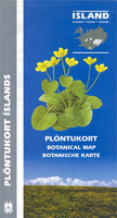
Iceland Botanical Map

78 of Island’s flowering plants, all beautifully illustrated and each presented with a map showing its distribution plus information on the type of habitat, size and flowering time. 32 more drawings show ferns, grasses, algae, lichens and fungi.All plants are shown with their English, German and Latin names and all other text includes English. The map provides clear and accessible information on Iceland’s main flora.
RIP - This product is no longer available on our network. It was last seen on 25.09.2019

This page now acts as a permanent archive for this product. Add more information using the comments box below to ensure it can still be found by future generations.

Use our search facility to see if it is available from an alternative contributor.
  • External links may include paid for promotion
  • Availability: Out Of Stock
  • Supplier: Stanfords
  • SKU: 9789979324003
Availability: In Stock
£15.99

Product Description

78 of Island’s flowering plants, all beautifully illustrated & each presented with a map showing its distribution plus information on the type of habitat, size & flowering time. 32 more drawings show ferns, grasses, algae, lichens & fungi. All plants are shown with their English, German & Latin names & all other text

Includes::
English. The map provides clear & accessible information on Iceland’s main flora.

Reviews/Comments

Add New

Intelligent Comparison

Oooops!
We couldn't find anything!
Perhaps this product's unique.... Or perhaps we are still looking for comparisons!
Click to bump this page and we'll hurry up.

Price History

Vouchers

No voucher codes found.
Do you know a voucher code for this product or supplier? Add it to Insights for others to use.

Facebook

Jargon Buster

Fungi - A large group of micro organisms including yeast, mold and mushrooms
Size - is the measurement of how big an object is in space.

Supplier Information

Stanfords
Stanfords was established in 1853 and opened their iconic Covent Garden flagship store in 1901. They have become the top retailer of maps, travel books and accessories in the UK and arguably offer the largest selection of maps and travel books worldwide. Famous names such as Captain Robert Falcon Scott, Ranulph Fiennes and Michael Palin have purchased from Stanfords. They now have a shop in Bristol and both stores together with other venues operate a calendar of events including talks, book signings and exhibitions. As a specialist map retailer, the map selection is comprehensive and includes road maps, street maps and walking maps from worldwide destinations, as well as a selection of world atlases and wall maps. Books include travel guides and travel literature. Stanfords also stock globes, from miniatures made of blue marble to magnificent floor-standing globes. The website features a selection of interesting articles on travel topics.
Page Updated: 2023-11-12 20:15:36

Community Generated Product Tags

Oh No! The productWIKI community hasn't generated any tags for this product yet!
Menu