More From Contributor
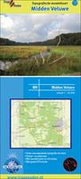
£10.99
A guidebook to walking in central Switzerl&, Europe. Few regions of the Alps contain greater contrasts than Central Switzerl&. The shores of the riviera-like Lake Lucerne & the ice-clad peaks of the Winterberg massif are a world apart, yet both are scenically spectacular & have magnificent walking country nearby. This guidebook reveals secluded corners of rarely-trodden as well as better known valleys, along lakeside pathways & across lofty ridges with stunning views. Here is a mountain region with vast potential for the walker & all who love fine scenery. Lucerne, Brunnen, Altdorf, Andermatt & Engelberg have no shortage of accommodation
- of all standards
- but there are also numerous other villages & remote alp hamlets, that offer overnight lodgings in the peace of the mountains. Kev Reynolds describes the villages, valleys & mountains of Central Switzerl&, & provides 90 of the region's best walking routes that will lead to some of the finest views in all the Alps. This guidebook is for use by walkers who may never have ambled through an alpine valley before, as well as the more experienced mountain trekkers aiming for the high cols & inner recesses of glacier-hung peaks. Something for everyone.

...
Archived Product
£7.95
Mountain walker's & climber's guide to an area of wild outstanding beauty to the East of the main Oberland range, accessible from the passes of Grimsel, Furka & Susten. This is the only climber's guide to this particular region currently available in English.

Includes::
sketches of the mountains showing routes & indexed.

...
Archived Product
£9.95
Detailed trekking map of the eastern corner of Kyrgyzstan on the border with Kazakhstan & China. The map shows mountain ridges with numerous spot heights & passes & indicates various types of terrain, glaciers, crevasses, moraine, rocky deposits, as well & springs & rivers. Roads, tracks, settlements & shephards ...
Archived Product
£6.99
Central United States map at 1:2, 650, 000 from Rand Mc Nally presenting the region’s road network on a base highlighting national parks or forests & Indian Reservations. Numerous enlargements show the areas around main cities in greater detail. Coverage in the north extends from Chicago to the western borders of the Dakotas, & in the south from the eastern border of Mississippi & New Orleans to include the whole of Texas. The index is arranged by state. The enlargements show: Austin, Baton Rouge, Chicago & vicinity with an additional plan of central Chicago, Dallas
- Fort Worth & vicinity, Des Moines, El Paso, Houston & vicinity, Jackson, Kansas City & vicinity, Little Rock, Madison, Mc Allen, Milwaukee, the Minneapolis
- St. Paul area, New Orleans, Oklahoma City, Omaha, San Antonio, St. Louis & vicinity, Tulsa, & Wichita. Also provided is a map with mileage & driving times on main routes across the whole of the US. To see other titles in this series please click on the series link.

...
Archived Product
£9.99
Central USA & the Mississippi River on a double-side indexed road map at 1:1, 840, 000 from ITMB showing the course of Mississippi & Missouri across from the northern states to the Mississippi Delta. The map is double-sided, with a generous overlap between the sides. Its northern side, extending from the Canadian border to Denver, stretches from central Montana & Wyoming to Chicago. The southern part, from Omaha to the Delta extends roughly from the Tennessee/ Alabama border westward to well beyond Oklahoma City & Denver. The map shows the region’s road network, highlighting interstate freeways & indicating toll highways. Driving distances are shown on many local routes. Railway lines are included & local airports are marked. The map indicates various places of interest & shows national parks & other protected areas, Indian Lands etc. Topography is shown by altitude colouring. Latitude & longitude lines are drawn at 1° intervals. Each side has a separate index. To see other regional titles from ITMB covering USA please click on the series link. ...
Archived Product
£9.99
Double-sided indexed map with street plans of Hue, Da Nang & Hoi An. The map shows the area’s road & rail networks & local airports. National parks, nature reserves, beaches & numerous places of interest are highlighted. Provincial boundaries are marked & names of administrative regions prominently shown. Topography is indicated by bold altitude colouring with spot heights. Latitude & longitude lines are drawn at 30’ intervals. The map also

Includes::
street plans of Hue, Da Nang & Hoi An, annotated with places of interest, accommodation & various facilities. An enlargement shows the environs of Hue in greater detail. All place names are shown in the Roman alphabet but with scrupulous transliteration, since the map was prepared by a company with strong Vietnamese connections & a number of local cartographers..

...
Archived Product
£34.95
Central Wales & Herefordshire Postcode Sector Map at 1:150, 000, encapsulated version, in a series of postcode sector maps showing the first part of the postcode & the first number of the second part, the Inward Code. Coverage extends north to Church Stretton, south to Cwmbran, east to Worcester & west to Tregaron. Map Marketing’s series of postcode sector maps covers Great Britain & Northern Ireland on 36 titles, each available only as a flat map, either on paper or encapsulated for greater durability. Presentation

Includes::
postcode changes in the most recent Royal Mail Postcode updates. The series covers Great Britain at 1:150, 000 (1” to 2.4 miles), with Northern Ireland shown at 1:210, 000 & London at two scales: 1:60, 000 for the area within the M25 & in more detail at 1:15, 000 for central London. Postcode area, district & sector boundaries & numbers/letters are shown in red, with County & Unitary Authority boundaries in green. The map base shows motorways, primary, ‘A’ & down to unclassified roads, with conurbation shapes & city plan insets showing street level detail for major cities. To see the list of all the titles in this series please click on the series link.LAMINATED & ENCAPSULATED WALL MAPS:- LAMINATED wall maps have a thin layer of plastic usually applied to the printed side only. They can be written on with suitable marker pens without any damage to the map but, unless laminated on both sides, they are not damp-proof.- ENCAPSULATED wall maps are sealed between two sheets of plastic. They are more rigid & heavier than laminated maps of the same size. They are damp-proof & do not crinkle in humid conditions. Encapsulation gives the map a shiny surface, similar to being displayed behind glass.- PLEASE NOTE: many publishers & retailers often use these two terms interchangeably. Our map titles & descriptions follow the definitions provided above.

...
Archived Product
£24.95
Central Wales & Herefordshire Postcode Sector Map at 1:150, 000, paper version, in a series of postcode sector maps showing the first part of the postcode & the first number of the second part, the Inward Code. Coverage extends north to Church Stretton, south to Cwmbran, east to Worcester & west to Tregaron. Map Marketing’s series of postcode sector maps covers Great Britain & Northern Ireland on 36 titles, each available only as a flat map, either on paper or encapsulated for greater durability. Presentation

Includes::
postcode changes in the most recent Royal Mail Postcode updates. The series covers Great Britain at 1:150, 000 (1” to 2.4 miles), with Northern Ireland shown at 1:210, 000 & London at two scales: 1:60, 000 for the area within the M25 & in more detail at 1:15, 000 for central London. Postcode area, district & sector boundaries & numbers/letters are shown in red, with County & Unitary Authority boundaries in green. The map base shows motorways, primary, ‘A’ & down to unclassified roads, with conurbation shapes & city plan insets showing street level detail for major cities. To see the list of all the titles in this series please click on the series link.

...
Archived Product
£15.99
Central Wielkopolska at 1:200, 000 from Höfer Verlag in a series of road maps of areas which used to be part of Germany or the Austro-Hungarian Empire, showing both current & the old German place names. In many places former settlements which now no longer exist are also named. Present road & rail networks are supplemented by historical information, e.g. former railway lines. There is no relief detail apart from spot heights. Forests, nature reserves, national park boundaries & locations of interest are marked, & symbols indicate campsites, historical sites, etc. The maps have no geographical coordinates. * Map legend

Includes::
English.* As the maps have dual place names, the print is rather small, but each title comes with a special magnifying lens attached to the map cover. Also included is a booklet with separate, cross-referenced indexes for each set of names & a street plan of the central part of the area’s main city, showing both old & current street layout.* In this title:* a street plan of central Poznan/ Posen.

...
Archived Product
£20.00
Which century from the past millennium saw the most influential events in the history of the Western world? The historian Ian Mortimer describes the most significant changes & developments from the 11th to the 20th century, covering not only major events such as the Black Death, the invention of printing or the Reformation, but also population growth & urbanization, scientific & medical progress, social attitudes, communications & the media, etc. Arranged century by century, each chapter discusses four or more significant topics from the hundred years. ...
Archived Product

Central Veluwe

Central Veluwe on a waterproof, tear-resistant, GPS compatible walking map at 1:25, 000 from Trage Paden, in a series of maps with extensive overprint for long-distance and local walking routes. GPS waypoints and route profiles are available for download from the publisher’s website.Contours used in this map series vary between 2, 5 to 5m according to the terrain, with 5m interval predominantly used for hilly areas. Varied colouring show different types of landscape: woods, vineyards, fields etc. An overprint highlights both the national long-distance walking routes and the shorter local circular trails, each clearly identified by a code and/or an abbreviation of its name. Recommended starting points for walks are designated by a symbol. Cycle lanes are visibly marked with a bike
symbol; roads with heavy traffic are clearly indicated. Symbols indicate various facilities, such as railway and bus stations, coffee shops, campsites, country restaurants/bars, sport and leisure facilities. Maps have the lines of the Dutch National Grid for measuring distances and for determining location using GPS device and they are printed on weather resistant and tear-resistant paper. Each map covers an area of approximately 25 x 26 km and the map legend is in Dutch only. The map is presented in an elegant cardboard case. To see all the titles in this series please click on the series link.
RIP - This product is no longer available on our network. It was last seen on 25.09.2019

This page now acts as a permanent archive for this product. Add more information using the comments box below to ensure it can still be found by future generations.

Use our search facility to see if it is available from an alternative contributor.
  • External links may include paid for promotion
  • Availability: Out Of Stock
  • Supplier: Stanfords
  • SKU: 9789081396134
Availability: In Stock
£11.99

Product Description

Central Veluwe on a waterproof, tear-resistant, GPS compatible walking map at 1:25, 000 from Trage Paden, in a series of maps with extensive overprint for long-distance & local walking routes. GPS waypoints & route profiles are available for download from the publisher’s website. Contours used in this map series vary between 2, 5 to 5m according to the terrain, with 5m interval predominantly used for hilly areas. Varied colouring show different types of landscape: woods, vineyards, fields etc. An overprint highlights both the national long-distance walking routes & the shorter local circular trails, each clearly identified by a code and/or an abbreviation of its name. Recommended starting points for walks are designated by a symbol. Cycle lanes are visibly marked with a bike symbol; roads with heavy traffic are clearly indicated. Symbols indicate various facilities, such as railway & bus stations, coffee shops, campsites, country restaurants/bars, sport & leisure facilities. Maps have the lines of the Dutch National Grid for measuring distances & for determining location using GPS device & they are printed on weather resistant & tear-resistant paper. Each map covers an area of Approx. 25 x 26 km & the map legend is in Dutch only. The map is presented in an elegant cardboard case. To see all the titles in this series please click on the series link.

Reviews/Comments

Add New

Intelligent Comparison

Oooops!
We couldn't find anything!
Perhaps this product's unique.... Or perhaps we are still looking for comparisons!
Click to bump this page and we'll hurry up.

Price History

Vouchers

No voucher codes found.
Do you know a voucher code for this product or supplier? Add it to Insights for others to use.

Facebook

Jargon Buster

GPS - Global Positioning System - Global position using satellites
Paper - A thin sheet mainly used for writing. Available in a variety of colours. Made mainly from wood pulp.
Waterproof - Resistant to water, usualy specified by depth in metres
Coffee - A popular brewed drink using roasted coffee beans
heavy - A concept of weight indicating an item may require some effort to lift or move
Weather - is the change of an atmospheres conditions.
Km - Kilometre. A unit of measurement equal to 1000 metres.
Resistant - Something that can repel against something.

Supplier Information

Stanfords
Stanfords was established in 1853 and opened their iconic Covent Garden flagship store in 1901. They have become the top retailer of maps, travel books and accessories in the UK and arguably offer the largest selection of maps and travel books worldwide. Famous names such as Captain Robert Falcon Scott, Ranulph Fiennes and Michael Palin have purchased from Stanfords. They now have a shop in Bristol and both stores together with other venues operate a calendar of events including talks, book signings and exhibitions. As a specialist map retailer, the map selection is comprehensive and includes road maps, street maps and walking maps from worldwide destinations, as well as a selection of world atlases and wall maps. Books include travel guides and travel literature. Stanfords also stock globes, from miniatures made of blue marble to magnificent floor-standing globes. The website features a selection of interesting articles on travel topics.
Page Updated: 2023-11-12 20:15:36

Community Generated Product Tags

Oh No! The productWIKI community hasn't generated any tags for this product yet!
Menu