
 United Kingdom
 France
 Germany
 Netherlands
 Sweden
 USA
USA
 Italy
Italy
 Spain
Spain
More From Contributor


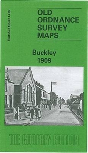
Buckley 1909
Buckley in 1909 in a fascinating series of reproductions of old Ordnance Survey plans in the Alan Godfrey Editions, ideal for anyone interested in the history of their neighbourhood or family. The map is double-sided. The main map covers the area from Victoria Terrace and Brunswick Road westward to Bryn-y-bal and part of Mynydd-isa, and northward to Buckley Mountain. Features include South Buckley Brick Works with mineral railway and tramway, High Street, The Square, Emmanuel church, Pren-Brigog, Wat`s Dike, Willow Colliery (disused), Ewloe Pottery, Belmount Brick Works, Ewloe Place, old coal shafts, chapels, etc. On the reverse is part of the adjacent sheet 14.09 extending coverage southward to include Padeswood & Buckley station and short stretch of LNWR Mold Branch,
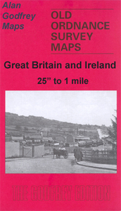
Bistre Farm, Nant-Mawr area, Garreg-lwyd, etc. About the Alan Godfrey Editions of the 25” OS Series:Selected towns in Great Britain and Ireland are covered by maps showing the extent of urban development in the last decades of the 19th and early 20th century. The plans have been taken from the Ordnance Survey mapping and reprinted at about 15 inches to one mile (1:4, 340). On the reverse most maps have historical notes and many also include extracts from contemporary directories. Most maps cover about one mile (1.6kms) north/south, one and a half miles (2.4kms) across; adjoining sheets can be combined to provide wider coverage.FOR MORE INFORMATION AND A COMPLETE LIST OF ALL AVAILABLE TITLES PLEASE CLICK ON THE SERIES LINK.
Bistre Farm, Nant-Mawr area, Garreg-lwyd, etc. About the Alan Godfrey Editions of the 25” OS Series:Selected towns in Great Britain and Ireland are covered by maps showing the extent of urban development in the last decades of the 19th and early 20th century. The plans have been taken from the Ordnance Survey mapping and reprinted at about 15 inches to one mile (1:4, 340). On the reverse most maps have historical notes and many also include extracts from contemporary directories. Most maps cover about one mile (1.6kms) north/south, one and a half miles (2.4kms) across; adjoining sheets can be combined to provide wider coverage.FOR MORE INFORMATION AND A COMPLETE LIST OF ALL AVAILABLE TITLES PLEASE CLICK ON THE SERIES LINK.

Product Description
Reviews/Comments
Add New
Intelligent Comparison
Archived Product
Brackley 1920 Stanfords
£2.95
Archived Product

Brackley 1920 Stanfords
£3.50
Archived Product

Burnley 1910 Stanfords
£3.50
Archived Product

Brockley 1894 Stanfords
£3.50
Archived Product
Birkdale 1909 Stanfords
£2.95
Archived Product
Birkdale 1909 Stanfords
£3.50
Vouchers
No voucher codes found.
Do you know a voucher code for this product or supplier? Add it to Insights for others to use.
Do you know a voucher code for this product or supplier? Add it to Insights for others to use.
 Denmark