
 United Kingdom
 France
 Germany
 Netherlands
 Sweden
 USA
USA
 Italy
Italy
 Spain
Spain
More From Contributor


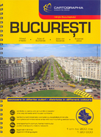
Bucharest Street Atlas
Spiral-bound, indexed street atlas of the city and the surrounding districts, with lists of public transport lines, hotels, museums, theatres, hospitals, etc. Municipal boundaries are drawn, notable buildings, parks and places of interest are marked and a range of symbols denotes specific features e.g. hotels and campsites, museums and monuments, bus terminals, hospitals, etc. The plan also shows public transport lines (rail, metro, tram, trolleybus, bus) and stations are markedThe city centre is shown in greater detail and clarity at 1:10, 000, and there are also plans of the Romexpo centre and the city Metro network. Bus, tram and trolleybus routes are listed, also addresses of many other useful locations, e.g. embassies, hotels, public offices and hospitals.
Street index lists locations outside the city’s administrative area separately. Map legend includes English.
Street index lists locations outside the city’s administrative area separately. Map legend includes English.

Product Description
Reviews/Comments
Add New
Intelligent Comparison
Archived Product
Durham Street Atlas Stanfords
£4.50
Archived Product
Bangalore Street Atlas Stanfords
£10.95
Archived Product
Barcelona Street Atlas Stanfords
£7.95
Archived Product
Southport Street Atlas Stanfords
£3.95
Archived Product
Lancashire Street Atlas Stanfords
£10.95
Archived Product
Dubai Street Atlas Stanfords
£30.00
Archived Product
Bradford Street Atlas Stanfords
£4.95
Archived Product
Southend Street Atlas Stanfords
£4.95
Vouchers
No voucher codes found.
Do you know a voucher code for this product or supplier? Add it to Insights for others to use.
Do you know a voucher code for this product or supplier? Add it to Insights for others to use.
 Denmark