
 United Kingdom
 France
 Germany
 Netherlands
 Sweden
 USA
USA
 Italy
Italy
 Spain
Spain
More From Contributor


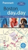

Boston Borch
Laminated, waterproof, indexed, street plan at 1:11, 000 of central Boston with Cambridge and Harvard from Borch, with a diagram of the MBTA metro/rail network, maps of Greater Boston and eastern Massachusetts with Cape Cod, and a plan of the Logan International Airport.The main plan clearly shows the metro network with stations indicating line numbers. One way streets and car parks also marked. Public buildings, including the city’s famous educational establishments, are highlighted and named, and 30 “Top Sights” are prominently marked.On the reverse is an overview map of Greater Boston within its motorway ring (1:200, 000) showing road access to the city centre, plus a road map of eastern Massachusetts (1:600, 000) including Cap Cod. Both maps are indexed and highlight
numerous places of interest. Also included is a diagram of the MBTA subway and commuter rail network, a plan of the Logan International Airport, information on the city’s climate, plus a small administrative map of USA showing states and time zones.
numerous places of interest. Also included is a diagram of the MBTA subway and commuter rail network, a plan of the Logan International Airport, information on the city’s climate, plus a small administrative map of USA showing states and time zones.

Product Description
Reviews/Comments
Add New
Intelligent Comparison
Archived Product
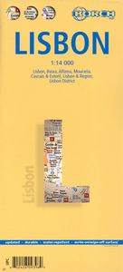
Lisbon Borch Stanfords
£8.99
Archived Product
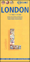
London Borch Stanfords
£8.99
Archived Product
Moscow Borch Stanfords
£8.99
Archived Product
Toronto Borch Stanfords
£8.99
Vouchers
No voucher codes found.
Do you know a voucher code for this product or supplier? Add it to Insights for others to use.
Do you know a voucher code for this product or supplier? Add it to Insights for others to use.
 Denmark