More From Contributor

£9.99
Map No. 131, Boston & Spalding 1901-1902, in the Cassini Historical Series of old Ordnance Survey mapping of England & Wales at 1:50, 000 in a format designed to offer a convenient comparison with the present day coverage from the OS, & most locations in three different editions. Old historical maps have been combined so that the sheet lines correspond to the current Landranger series & reproduced with the scale changed from one inch to one mile to 1:50, 000. Most locations are covered by three separate maps, showing how the area has changed over the decades, with selected major cities also presented in a fourth edition. * Old Series: the first detailed survey mapping dating for most areas from the first half of the 19th century, in black & white & with relief shown by hachuring.* Revised New Series from 1880s/1900s, with some colouring & a mixture of hachuring & contour lines.* Popular Edition from the inter-war years, with contour lines & colouring to indicate woodlands, parks, etc.* New Popular Edition from the late 1940s, reproduced in the Cassini series for the major cities. Each map

Includes::
notes on the development of Ordnance Survey & the various series produced by them. For those interested in maps & cartography in general, the Cassini series also provides a fascinating insight into how Ordnance Survey cartographic style has developed over a period of over 100 years. Coverage in this title

Includes::
present day Wisbech, Holbeach, Langrick, Leverton, Hubbert’s Bridge, Butterwick, Swineshead, Kirton, Bicker, Donnington, Sutterton, Gosberton, Fosdyke, Moulton Seas End, Holbeach St Matthew, Gedney Drove End, Lutton, Sutton Bridge, Long Sutton, Terrington St Clement, Tydd St Mary, Tydd St Giles, Walpole St Peter, Wiggenhall St Mary Magdalen, Sutton St James, Holbeach Drove, Holbeach St Johns, Whaplode, Moulton, Pinchbeck, Cowbit, Deeping St Nicholas & Crowl&.* PLEASE NOTE: Stanfords can also print on request mapping from all four series *centring the map on a location of your choice.* For more information please click on the link below.


...
Archived Product
£9.99
Map No. 131, Boston & Spalding 1922, in the Cassini Historical Series of old Ordnance Survey mapping of England & Wales at 1:50, 000 in a format designed to offer a convenient comparison with the present day coverage from the OS, & most locations in three different editions. Old historical maps have been combined so that the sheet lines correspond to the current Landranger series & reproduced with the scale changed from one inch to one mile to 1:50, 000. Most locations are covered by three separate maps, showing how the area has changed over the decades, with selected major cities also presented in a fourth edition. * Old Series: the first detailed survey mapping dating for most areas from the first half of the 19th century, in black & white & with relief shown by hachuring.* Revised New Series from 1880s/1900s, with some colouring & a mixture of hachuring & contour lines.* Popular Edition from the inter-war years, with contour lines & colouring to indicate woodlands, parks, etc.* New Popular Edition from the late 1940s, reproduced in the Cassini series for the major cities. Each map

Includes::
notes on the development of Ordnance Survey & the various series produced by them. For those interested in maps & cartography in general, the Cassini series also provides a fascinating insight into how Ordnance Survey cartographic style has developed over a period of over 100 years. Coverage in this title

Includes::
present day Wisbech, Holbeach, Langrick, Leverton, Hubbert’s Bridge, Butterwick, Swineshead, Kirton, Bicker, Donnington, Sutterton, Gosberton, Fosdyke, Moulton Seas End, Holbeach St Matthew, Gedney Drove End, Lutton, Sutton Bridge, Long Sutton, Terrington St Clement, Tydd St Mary, Tydd St Giles, Walpole St Peter, Wiggenhall St Mary Magdalen, Sutton St James, Holbeach Drove, Holbeach St Johns, Whaplode, Moulton, Pinchbeck, Cowbit, Deeping St Nicholas & Crowl&.* PLEASE NOTE: Stanfords can also print on request mapping from all four series *centring the map on a location of your choice.* For more information please click on the link below.


...
Archived Product
£8.99
Laminated, waterproof, indexed, street plan at 1:11, 000 of central Boston with Cambridge & Harvard from Borch, with a diagram of the MBTA metro/rail network, maps of Greater Boston & eastern Massachusetts with Cape Cod, & a plan of the Logan International Airport. The main plan clearly shows the metro network with stations indicating line numbers. One way streets & car parks also marked. Public buildings, including the city’s famous educational establishments, are highlighted & named, & 30 “ Top Sights” are prominently marked. On the reverse is an overview map of Greater Boston within its motorway ring (1:200, 000) showing road access to the city centre, plus a road map of eastern Massachusetts (1:600, 000) including Cap Cod. Both maps are indexed & highlight numerous places of interest. Also included is a diagram of the MBTA subway & commuter rail network, a plan of the Logan International Airport, information on the city’s climate, plus a small administrative map of USA showing states & time zones. ...
Archived Product
£13.99
Boston in the City Guide Series from Lonely Planet, profiling in comprehensive detail the history, major sights, best places to eat, nightlife, accommodation & shopping possibilities of an extensive range of cities worldwide. Frank & informal in style, the guides are renowned for their appeal to independent travellers & are written & researched by local authors. Each guide is divided into 11 main sections
- Getting Started, Background, Neighbourhoods, Shopping, Eating, Drinking & Nightlife, The Arts, Sports & Activities, Gay & Lesbian, Sleeping & Day Trips & Excursions. The Background section details the history, arts, architecture, environment, media, fashion & government & politics of the city. An
...
Archived Product
£6.99
Boston in the City Pack series from AA Publishing; covering an extensive selection of world-wide cities in a handy, pocket-sized laminated format. The guides provde a detailed overview of each destination, with each city organised by district to allow for practical use on the city streets. An introductory section introduces readers to the city, with individual features on a short stay in the city, the Top 25 attractions, shopping by theme, the city by night, eating out & restaurants by cuisine. Each guide is presented in a similar format, exploring the city by geographical area & district. A basic overview map is provided at the start of each section & there is detailed listings information on the principal sights, walks, shops, entertainment & nightlife & restaurants for each area of the city. A Farther Afield section explores the area outside the city limits, with suggestions for possible excursions & day trips. A dedicated accommodation chapter provides information about a range of budget, mid-range & luxury hotels to suit for individual tastes. There is also a Need to Know chapter with practical information on getting there & around, essential facts, language & a timeline of the city.. ...
Archived Product
£8.99
Boston in the Frommer's Day By Day series is a pocket-sized guide ideal for short trips, covering a variety of budgets. The best sights of each destination are listed in convenient full-day tours for one, two or three days such as: thematic tours for interests including art, architecture & history are described, allowing you to get the most out of your time; walking tours take you around each destination ...
Archived Product
£9.99
Boston in the Frommer`s Day By Day series is a pocket-sized guide ideal for short trips, covering a variety of budgets. The best sights of each destination are listed in convenient full-day tours for one, two or three days such as: thematic tours for interests including art, architecture & history are described, allowing you to get the most out of your time; walking tours take you around each destination’s principal neighbourhoods, detailing selected parks, activities, notable sights, shops & eateries. Categorized listings are given for the best of the area’s hotels & accommodation, shopping, food & drink, nightlife, music, outdoor activities, day-trips, & arts & entertainment, whilst a “ Savvy Traveller” section provides practical travel information, as well as a brief background & history of the destination. The guide is illustrated with colour photography & simple, easy-to-use bulleted maps with locations cross-referenced to the text, as well as having a removable tear-proof folded map in a pouch inside the back cover. ...
Archived Product
£6.39
Boston in the Encounter Guide Series from Lonely Planet, exploring a range of cities & regions worldwide in a handy, pocket-sized format designed to introduce visitors to the distinctive neighbourhoods of the destination. Frank & informal in style, the guides are renowned for their appeal to independent travellers & are written & researched by local authors. Each guide is organised into 5 distinct sections
- Highlights, Diary, Itineraries, Neighbourhoods & Snapshots
- recommending a series of essential encounters for visitors to the region. Each guide opens with a

...
Archived Product
£7.99
Many visitors come to historic Boston to walk in the footsteps of the Founding Fathers, but this collegiate city is also dynamic & modern, not to mention one of the greenest cities in America. Explore Boston is part of a br&-new series & is the ideal pocket companion when discovering this lively & historic place: a full-colour guide containing 16 easy-to-follow routes which lead you from the Freedom Trail`s famous sights around Boston Common & Charlestown to the Back Bay`s fabulous art museums & Harvard`s prestigious colleges, as well as out to the colonial settlements at Salem & Plymouth & the seaside charms of Provincetown. Insight`s trademark cultural coverage perfectly sets the routes in context, with introductions to Boston`s cuisine, love of sport & historical significance. Each route guides you through an interesting area with clear directions, a detailed map & authentic places to eat & drink along the way. The directory section contains a wealth of practical information & a range of carefully selected hotels & restaurants to suit all budgets. All routes are also plotted on the pull-out map. Whether you are new to the city or a repeat visitor, & however long your stay, Explore Boston will help you discover the self-proclaimed ”hub of the universe”. ...
Archived Product
£8.25
Street mapping of the whole of Boston & suburbs,

Includes::
Logan International Airport. Inset maps of the

...
Archived Product

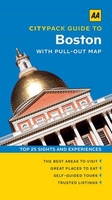
Boston CityPack Guide

The CityPack guide to Boston by AA Publishing combines practical information with inspiring photographs and a separate pull-out map in a handy pocket format, appealing to both business and leisure visitors. Save time, discover the world’s greatest cities with the AA’s Top 25 sights and experiences from the New England Aquarium to the Paul Revere House.The guide opens with a section which introduces the readers to the city, with individual features on a short stay in the city, the Top 25 attractions, shopping by theme, the city by night, eating out and restaurants by cuisine. This part is followed by five chapters, each exploring a different area of the city. A basic overview map is provided at the start of each section and there is detailed listings information on the principal
sights, walks, shops, entertainment and nightlife and restaurants for each area of the city. A Further Afield section explores the area outside the city limits, with suggestions for possible excursions and day trips. A dedicated accommodation chapter provides information about a range of budget, mid-range and luxury hotels to suit individual tastes. There is also a Need to Know chapter with practical information on getting there and around, essential facts, language and a timeline of the history of the city. The pocket guide is accompanied by a weather-resistant, pull-out map of Boston with symbols locating all the sights mentioned in the text, to help you navigate the city with ease. The map can be conveniently stored in its own wallet in the back of the guide. AA CityPack
Boston, your handy travel companion for a perfect city break.
RIP - This product is no longer available on our network. It was last seen on 25.09.2019

This page now acts as a permanent archive for this product. Add more information using the comments box below to ensure it can still be found by future generations.

Use our search facility to see if it is available from an alternative contributor.
  • Availability: Out Of Stock
  • Supplier: Stanfords
  • SKU: 9780749576530
Availability: In Stock
£7.99

Product Description

The City Pack guide to Boston by AA Publishing combines practical information with inspiring photographs & a separate pull-out map in a handy pocket format, appealing to both business & leisure visitors. Save time, discover the world’s greatest cities with the AA’s Top 25 sights & experiences from the New England Aquarium to the Paul Revere House. The guide opens with a section which introduces the readers to the city, with individual features on a short stay in the city, the Top 25 attractions, shopping by theme, the city by night, eating out & restaurants by cuisine. This part is followed by five chapters, each exploring a different area of the city. A basic overview map is provided at the start of each section & there is detailed listings information on the principal sights, walks, shops, entertainment & nightlife & restaurants for each area of the city. A Further Afield section explores the area outside the city limits, with suggestions for possible excursions & day trips. A dedicated accommodation chapter provides information about a range of budget, mid-range & luxury hotels to suit individual tastes. There is also a Need to Know chapter with practical information on getting there & around, essential facts, language & a timeline of the history of the city. The pocket guide is accompanied by a weather-resistant, pull-out map of Boston with symbols locating all the sights mentioned in the text, to help you navigate the city with ease. The map can be conveniently stored in its own wallet in the back of the guide. AA City Pack Boston, your handy travel companion for a perfect city break.

Reviews/Comments

Add New

Intelligent Comparison

Oooops!
We couldn't find anything!
Perhaps this product's unique.... Or perhaps we are still looking for comparisons!
Click to bump this page and we'll hurry up.

Price History

Vouchers

No voucher codes found.
Do you know a voucher code for this product or supplier? Add it to Insights for others to use.

Facebook

Jargon Buster

England - A country within the United Kingdom.
History - Anything that happens in the past. An acedemic subject.
World - A physical grouping, commonly used to describe earth and everything associated with ti
Entertainment - Something that provides amusement
Day - The time it takes a planet or other space objects to complete one rotation.
Weather - is the change of an atmospheres conditions.
Language - the method of communication used in different areas. Humans and computers have many different languages.
Resistant - Something that can repel against something.
Luxury - An exquisite way of living, an sometimes come at a higher price.
Accommodation - A room in which someone can live in, for example in a hotel
Practical - Weather a task is easy to carry out and realistically succeed.
Pocket - A bag shaped insert in clothing used to carry items
Individual - A single separate item or person.
Language - The way humans communicate either written and spoken.

Supplier Information

Stanfords
Stanfords was established in 1853 and opened their iconic Covent Garden flagship store in 1901. They have become the top retailer of maps, travel books and accessories in the UK and arguably offer the largest selection of maps and travel books worldwide. Famous names such as Captain Robert Falcon Scott, Ranulph Fiennes and Michael Palin have purchased from Stanfords. They now have a shop in Bristol and both stores together with other venues operate a calendar of events including talks, book signings and exhibitions. As a specialist map retailer, the map selection is comprehensive and includes road maps, street maps and walking maps from worldwide destinations, as well as a selection of world atlases and wall maps. Books include travel guides and travel literature. Stanfords also stock globes, from miniatures made of blue marble to magnificent floor-standing globes. The website features a selection of interesting articles on travel topics.
Page Updated: 2023-11-12 20:15:36

Community Generated Product Tags

Oh No! The productWIKI community hasn't generated any tags for this product yet!
Menu