
 United Kingdom
 France
 Germany
 Netherlands
 Sweden
 USA
USA
 Italy
Italy
 Spain
Spain
More From Contributor


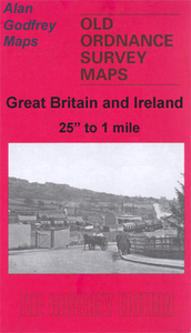
Blackburn West 1929
Blackburn West in 1929 in a fascinating series of reproductions of old Ordnance Survey plans in the Alan Godfrey Editions, ideal for anyone interested in the history of their neighbourhood or family. Selected towns in Great Britain and Ireland are covered by maps showing the extent of urban development in the last decades of the 19th and early 20th century.In this title: the map covers the western part of Blackburn, stretching from Montague Street and Leyland Street westward to Billinge Nook and Billinge Hill, and from Wycollard Road southward to Redlam Brow. Much of Witton Park is included on the map (but not the house). Features include Preston New Road, Wensley Fold, St Mark's church, Cross Hill school, Springfield Maternity Home, Billinge End, Garden Street Mill, Bank Top
Mill, Corporation Park, Johnston Street Mill, Peel Mill, St Paul's Ward, The Wrangling, Belle Vue Mill, Alexandra Meadows, many other mills, tramways, River Blakewater. On the reverse are extracts from a 1918 directory including street entries for Bank Top, Dukes Brow, Granville Road, Leamington Road, Preston New Road, Redlam, Revidge Road, West Park Road. About the Alan Godfrey Editions of the 25
Mill, Corporation Park, Johnston Street Mill, Peel Mill, St Paul's Ward, The Wrangling, Belle Vue Mill, Alexandra Meadows, many other mills, tramways, River Blakewater. On the reverse are extracts from a 1918 directory including street entries for Bank Top, Dukes Brow, Granville Road, Leamington Road, Preston New Road, Redlam, Revidge Road, West Park Road. About the Alan Godfrey Editions of the 25
Product Description
Reviews/Comments
Add New
Intelligent Comparison
Archived Product

Blackburn West 1929 Stanfords
£3.50
Archived Product
Blackburn 1929 Stanfords
£2.95
Archived Product

Blackburn 1929 Stanfords
£3.50
Archived Product
Blackburn North 1929 Stanfords
£2.95
Archived Product
Blackburn North 1929 Stanfords
£3.50
Archived Product

Blackburn 1910 Stanfords
£3.50
Vouchers
No voucher codes found.
Do you know a voucher code for this product or supplier? Add it to Insights for others to use.
Do you know a voucher code for this product or supplier? Add it to Insights for others to use.
 Denmark