
 United Kingdom
 France
 Germany
 Netherlands
 Sweden
 USA
USA
 Italy
Italy
 Spain
Spain
More From Contributor


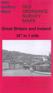
Blackburn 1929
Blackburn in 1910 in a fascinating series of reproductions of old Ordnance Survey plans in the Alan Godfrey Editions, ideal for anyone interested in the history of their neighbourhood or family. Selected towns in Great Britain and Ireland are covered by maps showing the extent of urban development in the last decades of the 19th and early 20th century.In this title: two versions of this map have been published, covering the area from Wimberley Street and Brockkhouse southward to Lower Audley Steet and Pringle Street, and from Bradshaw Street and New Park Street eastward to Hole House. They cover the town centre and the many features include the railway station, Daisyfield station, Leeds & Liverpool Canal, Town Hall, Market Place, Cathedral, Audley Mill, Walpole Street Mill,
Cicely Bridge Mill, Higher Mill, Parkside Mill, Newton Street Mill, Springfield Mills, Prospect Mill, Furthergate Mill, many other mills, tramways, Higher Audley, St Peter's Ward, St Mary's Ward, St John's Ward, St Matthew's Ward, Trinity Ward, Green Bank, Canal Engineering Works. By the time of the 1929 map some of the mills were disused, an ominous sign that Blackburn's great age of prosperity as a great mill town was over. On the reverse of both maps are extracts from street directories; the 1929 map has extracts from a 1918 directory for Bottom Gate, Church Street, Copy Nook, Darwen Street, Eanam, Higher Audley Street, Higher Eanam, Larkhill, Larkhill Street, Mincing Lane, Railway Road, Salford, Scotland Road. About the Alan Godfrey Editions of the 25
Cicely Bridge Mill, Higher Mill, Parkside Mill, Newton Street Mill, Springfield Mills, Prospect Mill, Furthergate Mill, many other mills, tramways, Higher Audley, St Peter's Ward, St Mary's Ward, St John's Ward, St Matthew's Ward, Trinity Ward, Green Bank, Canal Engineering Works. By the time of the 1929 map some of the mills were disused, an ominous sign that Blackburn's great age of prosperity as a great mill town was over. On the reverse of both maps are extracts from street directories; the 1929 map has extracts from a 1918 directory for Bottom Gate, Church Street, Copy Nook, Darwen Street, Eanam, Higher Audley Street, Higher Eanam, Larkhill, Larkhill Street, Mincing Lane, Railway Road, Salford, Scotland Road. About the Alan Godfrey Editions of the 25
Product Description
Reviews/Comments
Add New
Intelligent Comparison
Archived Product

Blackburn 1929 Stanfords
£3.50
Archived Product

Blackburn 1910 Stanfords
£3.50
Archived Product
Blackburn West 1929 Stanfords
£2.95
Archived Product

Blackburn West 1929 Stanfords
£3.50
Archived Product
Blackburn North 1929 Stanfords
£2.95
Archived Product
Blackburn North 1929 Stanfords
£3.50
Archived Product
Bannockburn 1896 Stanfords
£2.95
Archived Product
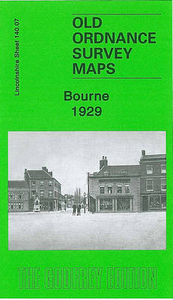
Bourne 1929 Stanfords
£3.50
Vouchers
No voucher codes found.
Do you know a voucher code for this product or supplier? Add it to Insights for others to use.
Do you know a voucher code for this product or supplier? Add it to Insights for others to use.
 Denmark