
 United Kingdom
 France
 Germany
 Netherlands
 Sweden
 USA
USA
 Italy
Italy
 Spain
Spain
More From Contributor


Blackburn North 1929
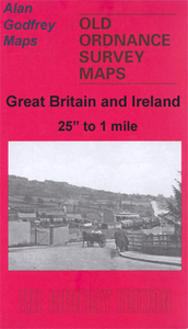
Blackburn North in 1929 in a fascinating series of reproductions of old Ordnance Survey plans in the Alan Godfrey Editions, ideal for anyone interested in the history of their neighbourhood or family. Selected towns in Great Britain and Ireland are covered by maps showing the extent of urban development in the last decades of the 19th and early 20th century.In this title: the map covers the northern part of Blackburn, stretching from Cornelian Street and Emerald Street southward to Ash Street and Whalley Range. The Whalley New Road runs through the map, alongside the railway, and features include Wellfield Mill (at foot of map), Bastfield Mill, Little Harwood, Broad Fold, Green Head Farm, tramways, Lower Oozeboth, Hollinshead Mill, India Mill, Royshaw Mill, Royal Mill,
Boundary Mill, Lion Brewery, Florence Mill, Roe Lee New Mill, Roe Lee Mill, Upper Royshaw, Royshaw Hill, Pleckgate, Higher Wilworth, Four Lane Ends (left side of map), St James church, cemetery, Bank Hey, Peacock Row, St Joseph's football ground, Higher Cunliffe (top right corner), Great Harwood Junction (bottom right corner). On the reverse are street directories for Shear Brow, Whalley New Road, and Whalley Range in 1918. About the Alan Godfrey Editions of the 25
Boundary Mill, Lion Brewery, Florence Mill, Roe Lee New Mill, Roe Lee Mill, Upper Royshaw, Royshaw Hill, Pleckgate, Higher Wilworth, Four Lane Ends (left side of map), St James church, cemetery, Bank Hey, Peacock Row, St Joseph's football ground, Higher Cunliffe (top right corner), Great Harwood Junction (bottom right corner). On the reverse are street directories for Shear Brow, Whalley New Road, and Whalley Range in 1918. About the Alan Godfrey Editions of the 25
Product Description
Reviews/Comments
Add New
Intelligent Comparison
Archived Product
Blackburn North 1929 Stanfords
£3.50
Archived Product
Blackburn 1929 Stanfords
£2.95
Archived Product

Blackburn 1929 Stanfords
£3.50
Archived Product
Blackburn West 1929 Stanfords
£2.95
Archived Product

Blackburn West 1929 Stanfords
£3.50
Archived Product

Blackburn 1910 Stanfords
£3.50
Vouchers
No voucher codes found.
Do you know a voucher code for this product or supplier? Add it to Insights for others to use.
Do you know a voucher code for this product or supplier? Add it to Insights for others to use.
 Denmark