
 United Kingdom
 France
 Germany
 Netherlands
 Sweden
 USA
USA
 Italy
Italy
 Spain
Spain
More From Contributor


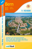


Bern & Suburbs
Detailed, clear street plan of Bern combining road & tourist information and extending north-west to the Wohlen area and south to the Kehrsatz area including the airport.Detail includes railways, tram & bus routes, car parks, one-way streets, pedestrian zones and public buildings. Symbols indicate museums & places of interest, tourist information points, churches, hotels, hostels & campsites, police stations & post offices, taxi terminals, botanical gardens and other leisure & tourist sites.There is an inset map of the city centre (1:6, 500) from the Hauptbahnhof to Nydeggbruecke, and a small overview of the city`s surroundings from Biel/Bienne to Thun.On the reverse are more maps at 1:15, 000 extending the coverage to outer suburbs eg. Zollikofen, Muenchenbuchsee, Wohlen,
Frauenkappeln, Neuenegg, Belp, Muensingen, Worb.Four public transport diagrams are included.Map legend includes English.
Frauenkappeln, Neuenegg, Belp, Muensingen, Worb.Four public transport diagrams are included.Map legend includes English.

Product Description
Reviews/Comments
Add New
Intelligent Comparison
Archived Product
Tehran And Suburbs Stanfords
£33.95
Vouchers
No voucher codes found.
Do you know a voucher code for this product or supplier? Add it to Insights for others to use.
Do you know a voucher code for this product or supplier? Add it to Insights for others to use.
 Denmark