More From Contributor

£19.95
Attractive 93x 71cm topographical wallmap of the isl&, with street maps of Hamilton & St George included. On the main map general relief is shown by hill-shading, spot heights & contours at 50ft intervals. The principal road network is marked & some road names are shown. Marsh areas, beaches, golf courses & built-up areas are shown & scattered buildings are marked. In particular, selected buildings are identified eg. schools, churches, major hotels. Ferry routes across Great Sound are marked, lighthouses are marked & many islands, beaches & bays are named. Latitude & longitude values are shown at the sheet corners only, & there are no grid lines. Parish, municipal & USAF boundaries are indicated. Street plans of Hamilton & St George at 1:7040 are included in insets. These show street names & identify many notable buildings & landmarks. ...
Archived Product
£102.99
Third title of a series of 8 DVDs covering the whole country. About this series: The Swiss Map 25 series covers the whole of the country at 1:25, 000,

Includes::
the complete official Swiss footpath network & it is compatible with both Swiss Map 50 & 100, & with the Dufour Map. There are 8 DVD titles in the series, each also including the Swiss Map 500 covering the whole country. The cartography of Swiss Map 25 is equivalent to that of the printed Swiss Survey maps & the individually selectable map extracts can be easily printed & exported. The diversity of the graphic tools makes it possible to show political & administrative boundaries (including municipalities, districts & cantons), highlight castles, heritage sites & other tourist information, & search for all displayed place names. It is also possible to calculate distances, hiking times & profiles' elevation, to enter individual routes or add personal data to a map. Up-to-date information from the Switzerland Tourism organisation about holiday destinations, hotels, events & excursions can also be accessed from the map via the Internet. Each DVD is compatible with Windows, Mac & GPS (NMEA, Garmin & Magellan). All data is available in English, German, French & Italian. System requirements:1 GB free hard disk space Screen 1024 x 768 pixels Thousands of colours (16 bits) Internet Browser 4.x (or higher) Windows
- 2000 or XP
- Pentium processor III
- 256 MB RAMMacintosh
- Mac OS X 10.1.5 (or higher)
- G3 500 MHz
- 256 MB RAM


...
Archived Product
£19.99
Bern area at 1:50, 000 in a series from Hallwag covering Switzerland’s popular hiking regions on light, waterproof & tear-resistant maps highlighting long-distance paths: the nine national routes plus special regional routes, as well as other local hiking trails. Cartography is similar to that used both in Hallwag’s hiking atlases & in the walking series from Kümmerly + Frey at 1:60, 000 covering the whole country. The maps have contours at 50m or 25m intervals according to the terrain, enhanced by graphic relief & shading. A special feature of this series is an overprint indicating the nine national long-distance routes, plus regional long-distance trails. The overprint also shows other local paths, distinguishing between sign-posted hiking paths, mountain paths where proper walking shoes are necessary, & alpine paths requiring special equipment for glacier traverses & light climbing. Mountain huts are marked, plus various types of accommodation: campsites, youth hostels, “ Friends of Nature” houses, & secluded hotels & restaurants. Road network indicates local bus routes with stops. Railways, narrow gauge mountain railways, cable car lines, & chair lifts are shown, with various symbols highlighting places of interest, viewpoints, picnic sites, swimming pools, etc. The maps have a 1km grid for Swiss national coordinates (datum CH1903 Bessel), with latitude & longitude shown as margin ticks at 5’. * Map legend

Includes::
English.* On the reverse, an index of towns & villages

Includes::
names of geographical features such as mountains, alpine passes, glaciers, lakes, rivers, as well as places of interest. Also provided is a small road map at 1:301, 000 of a wider region around the area covered by each title.


...
Archived Product
£8.99
Pocket street plan of Bern at 1:10, 000 from Swiss publishers Orell Füssli, with an enlargement showing the city’s historic centre in greater detail at 1:7, 500. The main plan extends north, east & west to the motorways (Nos. 1, 6 & 12), & south to Köniz & the offices of the Swiss national survey organization, Swisstopo, in Wabern. Bus & tram routes are shown with line number & stops; the plan also clearly shows S-Bahn & railway lines & stations. Main traffic arteries are highlighted & the “zone favourable to pedestrians” is marked. Symbols indicate various places of interest & facilities, including car parks, cultural institutions, the city`s famous fountains, etc. Map legend

Includes::
English. Street index is on the reverse, together with multilingual notes describing the city’s best know sights.

...
Archived Product
£8.99
Detailed, clear street plan of Bern combining road & tourist information & extending north-west to the Wohlen area & south to the Kehrsatz area including the airport. Detail

Includes::
railways, tram & bus routes, car parks, one-way streets, pedestrian zones & public buildings. Symbols indicate museums & places of interest, tourist information points, churches, hotels, hostels & campsites, police stations & post offices, taxi terminals, botanical gardens & other leisure & tourist sites. There is an inset map of the city centre (1:6, 500) from the Hauptbahnhof to Nydeggbruecke, & a small overview of the city`s surroundings from Biel/ Bienne to Thun. On the reverse are more maps at 1:15, 000 extending the coverage to outer suburbs eg. Zollikofen, Muenchenbuchsee, Wohlen, Frauenkappeln, Neuenegg, Belp, Muensingen, Worb. Four public transport diagrams are included. Map legend

Includes::
English.


...
Archived Product
£8.99
The double-sided city maps include all essential information:- detailed & clear representation of town centre- appealing 3D-display of selected typical buildings- brief description of 16 highlights in 4 languages complemented with attractive pictures- useful additional information for a successful trip (vicinity map, public transport, travel information, climate chart, index of important streets)- up-to-date amendments via QR-Code (airports, local traffic, fairgrounds…). ...
Archived Product
£19.99
Bern Region at 1:60, 000 in Kümmerly + Frey’s hiking series of Switzerl&, with most titles now printed on light, waterproof & tear-resistant plastic paper. The series offers a popular alternative to Swiss survey maps & cartography which many walkers find easier to follow. Coverage of the whole country is designed so that each title presents a popular hiking area. The maps have contours at 50 or 25-metre intervals according to the terrain, enhanced by graphic relief & shading. An overprint distinguishes between sign-posted hiking paths, mountain path where proper walking shoes are necessary, & alpine paths requiring special equipment. Most titles now also indicate national & regional long-distance hiking routes, each annotated with its official number. Mountain huts are marked, plus various types of accommodation: campsites, youth hostels, “ Friends of Nature” houses, & secluded hotels & restaurants. Road network indicates local bus routes with stops. Railways, narrow gauge mountain railways, cable car lines, & chair lifts are shown, with various symbols highlighting places of interest, viewpoints, picnic sites, swimming pools, etc. Each title covers an area of Approx. 60 x 42 km (37 x 26 miles). The maps have a 1km Swiss national grid, plus latitude & longitude margin ticks at 5’ intervals. * Map legend

Includes::
English.* On the reverse, an index of towns & villages

Includes::
names of geographical features such as mountains, alpine passes, glaciers, lakes, rivers, as well as places of interest. Also provided is an overview road map of surrounding region.


...
Archived Product
£19.99
Bern Region at 1:60, 000 in Kümmerly + Frey’s series of cycling maps published in co-operation with the Association for Transport & Environment & showing the official “ Cycling in Switzerland” routes. The aim of the series is to present a network of routes with as few problems as possible caused by motor traffic. The maps have a detailed base, with contours plus graphic relief & shading providing an excellent representation of the terrain. Routes are classified according to the density of motorized traffic, the difficulty of the terrain, & road restrictions. Unsurfaced roads are indicated, gradient marks show steep inclines, & local danger spots are highlighted. The maps show facilities for transporting cycles by train, bus, ferries, mountain railways, chair lifts, & cable cars. Border crossings indicate those open only to hikers & cyclist during daylight hours. Bike rental facilities are marked & towns with special bicycle-friendly accommodation are highlighted. Other tourist information

Includes::
various types of accommodations (campsites, youth hostels, “ Friends of Nature” houses, etc), viewpoints, picnic sites, swimming pools, & places of interest. Each title covers an area of Approx. 60 x 42 km (37 x 26 miles). The maps have a 1km grid for GPS users, with latitude & longitude shown as margin ticks. Map legend

Includes::
English. On the reverse, an index of towns & villages also lists names of geographical features such as mountains, alpine passes, glaciers, etc. Also included is general information on the country’s long-distance cycling routes & on transporting bikes by train (text

Includes::
English). To see the list of titles in this series please click on the series link.


...
Archived Product
£12.99
Map No. 1166, Bern, in the topographic survey of Switzerland at 1:25, 000 from Bundesamt für Landestopographie (swisstopo), covering the whole country on 247 small format sheets, with special larger maps published for popular regions including some titles now available in hiking versions. Highly regarded for their superb use of graphic relief & hill shading, the maps give an almost 3-D picture of Switzerland`s mountainous terrain. Contours are at 10 m intervals, with 20m intervals in the mountainous areas. All the maps have a 1-km grid for Swiss national coordinates (datum CH 1903). * Small format sheets (Nos. 1011
- 1374)* Map legend in the language of the area covered by the map. Additional margin ticks show latitude & longitude in steps of 2`. The area covered by each map is 17 x 12 km (11 x 7 miles approx). * Special larger sheets (Nos. from 2501 onwards) – STANDARD editions:* No map legend is included but a separate leaflet can be provided instead. The area covered by each map is 25 x 17 km (15 x 11 miles approx).* Special larger sheets (Nos. from 2501 onwards) – HIKING editions:* An overprint highlights hiking, mountain & alpine paths, including regional & national long-distance trails. The maps also show bus routes with bus stops, plus inns in remote locations. The area covered by each map is 25 x 17 km (15 x 11 miles approx).
...
Archived Product
£12.99
Bern, map No. 243, in the standard topographic survey of Switzerland at 1:50, 000 from Swisstopo, i.e. without the special overprint highlighting walking trails, local bus stops, etc, presented in Swisstopo’s hiking editions of the 50K survey. Highly regarded for their superb use of graphic relief & hill shading, the maps give an almost 3-D picture of Switzerland`s mountainous terrain. Contours are at 20m intervals. All the maps have a 1-km grid with the Swiss national coordinates. This standard version of the 50K survey covers the whole country on 78 small format sheets, with special larger format maps published for several popular tourist destinations. Small format sheets cover an area of 35 x 24 km (21 x 15 miles approx) & have map legend in the language of the area covered by the map. The special larger sheets cover 50 x 35 km (31 x 22 miles approx) & have no map legend, but a separate leaflet can be provided instead.PLEASE NOTE: the hiking editions of the 1:50, 000 Swisstopo survey are listed on our website in a separate series. ...
Archived Product

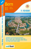
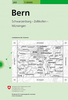
Bern - Wohlensee - Gantrisch

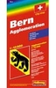
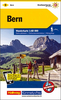
The environs of Bern extending south-east to Thun presented at 1:50, 000 on a waterproof and tear-resistant, contoured and GPS compatible map from the Hallwag/Kümmerly + Frey group, with route profiles, grading for the severity of the terrain and the degree of fitness required, etc.The cartography provides an excellent picture of the terrain through contours at 25-metre intervals enhanced by shading, graphic relief for exposed rock, and colouring for glaciers and woodlands. All local footpaths are on the maps, but the overprint specifically highlights 33 trails selected by the publishers in collaboration with Geo-tracks. The colouring of each trail indicates the degree of fitness needed, from “no physical shape required” to “extremely high level of physical fitness
necessary”. The trails start near a railway station or a bus stop (the colouring of the road network indicates routes with public transport and locations of individual bus stops). The maps have the lines of the Swiss national grid at 1-km intervals. On the reverse each trail has a route profile, its grading according to severity of the terrain and the degree of fitness required to attempt it, details of length and approximate timing, the change in altitude on assent and descent, plus a brief description. Map legend includes English; all the text on the reverse is in German. Each title also includes a code for a free download onto a smartphone.To see other titles in this series please click on the series link.USEFUL TIP: the same cartography, reduced slightly to 1:60, 000, is used
in Kümmerly + Frey’s hiking series with highlighting for all the waymarked trails rather than, as in this series, just a selection of 33 special routes recommended by the publishers.
RIP - This product is no longer available on our network. It was last seen on 25.09.2019

This page now acts as a permanent archive for this product. Add more information using the comments box below to ensure it can still be found by future generations.

Use our search facility to see if it is available from an alternative contributor.
  • Availability: Out Of Stock
  • Supplier: Stanfords
  • SKU: 9783828308404
Availability: In Stock
£18.99

Product Description

The environs of Bern extending south-east to Thun presented at 1:50, 000 on a waterproof & tear-resistant, contoured & GPS compatible map from the Hallwag/Kümmerly + Frey group, with route profiles, grading for the severity of the terrain & the degree of fitness required, etc. The cartography provides an excellent picture of the terrain through contours at 25-metre intervals enhanced by shading, graphic relief for exposed rock, & colouring for glaciers & woodlands. All local footpaths are on the maps, but the overprint specifically highlights 33 trails selected by the publishers in collaboration with Geo-tracks. The colouring of each trail indicates the degree of fitness needed, from “no physical shape required” to “extremely high level of physical fitness necessary”. The trails start near a railway station or a bus stop (the colouring of the road network indicates routes with public transport & locations of individual bus stops). The maps have the lines of the Swiss national grid at 1-km intervals. On the reverse each trail has a route profile, its grading according to severity of the terrain & the degree of fitness required to attempt it, details of length & approximate timing, the change in altitude on assent & descent, plus a brief description. Map legend

Includes::
English; all the text on the reverse is in German. Each title also

Includes::
a code for a free download onto a smartphone. To see other titles in this series please click on the series link.USEFUL TIP: the same cartography, reduced slightly to 1:60, 000, is used in Kümmerly + Frey’s hiking series with highlighting for all the waymarked trails rather than, as in this series, just a selection of 33 special routes recommended by the publishers.

Reviews/Comments

Add New

Intelligent Comparison

Oooops!
We couldn't find anything!
Perhaps this product's unique.... Or perhaps we are still looking for comparisons!
Click to bump this page and we'll hurry up.

Price History

Vouchers

No voucher codes found.
Do you know a voucher code for this product or supplier? Add it to Insights for others to use.

Facebook

Jargon Buster

GPS - Global Positioning System - Global position using satellites
Hiking - An outdoor activity envolving walking in nature
swiss - Short for Switzerland, one of the richest countries in the world
Physical - Used to describe strength or visual properties of an item
Waterproof - Resistant to water, usualy specified by depth in metres
Network - A link and communication between things. Often computers or people.
Km - Kilometre. A unit of measurement equal to 1000 metres.
Road - a manmade lane or a path that is used to speed up travel.
Resistant - Something that can repel against something.
Metre - 100cm. A unit of length.
Altitude - Something that can be quite high in relation to sea or ground level.
Degree - An angle measurement, also can be the measurement of an extent that something happens, can also relate to an university academic measurement.
degree - The extremity of something or the angle. Can also relate to a university achievement.
Collaboration - To work alongside someone to create something.
Individual - A single separate item or person.
Transport - Something that carries people or goods.

Supplier Information

Stanfords
Stanfords was established in 1853 and opened their iconic Covent Garden flagship store in 1901. They have become the top retailer of maps, travel books and accessories in the UK and arguably offer the largest selection of maps and travel books worldwide. Famous names such as Captain Robert Falcon Scott, Ranulph Fiennes and Michael Palin have purchased from Stanfords. They now have a shop in Bristol and both stores together with other venues operate a calendar of events including talks, book signings and exhibitions. As a specialist map retailer, the map selection is comprehensive and includes road maps, street maps and walking maps from worldwide destinations, as well as a selection of world atlases and wall maps. Books include travel guides and travel literature. Stanfords also stock globes, from miniatures made of blue marble to magnificent floor-standing globes. The website features a selection of interesting articles on travel topics.
Page Updated: 2023-11-12 20:15:36

Community Generated Product Tags

Oh No! The productWIKI community hasn't generated any tags for this product yet!
Menu