
 United Kingdom
 France
 Germany
 Netherlands
 Sweden
 USA
USA
 Italy
Italy
 Spain
Spain
More From Contributor


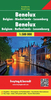
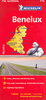


Benelux Road Atlas
Benelux Road Atlas at 1:250, 000 from De Rouck Geocart, with coverage including the Channel ports area of France, 20 enlargements at 1:100, 00 for environs of main cities, and 56 indexed street plans of towns in the three countries.The main section of the atlas covers Belgium, Netherlands and Luxembourg, with northern France from Lille to the coast to include the Channel Tunnel terminal at Calais, Boulogne and Dunkerque. Road presentation emphasizes the motorway network, shown with parking areas, fuel supplies and restaurant services. Driving distances are shown on main and selected secondary roads, both types classified according to the number of lanes. Railway lines are included and ferry connections are marked. Colouring and graphics show forested areas and nature reserves,
with symbols indicating campsites and youth hostels, historical monuments, military cemeteries, sport and recreational facilities, etc. The maps have no geographical coordinated. Each page is divided in 12 numbered squares, making the index of place names very easy to use.20 enlargements at 1:100, 000 present access to main cities in greater detail, covering Antwerp (with the port area), Bruges, Brussels, Charleroi, Gent, Liege, Mons, Lille, Luxembourg City, Amsterdam, Apeldoorn, Arnhem, Breda, The Hague, Eindhoven, Groningen, Maastricht, Nijmegen, Rotterdam - Delft area and Utrecht.Street plans include all the above cities except Lille, covering 34 towns in Belgium, 5 in Luxembourg and 18 in the Netherlands. Most plans cover one page of the atlas and in larger
cities present the central area. Brussels, Antwerp, Bruges, Gent and Liege are shown on two or more pages with wider coverage. Each plan has a separate street index.Also provided in a comprehensive distance table which conveniently includes towns outside Benelux, e.g. Calais, Paris, Cologne, Frankfurt, etc.
Product Description
Reviews/Comments
Add New
Intelligent Comparison
Archived Product
Benelux Road Atlas Stanfords
£7.99
Archived Product
Belarus Road Atlas Stanfords
£44.50
Archived Product
Belarus Road Atlas Stanfords
£32.50
Archived Product
Greece Road Atlas Stanfords
£25.50
Archived Product
Israel Road Atlas Stanfords
£23.95
Archived Product

Thailand Deluxe Road Atlas Stanfords
£22.99
Archived Product
Germany Road Atlas Stanfords
£6.99
Archived Product
Germany Road Atlas Stanfords
£8.99
Vouchers
No voucher codes found.
Do you know a voucher code for this product or supplier? Add it to Insights for others to use.
Do you know a voucher code for this product or supplier? Add it to Insights for others to use.
 Denmark