
 United Kingdom
 France
 Germany
 Netherlands
 Sweden
 USA
USA
 Italy
Italy
 Spain
Spain
More From Contributor
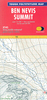
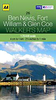


Ben Nevis, Fort William And Glen Coe OS ACTIVE MAP
Map No. 41, Ben Nevis, Fort William/An Gearasdan and Glen Coe, in a waterproof and tear-resistant OS Active version of the Ordnance Survey Landranger series at 1:50, 000, including Glen Mallie, Meall Onfhaidh, Glen Roy, Glen Spean, Stob Coearg, Binnein Beag, Leum Uilleim, Sgor na h-Ulaidh, Glen Etive, Rannoch Moor, Loch Eil, Loch Linnhe, Loch Lochy, Loch Leven, Loch Treig, Loch Ossian, Loch Laidon, the Blackwater Reservoir, Dalness, Kentallen, South Ballachulish, Glencoe, Kinlochleven, North Ballachulish, Inchree, Blarmachfoldach, Stronchreggan, Duisky, Corpach, Torlundy, Muirshearlich, Gairlochy, Clunes, Stronenaba, Spean Bridge, Achlauchrach and Fersir, with the last section of the West Highland Way and the Great Glen Way. Edition C2; Publication
Date: July 2011 This title is also available on our website in a paper version.Maps in this series are only published folded. Stanfords can also print flat versions of Ordnance Survey maps through the OS Select system, centring the map on a location of your choice and with a picture provided by you on the cover. For more information please click on the link at the bottom of this description.About Ordnance Survey
Date: July 2011 This title is also available on our website in a paper version.Maps in this series are only published folded. Stanfords can also print flat versions of Ordnance Survey maps through the OS Select system, centring the map on a location of your choice and with a picture provided by you on the cover. For more information please click on the link at the bottom of this description.About Ordnance Survey
Product Description
Reviews/Comments
Add New
Intelligent Comparison
Archived Product
Ben Nevis, Fort William And Glen Coe Stanfords
£5.59
Archived Product
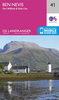
Ben Nevis & Fort William OS ACTIVE Map Stanfords
£11.19
Vouchers
No voucher codes found.
Do you know a voucher code for this product or supplier? Add it to Insights for others to use.
Do you know a voucher code for this product or supplier? Add it to Insights for others to use.
 Denmark