
 United Kingdom
 France
 Germany
 Netherlands
 Sweden
 USA
USA
 Italy
Italy
 Spain
Spain
More From Contributor
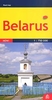


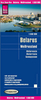

Belarus (English Edition)
Indexed road map of Belarus at 1:850, 000 from Belkartographia with all place names shown in Latin alphabet. Enlargements show main transit routes and streets in Brest, Vitebsk, Homiel, Hrodna, Minsk and Mogiliev. All place names The map shows the road network in detail, indicating driving distances on small local roads. Locations of fuel supplies and car repair services are marked. Border crossings symbols indicate those for all the vehicles, cars only, or cars and buses. Symbols also indicate locations with tourist accommodation. Railways are includes and local airports are marked. Longitude and latitude lines are marked at 1° and 40’ intervals respectively. A handy table of driving distances is included with the main map for cities with a population of over 50, 000.On the
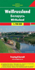
reverse are street maps of Brest (1:69, 000), Vitebsk (1:69, 000), Homiel (1:86, 000), Hrodna (1:69, 000), Minsk (1:88, 000) and Mahiliou/Mogiliev (1:86, 000) highlighting main traffic arteries and naming a selection of streets. The maps show locations of fuel supplies, car repair facilities and car parks, as well as selected hotels and restaurants or cafes.Map legend and all the text is in English.
reverse are street maps of Brest (1:69, 000), Vitebsk (1:69, 000), Homiel (1:86, 000), Hrodna (1:69, 000), Minsk (1:88, 000) and Mahiliou/Mogiliev (1:86, 000) highlighting main traffic arteries and naming a selection of streets. The maps show locations of fuel supplies, car repair facilities and car parks, as well as selected hotels and restaurants or cafes.Map legend and all the text is in English.
 "Pin It")
Product Description
Reviews/Comments
Add New
Intelligent Comparison
Archived Product
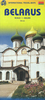
Belarus (Cyrillic Edition) Stanfords
£9.95
Archived Product
Belarus (Cyrillic Edition) Stanfords
£9.99
Vouchers
No voucher codes found.
Do you know a voucher code for this product or supplier? Add it to Insights for others to use.
Do you know a voucher code for this product or supplier? Add it to Insights for others to use.
 Denmark