
 United Kingdom
 France
 Germany
 Netherlands
 Sweden
 USA
USA
 Italy
Italy
 Spain
Spain
More From Contributor

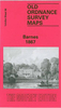

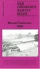
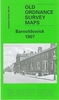


Barnet And Hadley 1896
Barnet and Hadley in 1896 in a fascinating series of reproductions of old Ordnance Survey plans in the Alan Godfrey Editions, ideal for anyone interested in the history of their neighbourhood or family. The map shows parts of two communities, Chipping Barnet and Monken Hadley. Coverage extends from Wood Street, in Chipping Barnet, northward along the High Street - or Great North Road - to Hadley Green. Just north of this, at the top of the map, is the site of the Battle of Barnet 1471. The map extends west to Galley Lane, the boundary with Hertfordshire. Features on the map include Hadley Brewery, Hadley House, Old Windmill pub, Old Fold Manor Farm, Militia Barracks, Christ Church. On the reverse are street directories for Hadley Green, Hadley High Stone, Barnet High Street,
Puller Road, Salisbury Road, Sebright Road, Stapylton Road, Union Street and Wood Street.About the Alan Godfrey Editions of the 25” OS Series:Selected towns in Great Britain and Ireland are covered by maps showing the extent of urban development in the last decades of the 19th and early 20th century. The plans have been taken from the Ordnance Survey mapping and reprinted at about 15 inches to one mile (1:4, 340). On the reverse most maps have historical notes and many also include extracts from contemporary directories. Most maps cover about one mile (1.6kms) north/south, one and a half miles (2.4kms) across; adjoining sheets can be combined to provide wider coverage.FOR MORE INFORMATION AND A COMPLETE LIST OF ALL AVAILABLE TITLES PLEASE CLICK ON THE SERIES LINK.
Puller Road, Salisbury Road, Sebright Road, Stapylton Road, Union Street and Wood Street.About the Alan Godfrey Editions of the 25” OS Series:Selected towns in Great Britain and Ireland are covered by maps showing the extent of urban development in the last decades of the 19th and early 20th century. The plans have been taken from the Ordnance Survey mapping and reprinted at about 15 inches to one mile (1:4, 340). On the reverse most maps have historical notes and many also include extracts from contemporary directories. Most maps cover about one mile (1.6kms) north/south, one and a half miles (2.4kms) across; adjoining sheets can be combined to provide wider coverage.FOR MORE INFORMATION AND A COMPLETE LIST OF ALL AVAILABLE TITLES PLEASE CLICK ON THE SERIES LINK.

Product Description
Reviews/Comments
Add New
Intelligent Comparison
Archived Product

Monken Hadley 1896 Stanfords
£3.50
Archived Product

Barnet & Hadley Past Stanfords
£15.95
Vouchers
No voucher codes found.
Do you know a voucher code for this product or supplier? Add it to Insights for others to use.
Do you know a voucher code for this product or supplier? Add it to Insights for others to use.
 Denmark