More From Contributor
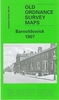
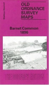
£3.50
Barnes in 1867 in a fascinating series of reproductions of old Ordnance Survey plans in the Alan Godfrey Editions, ideal for anyone interested in the history of their neighbourhood or family. Three versions have been published for this area, stretching from Church Avenue at Mortlake eastward to Lower Common South on the outskirts of Putney, & from Madrid Road & part of Castelnau southward to Upper Richmond Road. The map covers east Mortlake with St Mary`s church, part of the High St, Mortlake cemetery, the adjacent hospital, the malthouse, the RC church, & council offices. The northern part of the map is largely Barnes, including Barnes Green, Barnes Common, Mill Hill, St Mary`s church, St Michael & All Angel`s church, High St, & Barn Elms Park; the small segment of Putney

Includes::
Putney cemetery. The railway, including Barnes station & Barnes Bridge, runs through the map. The 1867 map

Includes::
a trade directory & list of private residents. About the Alan Godfrey Editions of the 25” OS Series: Selected towns in Great Britain & Ireland are covered by maps showing the extent of urban development in the last decades of the 19th & early 20th century. The plans have been taken from the Ordnance Survey mapping & reprinted at about 15 inches to one mile (1:4, 340). On the reverse most maps have historical notes & many also include extracts from contemporary directories. Most maps cover about one mile (1.6kms) north/south, one & a half miles (2.4kms) across; adjoining sheets can be combined to provide wider coverage.FOR MORE INFORMATION & A COMPLETE LIST OF ALL AVAILABLE TITLES PLEASE CLICK ON THE SERIES LINK.


...
Archived Product
£3.50
Barnes in 1983 in a fascinating series of reproductions of old Ordnance Survey plans in the Alan Godfrey Editions, ideal for anyone interested in the history of their neighbourhood or family. Three versions have been published for this area, stretching from Church Avenue at Mortlake eastward to Lower Common South on the outskirts of Putney, & from Madrid Road & part of Castelnau southward to Upper Richmond Road. The map covers east Mortlake with St Mary`s church, part of the High St, Mortlake cemetery, the adjacent hospital, the malthouse, the RC church, & council offices. The northern part of the map is largely Barnes, including Barnes Green, Barnes Common, Mill Hill, St Mary`s church, St Michael & All Angel`s church, High St, & Barn Elms Park; the small segment of Putney

Includes::
Putney cemetery. The railway, including Barnes station & Barnes Bridge, runs through the map. The 1893 map has the Barnes commercial directory from Kelly`s Surrey directory of 1903. About the Alan Godfrey Editions of the 25” OS Series: Selected towns in Great Britain & Ireland are covered by maps showing the extent of urban development in the last decades of the 19th & early 20th century. The plans have been taken from the Ordnance Survey mapping & reprinted at about 15 inches to one mile (1:4, 340). On the reverse most maps have historical notes & many also include extracts from contemporary directories. Most maps cover about one mile (1.6kms) north/south, one & a half miles (2.4kms) across; adjoining sheets can be combined to provide wider coverage.FOR MORE INFORMATION & A COMPLETE LIST OF ALL AVAILABLE TITLES PLEASE CLICK ON THE SERIES LINK.

...
Archived Product
£3.50
Barnes in 1913 in a fascinating series of reproductions of old Ordnance Survey plans in the Alan Godfrey Editions, ideal for anyone interested in the history of their neighbourhood or family. Three versions have been publised for this area, stretching from Church Avenue at Mortlake eastward to Lower Common South on the outskirts of Putney, & from Madrid Road & part of Castelnau southward to Upper Richmond Road. The map covers east Mortlake with St Mary`s church, part of the High St, Mortlake cemetery, the adjacent hospital, the malthouse, the RC church, & council offices. The northern part of the map is largely Barnes, including Barnes Green, Barnes Common, Mill Hill, St Mary`s church, St Michael & All Angel`s church, High St, & Barn Elms Park; the small segment of Putney

Includes::
Putney cemetery. The railway, including Barnes station & Barnes Bridge, runs through the map. The 1913 map has street directory extracts, including Archway Street, Castelnau, Church Road & Cleveland Gardens. About the Alan Godfrey Editions of the 25” OS Series: Selected towns in Great Britain & Ireland are covered by maps showing the extent of urban development in the last decades of the 19th & early 20th century. The plans have been taken from the Ordnance Survey mapping & reprinted at about 15 inches to one mile (1:4, 340). On the reverse most maps have historical notes & many also include extracts from contemporary directories. Most maps cover about one mile (1.6kms) north/south, one & a half miles (2.4kms) across; adjoining sheets can be combined to provide wider coverage.FOR MORE INFORMATION & A COMPLETE LIST OF ALL AVAILABLE TITLES PLEASE CLICK ON THE SERIES LINK.

...
Archived Product
£15.95
High above London are the old settlements of Chipping Barnet & Hadley, halfway to St Albans from the City. Both villages prospered from many inns, crucial to horse traffic before the age of steam. The railway changed things, giving rise to an entirely new suburb, New Barnet, when commuting to & from London became possible. But Hadley survived almost untouced & is today an unusual London area with a splended wealth of Georgian houses overlooking open spaces. ...
Archived Product
£3.50
Barnet & Hadley in 1896 in a fascinating series of reproductions of old Ordnance Survey plans in the Alan Godfrey Editions, ideal for anyone interested in the history of their neighbourhood or family. The map shows parts of two communities, Chipping Barnet & Monken Hadley. Coverage extends from Wood Street, in Chipping Barnet, northward along the High Street
- or Great North Road
- to Hadley Green. Just north of this, at the top of the map, is the site of the Battle of Barnet 1471. The map extends west to Galley Lane, the boundary with Hertfordshire. Features on the map include Hadley Brewery, Hadley House, Old Windmill pub, Old Fold Manor Farm, Militia Barracks, Christ Church. On the reverse are street directories for Hadley Green, Hadley High Stone, Barnet High Street, Puller Road, Salisbury Road, Sebright Road, Stapylton Road, Union Street & Wood Street. About the Alan Godfrey Editions of the 25” OS Series: Selected towns in Great Britain & Ireland are covered by maps showing the extent of urban development in the last decades of the 19th & early 20th century. The plans have been taken from the Ordnance Survey mapping & reprinted at about 15 inches to one mile (1:4, 340). On the reverse most maps have historical notes & many also include extracts from contemporary directories. Most maps cover about one mile (1.6kms) north/south, one & a half miles (2.4kms) across; adjoining sheets can be combined to provide wider coverage.FOR MORE INFORMATION & A COMPLETE LIST OF ALL AVAILABLE TITLES PLEASE CLICK ON THE SERIES LINK.

...
Archived Product
£3.50
Barnoldswick in 1907 in a fascinating series of reproductions of old Ordnance Survey plans in the Alan Godfrey Editions, ideal for anyone interested in the history of their neighbourhood or family. The map covers Barnoldswick, a small Yorkshire mill town which since council reorganization is now in Lancashire. The Barnoldswick Branch of the Midland Railway travels from the south-east of the map into the town, with its station being close to Foresters Buildings. Butts Mill & Calf Hall Shed are in the centre of the map, east of Higher Calf Hall. Other points of interest include Clough Mills, Moss & Long Ing Shed & Well House Mill. On the reverse side are extracts from a contemporary directory, plus the Midland Railway Timetable 1916, About the Alan Godfrey Editions of the 25” OS Series: Selected towns in Great Britain & Ireland are covered by maps showing the extent of urban development in the last decades of the 19th & early 20th century. The plans have been taken from the Ordnance Survey mapping & reprinted at about 15 inches to one mile (1:4, 340). On the reverse most maps have historical notes & many also include extracts from contemporary directories. Most maps cover about one mile (1.6kms) north/south, one & a half miles (2.4kms) across; adjoining sheets can be combined to provide wider coverage.FOR MORE INFORMATION & A COMPLETE LIST OF ALL AVAILABLE TITLES PLEASE CLICK ON THE SERIES LINK. ...
Archived Product
£3.50
Street by Street Barnsley Midi has been fully updated with a stylish new cover design, in a handy glovebox size. Quick to navigate & easy-to-use, the maps clearly show AA recommended restaurants, pubs, hotels, one-way streets & car parks. Featuring a clever use of colour to ensure they can be read under street lighting, & National Grid referencing, the Street by Street Barnsley Midi map is all you need to keep you on the move. ...
Archived Product
£4.50
Barnsley in 1890 in a fascinating series of reproductions of old Ordnance Survey plans in the Alan Godfrey Editions, ideal for anyone interested in the history of their neighbourhood or family. Two versions have been published for this area. The 1890 version is in full colour, taken from the beautiful 1st Edition OS h&-coloured map. The maps cover most of the town centre, extending westward to Gawber & northward to Green Foot & New Gawber. Features include May Day Green, Court House station, Midland Railway & South Yorkshire Railway, Old Mill Bleach Works, Harborough House, Gawber Hall, Hope Works, Taylor`s Mill, Jordan Hill, Summer Lane Station, Pog Moor, Workhouse, etc. Each map

Includes::
extracts from an early directory. About the Alan Godfrey Editions of the 25” OS Series: Selected towns in Great Britain & Ireland are covered by maps showing the extent of urban development in the last decades of the 19th & early 20th century. The plans have been taken from the Ordnance Survey mapping & reprinted at about 15 inches to one mile (1:4, 340). On the reverse most maps have historical notes & many also include extracts from contemporary directories. Most maps cover about one mile (1.6kms) north/south, one & a half miles (2.4kms) across; adjoining sheets can be combined to provide wider coverage.FOR MORE INFORMATION & A COMPLETE LIST OF ALL AVAILABLE TITLES PLEASE CLICK ON THE SERIES LINK.

...
Archived Product
£3.50
Barnsley in 1904 in a fascinating series of reproductions of old Ordnance Survey plans in the Alan Godfrey Editions, ideal for anyone interested in the history of their neighbourhood or family. Two versions have been published for this area. The 1890 version is in full colour, taken from the beautiful 1st Edition OS h&-coloured map. The maps cover most of the town centre, extending westward to Gawber & northward to Green Foot & New Gawber. Features include May Day Green, Court House station, Midland Railway & South Yorkshire Railway, Old Mill Bleach Works, Harborough House, Gawber Hall, Hope Works, Taylor`s Mill, Jordan Hill, Summer Lane Station, Pog Moor, Workhouse, etc. Each map

Includes::
extracts from an early directory. About the Alan Godfrey Editions of the 25” OS Series: Selected towns in Great Britain & Ireland are covered by maps showing the extent of urban development in the last decades of the 19th & early 20th century. The plans have been taken from the Ordnance Survey mapping & reprinted at about 15 inches to one mile (1:4, 340). On the reverse most maps have historical notes & many also include extracts from contemporary directories. Most maps cover about one mile (1.6kms) north/south, one & a half miles (2.4kms) across; adjoining sheets can be combined to provide wider coverage.FOR MORE INFORMATION & A COMPLETE LIST OF ALL AVAILABLE TITLES PLEASE CLICK ON THE SERIES LINK.

...
Archived Product
£3.95
Barnsley Street Atlas from the Geographers` A-Z Map Company in an A5 paperback format at 1:19, 000 (3.33” to a mile). Coverage


...
Archived Product

Barnet Common 1896

Barnet Common in 1896 in a fascinating series of reproductions of old Ordnance Survey plans in the Alan Godfrey Editions, ideal for anyone interested in the history of their neighbourhood or family. This double-sided map covers the southern part of Chipping Barnet. A small portion of the High Street is in the north-easten corner of the main map and coverage includes Barnet Workhouse, Bells Hill and the southern fringe of the village. Cover then extends southward beyond Ducks Island to Dollis Brook, and westward along May`s Lane to Totteridgevale Farm and Whitings Hill. Much of this area is referred to as Barnet Common. On the reverse is half of Sheet 6.06 and this extends coverage westward to the village of Arkley, including St Peter`s church, Arkley Hall and Rowley Green; then
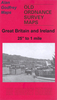
further west to Barnet Gate and Hyver Hall.About the Alan Godfrey Editions of the 25” OS Series:Selected towns in Great Britain and Ireland are covered by maps showing the extent of urban development in the last decades of the 19th and early 20th century. The plans have been taken from the Ordnance Survey mapping and reprinted at about 15 inches to one mile (1:4, 340). On the reverse most maps have historical notes and many also include extracts from contemporary directories. Most maps cover about one mile (1.6kms) north/south, one and a half miles (2.4kms) across; adjoining sheets can be combined to provide wider coverage.FOR MORE INFORMATION AND A COMPLETE LIST OF ALL AVAILABLE TITLES PLEASE CLICK ON THE SERIES LINK.
RIP - This product is no longer available on our network. It was last seen on 25.09.2019

This page now acts as a permanent archive for this product. Add more information using the comments box below to ensure it can still be found by future generations.

Use our search facility to see if it is available from an alternative contributor.
  • Availability: Out Of Stock
  • Supplier: Stanfords
  • SKU: 9780850544770
Availability: In Stock
£3.50

Product Description

Barnet Common in 1896 in a fascinating series of reproductions of old Ordnance Survey plans in the Alan Godfrey Editions, ideal for anyone interested in the history of their neighbourhood or family. This double-sided map covers the southern part of Chipping Barnet. A small portion of the High Street is in the north-easten corner of the main map & coverage

Includes::
Barnet Workhouse, Bells Hill & the southern fringe of the village. Cover then extends southward beyond Ducks Island to Dollis Brook, & westward along May`s Lane to Totteridgevale Farm & Whitings Hill. Much of this area is referred to as Barnet Common. On the reverse is half of Sheet 6.06 & this extends coverage westward to the village of Arkley, including St Peter`s church, Arkley Hall & Rowley Green; then further west to Barnet Gate & Hyver Hall. About the Alan Godfrey Editions of the 25” OS Series: Selected towns in Great Britain & Ireland are covered by maps showing the extent of urban development in the last decades of the 19th & early 20th century. The plans have been taken from the Ordnance Survey mapping & reprinted at about 15 inches to one mile (1:4, 340). On the reverse most maps have historical notes & many also include extracts from contemporary directories. Most maps cover about one mile (1.6kms) north/south, one & a half miles (2.4kms) across; adjoining sheets can be combined to provide wider coverage.FOR MORE INFORMATION & A COMPLETE LIST OF ALL AVAILABLE TITLES PLEASE CLICK ON THE SERIES LINK.

Reviews/Comments

Add New

Intelligent Comparison

Oooops!
We couldn't find anything!
Perhaps this product's unique.... Or perhaps we are still looking for comparisons!
Click to bump this page and we'll hurry up.

Price History

Vouchers

No voucher codes found.
Do you know a voucher code for this product or supplier? Add it to Insights for others to use.

Facebook

Jargon Buster

Contemporary - Modern era design
Contemporary - A design reference to indicate post war modern design
History - Anything that happens in the past. An acedemic subject.
Small - something that takes up less space than normal.
Contemporary - An object that is living in the same time.
Hall - A room at the inside of an entrance of a house.
Ideal - Something that satisfies a perfect criteria.
Family - A group of people that live together made up from parents and children.

Supplier Information

Stanfords
Stanfords was established in 1853 and opened their iconic Covent Garden flagship store in 1901. They have become the top retailer of maps, travel books and accessories in the UK and arguably offer the largest selection of maps and travel books worldwide. Famous names such as Captain Robert Falcon Scott, Ranulph Fiennes and Michael Palin have purchased from Stanfords. They now have a shop in Bristol and both stores together with other venues operate a calendar of events including talks, book signings and exhibitions. As a specialist map retailer, the map selection is comprehensive and includes road maps, street maps and walking maps from worldwide destinations, as well as a selection of world atlases and wall maps. Books include travel guides and travel literature. Stanfords also stock globes, from miniatures made of blue marble to magnificent floor-standing globes. The website features a selection of interesting articles on travel topics.
Page Updated: 2023-11-12 20:15:36

Community Generated Product Tags

Oh No! The productWIKI community hasn't generated any tags for this product yet!
Menu