
 United Kingdom
 France
 Germany
 Netherlands
 Sweden
 USA
USA
 Italy
Italy
 Spain
Spain
More From Contributor


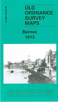
Barnes 1913
Barnes in 1913 in a fascinating series of reproductions of old Ordnance Survey plans in the Alan Godfrey Editions, ideal for anyone interested in the history of their neighbourhood or family. Three versions have been publised for this area, stretching from Church Avenue at Mortlake eastward to Lower Common South on the outskirts of Putney, and from Madrid Road and part of Castelnau southward to Upper Richmond Road. The map covers east Mortlake with St Mary`s church, part of the High St, Mortlake cemetery, the adjacent hospital, the malthouse, the RC church, and council offices. The northern part of the map is largely Barnes, including Barnes Green, Barnes Common, Mill Hill, St Mary`s church, St Michael & All Angel`s church, High St, and Barn Elms Park; the small segment of
Putney includes Putney cemetery. The railway, including Barnes station and Barnes Bridge, runs through the map. The 1913 map has street directory extracts, including Archway Street, Castelnau, Church Road and Cleveland Gardens. About the Alan Godfrey Editions of the 25” OS Series:Selected towns in Great Britain and Ireland are covered by maps showing the extent of urban development in the last decades of the 19th and early 20th century. The plans have been taken from the Ordnance Survey mapping and reprinted at about 15 inches to one mile (1:4, 340). On the reverse most maps have historical notes and many also include extracts from contemporary directories. Most maps cover about one mile (1.6kms) north/south, one and a half miles (2.4kms) across; adjoining sheets can be combined to
provide wider coverage.FOR MORE INFORMATION AND A COMPLETE LIST OF ALL AVAILABLE TITLES PLEASE CLICK ON THE SERIES LINK.

Product Description
Reviews/Comments
Add New
Intelligent Comparison
Archived Product
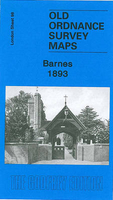
Barnes 1893 Stanfords
£3.50
Archived Product
Larne 1903 Stanfords
£2.95
Archived Product
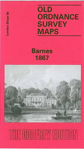
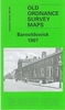
Barnes 1867 Stanfords
£3.50
Archived Product
Bangor 1913 Stanfords
£3.50
Vouchers
No voucher codes found.
Do you know a voucher code for this product or supplier? Add it to Insights for others to use.
Do you know a voucher code for this product or supplier? Add it to Insights for others to use.
 Denmark