
 United Kingdom
 France
 Germany
 Netherlands
 Sweden
 USA
USA
 Italy
Italy
 Spain
Spain
More From Contributor


Azores
The Rother walking guide to the Azores explores some of the finest walking opportunities on the coast and in the mountains of the nine Azorean islands; Santa Maria, Sao Miguel, Pico, Faial, Sao Jorge, Terceira, Graciosa, Flores and Corvo. Introductory sections profile the destination, with background information on the inhabitants of the islands, history, festivities, gastronomy, culture, language, economy, nature and the environment, geography and geology and flora and fauna. A 'Touristic Information' section also provides details of the best time to visit, getting there, travel within the Azores, accommodation, useful addresses and telephone numbers, visa information, holidays, sports, currency, opening hours and other useful information. Each chapter is arranged
geographically by island and includes an Information box with an overview of the island, giving details of population, capital, area, length, coastline and highest point. Individual walks have a gradient diagram as well as as Freytag & Berndt cartography highlighting the route. Extensive descriptions of each walking route are also provided.
geographically by island and includes an Information box with an overview of the island, giving details of population, capital, area, length, coastline and highest point. Individual walks have a gradient diagram as well as as Freytag & Berndt cartography highlighting the route. Extensive descriptions of each walking route are also provided.
Product Description
Reviews/Comments
Add New
Intelligent Comparison
Archived Product
Azores Stanfords
£4.99
Archived Product
Azores Stanfords
£9.50
Archived Product
Azores Stanfords
£7.95
Archived Product
Azores Stanfords
£12.99
Archived Product
Azores Stanfords
£15.99
Archived Product
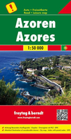
Azores F&B Stanfords
£10.99
Archived Product
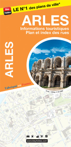
Arles Stanfords
£6.99
Vouchers
No voucher codes found.
Do you know a voucher code for this product or supplier? Add it to Insights for others to use.
Do you know a voucher code for this product or supplier? Add it to Insights for others to use.
 Denmark