-
Home
-
Contributors
-
International
-
Account
-
Information
More From Contributor
Includes:: English. Please note: maps of the Azores by Turinta & by Freytag & Berndt use identical cartography, although the Turinta version does not include A booklet with an index & descriptions of sights. ...
Includes:: in-depth sections on whaling, fishing & agriculture, climate, & geology. There is now a wide choice of accommodation, from 4-star hotels to small family-run affairs, simple pensions, rented cottages & B& Bs
- all detailed in the guide. Tourism services have expanded with greater numbers of marked walking trails, enhanced opportunities for diving, whale watching & adventurous activities such as sea kayaking & jeep safaris, & excellent new museums. The islands remain an outstanding destination for walkers & lovers of nature & the simple life. Tourism has not been allowed to spoil the archipelago & the islands retain much of their traditional charm
- they are not a beach destination, & there is little nightlife or commercial entertainment. With this guide visitors can discover the best walks, tour Europe's westernmost coast
- the island of Flores
- visit Europe's only tea plantations or step into the hot springs & gurgling mud pools of Furnas. Brimming with practical information this new edition of The Azores is the perfect guide to these garden-like islands. ...
Includes:: English. ...

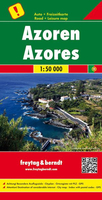
Azores F&B
museums, churches and castles, viewpoints, beaches, campsites and motels, etc. Latitude and longitude lines are drawn at 2` intervals. A small inset shows the islands together as a group and ferry and domestic airlines connection within the islands.The multilingual booklet, which includes English, contains an index listing all the localities with their postcodes and GPS coordinates and a brief description of main tourist sights.* Please note: maps of the Azores by Turinta and by Freytag & Berndt use identical cartography, although the Turinta version does not include the booklet with an index and descriptions of sights.
This page now acts as a permanent archive for this product. Add more information using the comments box below to ensure it can still be found by future generations.
Use our search facility to see if it is available from an alternative contributor.
- External links may include paid for promotion
- Availability: Out Of Stock
- Supplier: Stanfords
- SKU: 9783707910605
Product Description
This large double-sided road map of the Azores, at 1:50, 000 from Freytag & Berndt, shows the islands both individually & as a group & comes with an attached index & concise leisure guide booklet. This map shows main & minor roads, motorways & toll roads, sections under construction or closed to traffic. Conveniently highlighted are scenic routes, gradients on steep roads, driving distances in kilometres, petrol & service stations etc. Railway lines are marked & international & local airports are indicated as well as ferry connections to the other islands. Relief shading, spot heights & colouring and/or graphics provide a good presentation of the islands topography. Natural reserves are marked & symbols indicate various places of interest & facilities, e.g. museums, churches & castles, viewpoints, beaches, campsites & motels, etc. Latitude & longitude lines are drawn at 2` intervals. A small inset shows the islands together as a group & ferry & domestic airlines connection within the islands. The multilingual booklet, which
Includes:: English, contains an index listing all the localities with their postcodes & GPS coordinates & a brief description of main tourist sights.* Please note: maps of the Azores by Turinta & by Freytag & Berndt use identical cartography, although the Turinta version does not include the booklet with an index & descriptions of sights.
Reviews/Comments
Add New
Intelligent Comparison
Price History
Vouchers
Do you know a voucher code for this product or supplier? Add it to Insights for others to use.


 United Kingdom
 France
 Germany
 Netherlands
 Sweden
 USA
USA
 Italy
Italy
 Spain
Spain


 Denmark