
 United Kingdom
 France
 Germany
 Netherlands
 Sweden
 USA
USA
 Italy
Italy
 Spain
Spain
More From Contributor


Ashton In Makerfield 1906
Ashton in Makerfield in 1906 in a fascinating series of reproductions of old Ordnance Survey plans in the Alan Godfrey Editions, ideal for anyone interested in the history of their neighbourhood or family. The map covers most of the small town of Ashton in Makerfield, once an urban district but today part of Wigan MBC. Features include St Thomas church, St Oswald RC church, Market, tramways, St Oswald`s Schools, Town Bridge, Jubilee Parks, Old Road, Garswood Hall Colliery Institute, Home Farm, Garswood Hall, Barrow Lane Colliery, etc. Coverage extends west to Park Collieries, the LNWR Lancashire Union Line with Garswood station (at margin of map), Birchenheds Colliery, Hinge & Lock Factory, Ashton Cross, etc. On the reverse is a timetable for the Liverpool-Wigan
line.About the Alan Godfrey Editions of the 25” OS Series:Selected towns in Great Britain and Ireland are covered by maps showing the extent of urban development in the last decades of the 19th and early 20th century. The plans have been taken from the Ordnance Survey mapping and reprinted at about 15 inches to one mile (1:4, 340). On the reverse most maps have historical notes and many also include extracts from contemporary directories. Most maps cover about one mile (1.6kms) north/south, one and a half miles (2.4kms) across; adjoining sheets can be combined to provide wider coverage.FOR MORE INFORMATION AND A COMPLETE LIST OF ALL AVAILABLE TITLES PLEASE CLICK ON THE SERIES LINK.
line.About the Alan Godfrey Editions of the 25” OS Series:Selected towns in Great Britain and Ireland are covered by maps showing the extent of urban development in the last decades of the 19th and early 20th century. The plans have been taken from the Ordnance Survey mapping and reprinted at about 15 inches to one mile (1:4, 340). On the reverse most maps have historical notes and many also include extracts from contemporary directories. Most maps cover about one mile (1.6kms) north/south, one and a half miles (2.4kms) across; adjoining sheets can be combined to provide wider coverage.FOR MORE INFORMATION AND A COMPLETE LIST OF ALL AVAILABLE TITLES PLEASE CLICK ON THE SERIES LINK.

Product Description
Reviews/Comments
Add New
Intelligent Comparison
Archived Product
Ince In Makerfield 1907 Stanfords
£2.95
Archived Product

Ince In Makerfield 1907 Stanfords
£3.50
Archived Product

Ince In Makerfield 1927 Stanfords
£3.50
Archived Product

Ashton In Makerfield East And Edge Green 1906 Stanfords
£3.50
Archived Product
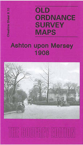
Ashton Upon Mersey 1908 Stanfords
£2.95
Archived Product
Ashton Upon Mersey 1908 Stanfords
£3.50
Archived Product

Ashton And Dukinfield 1907 Stanfords
£3.50
Vouchers
No voucher codes found.
Do you know a voucher code for this product or supplier? Add it to Insights for others to use.
Do you know a voucher code for this product or supplier? Add it to Insights for others to use.
 Denmark